Seven Kingdoms MapRegions, Houses, Borders, Castles & Political Power in Westeros
Regional hub map • ThroneAtlas map guide
A complete Seven Kingdoms atlas explaining the regions of Westeros, ruling houses, major castles, border logic, roads, ports, and political power centers. This guide follows Seven Kingdoms Map through its locations, sequence, power connections, common map mistakes, and related atlas pages.
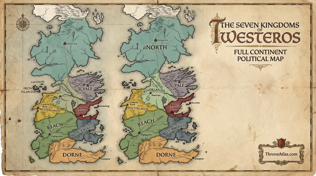
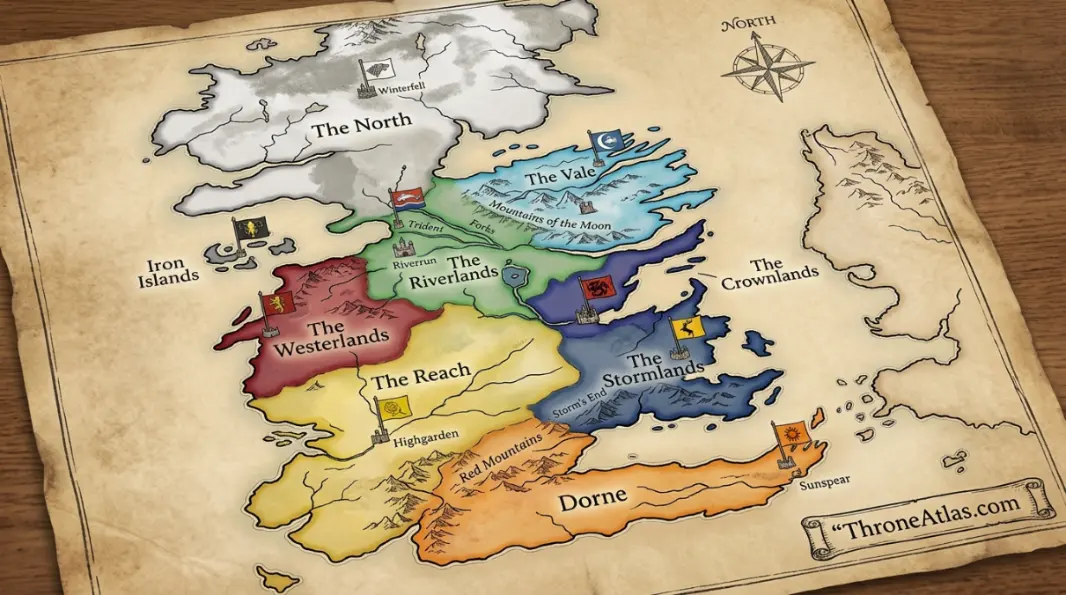
The Seven Kingdoms Map explains Westeros as a political continent rather than a flat list of castles. The North is vast and difficult to control. The Riverlands are exposed at the center of the realm. The Vale is protected by mountains. The Westerlands are wealthy and coastal. The Reach is fertile and heavily populated. The Stormlands face the sea and Dornish routes. Dorne is culturally distinct and geographically defensive. The Iron Islands are a maritime outlier. The Crownlands sit around the capital and Blackwater Bay. Together, these regions explain why the Iron Throne is always a geographic problem as much as a legal one.
Page Index
Seven Kingdoms Map Key Details
A quick reference for the regions, central locations, and strongest linked pages.
Seven Kingdoms Map: What This Map Explains
The Seven Kingdoms Map is built for readers who want more than a list of names. It explains how locations connect to consequence. A season, hub, timeline, or rider map becomes useful when the reader can see why one place leads to another and why certain castles, roads, harbors, rivers, council rooms, and battlefields keep returning to the story.
The Seven Kingdoms Map explains Westeros as a political continent rather than a flat list of castles. The North is vast and difficult to control. The Riverlands are exposed at the center of the realm. The Vale is protected by mountains. The Westerlands are wealthy and coastal. The Reach is fertile and heavily populated. The Stormlands face the sea and Dornish routes. Dorne is culturally distinct and geographically defensive. The Iron Islands are a maritime outlier. The Crownlands sit around the capital and Blackwater Bay. Together, these regions explain why the Iron Throne is always a geographic problem as much as a legal one.
This regional hub connects the major Westeros map pages into one reader-friendly political atlas. This scope matters because the world of Westeros and Essos is not organized like a modern road atlas. Power moves through castles, old oaths, sea lanes, bloodlines, dragon access, marriages, hostage routes, religious institutions, and remembered wars. A reader who understands those layers will understand why the same location can change meaning from one season or era to the next.
Read the Seven Kingdoms as an old political name sitting on top of a more complicated regional map. The phrase is useful, but the houses, roads, ports, and borders explain how power actually moves.
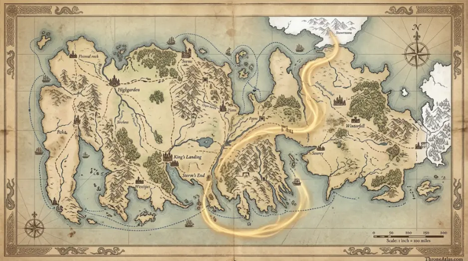
Visual Map Guide
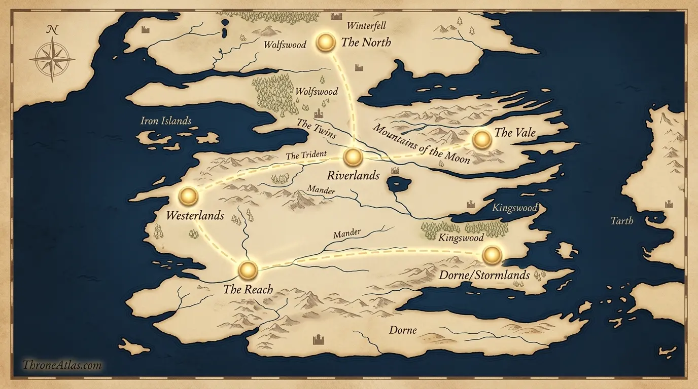
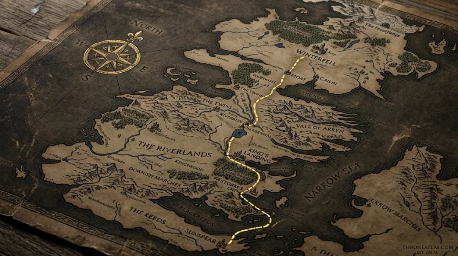
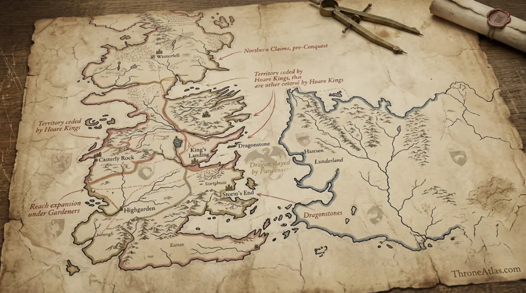
The visual guide below reduces the page to its clearest map anchors. It does not replace the complete Westeros map; it gives readers a fast route board so the order of locations is easier to follow. Begin on the left, follow the route line, and notice how the meaning of the map changes with each stop.
For Seven Kingdoms Map, the key reading method is to separate location from consequence. A castle may appear on the map for only one event, but if that event changes a claim, alliance, battle, or future route, the castle belongs in the main sequence. A city may return many times, but each return should have a different reason. This is how the page avoids becoming a flat list.
Location Sequence and Map Logic
The location sequence is the spine of the page. Each stop below has a region, a map function, and a reason it matters. This makes the page useful for readers who are trying to follow the story visually, for editors building internal links, and for fans comparing season routes with house territories and battle locations.
| Location | Region | Map Function | Why It Matters |
|---|---|---|---|
| The North | Northern Westeros | Largest region | Winterfell, the Wall, White Harbor, and Stark loyalty define the northern map. |
| Riverlands | Central Westeros | Crossroads region | Riverrun, Harrenhal, the Twins, and river crossings make this the realm’s vulnerable middle. |
| The Vale | Eastern Westeros | Mountain defense | The Eyrie and the Bloody Gate make the Vale hard to invade and slow to influence. |
| Westerlands | Western coast | Wealth engine | Casterly Rock and Lannisport anchor gold, ships, and Lannister pressure. |
| The Reach | Southwest interior | Food and population | Highgarden, Oldtown, and the Arbor give the Reach supply and soft power. |
| Dorne and Stormlands | Southern map | Border tension | Sunspear, Storm’s End, Prince’s Pass, and the Boneway explain southern defense. |
Read the sequence as a chain of pressure. The first location establishes the map frame. The middle locations widen the conflict. The final locations carry the consequence into another page. That chain is what turns the atlas into a connected reading system rather than a collection of isolated articles.
- The North: Winterfell, the Wall, White Harbor, and Stark loyalty define the northern map. This location also connects to Northern Westeros and works as a largest region inside the page.
- Riverlands: Riverrun, Harrenhal, the Twins, and river crossings make this the realm’s vulnerable middle. This location also connects to Central Westeros and works as a crossroads region inside the page.
- The Vale: The Eyrie and the Bloody Gate make the Vale hard to invade and slow to influence. This location also connects to Eastern Westeros and works as a mountain defense inside the page.
- Westerlands: Casterly Rock and Lannisport anchor gold, ships, and Lannister pressure. This location also connects to Western coast and works as a wealth engine inside the page.
- The Reach: Highgarden, Oldtown, and the Arbor give the Reach supply and soft power. This location also connects to Southwest interior and works as a food and population inside the page.
- Dorne and Stormlands: Sunspear, Storm’s End, Prince’s Pass, and the Boneway explain southern defense. This location also connects to Southern map and works as a border tension inside the page.
Timeline and Chronology Notes
Chronology matters because maps change over time. A place that begins as a refuge may become a command center. A court may become a prison. A road may become a military corridor. A bay may become a blockade. A castle may become symbolic long after the event has ended. The table below keeps the major moments in sequence.
| Moment | Timeframe | Map Anchor | Reading Note |
|---|---|---|---|
| Aegon’s Conquest | Historical foundation | Westeros | The old kingdoms are forced into a new realm around the Iron Throne. |
| Dornish resistance | Post-conquest era | Dorne | Dorne shows that geography can defeat dragons when war becomes occupation. |
| Robert’s Rebellion | Recent history | Riverlands and Crownlands | A realm-wide rebellion proves how quickly regional alliances can connect. |
| War of the Five Kings | Main series | Multiple regions | The realm fractures when claims and regional loyalties collide. |
| Long Night return | Final war | North | The oldest northern border problem becomes the realm’s survival problem. |
| Post-war settlement | Finale | King’s Landing and North | The political map changes again when the North separates. |
The most reliable way to read chronology is to ask what each event leaves behind. Does it change a ruler, a border, a family relationship, a military route, a dragon balance, a public reputation, or a survival strategy? If it does, the event is not only a plot point. It is a map point.
Characters, Houses, and Power Connections
No major ThroneAtlas page stands alone. A season map needs character routes. A timeline map needs house pages. A dragon-rider map needs battle maps. A regional hub needs castles and roads. The connections below show how this page joins the wider atlas.
House Stark
Controls the North from Winterfell and shapes the Wall-facing map.
House Lannister
Links the Westerlands, capital politics, and gold-backed power.
House Targaryen
Connects Dragonstone, conquest, dragons, and royal centralization.
House Baratheon
Holds Storm’s End and bridges rebellion, crown, and southern routes.
House Tyrell
Turns the Reach into food, marriage, and alliance power.
House Martell
Makes Dorne a distinct southern political and geographic force.
These connections also help readers choose the next page. One reader may follow a location, another may follow a battle, and another may follow a house claim. A good page supports all three paths without forcing the same route on everyone. That is why internal links appear naturally near the section where they help the reader most.
Book and Show Map Notes
The show and books both use the phrase Seven Kingdoms, but the practical map of Westeros includes more than seven active regional identities. A good atlas keeps the historical phrase while explaining the political regions readers actually need.
When versions differ, the safest atlas method is to preserve the shared anchors first. The page should make clear which places are essential, which places are emphasized differently, and which routes are compressed or expanded. This lets a viewer and a book reader use the same page without losing the map logic.
The goal is not to force every version into one identical path. The goal is to explain why a location matters across versions and how that location connects to nearby pages. If a scene is moved, shortened, expanded, or implied, the map should still help the reader understand the power structure behind it.
Common Map Mistakes
Most map mistakes happen when readers remember a famous scene but forget the geography around it. These are the mistakes to avoid when reading, illustrating, or linking this page.
- Calling the Seven Kingdoms a literal count of seven current regions without explaining historic naming.
- Forgetting the Crownlands and Iron Islands when describing political Westeros.
- Treating borders as neat modern lines even though roads, rivers, marriages, and castles often matter more.
The easiest correction is to keep every event attached to three details: the place, the controlling power, and the consequence. Once those three details are clear, the page becomes much harder to misread.
Best Reading Path After This Page
After this page, the best route is to open one major location map, one character or house page, one battle or event map, and one broader hub. That pattern gives readers a complete atlas loop. The location page explains where the action sits. The character or house page explains why a person or family matters. The battle or event page explains what changed. The hub places everything back into a larger structure.
For Seven Kingdoms Map, begin with Westeros Map, then continue to Houses Hub and Winterfell Map. This creates a strong reading path because it moves from core geography into adjacent consequence.
The page is also useful for image planning. The best images should show the broad map, the central location, the route sequence, one political detail, and one related atlas direction. A weak image only repeats the title. A strong image teaches the reader where to look next.
ThroneAtlas works best when each page is treated as a doorway. This page opens into nearby routes, battles, houses, and lore pages so the reader can keep moving through the map without losing the thread.
Deep Atlas Notes for Careful Readers
A careful map reading should look at scale, access, and consequence. Scale asks whether the page is operating at the level of a room, a castle, a city, a road, a region, a sea lane, or an entire continent. Access asks who can enter that place, who controls the gate, who has ships, who sends ravens, who commands riders, and who can survive the journey. Consequence asks what the map looks like after the scene is over. If a location changes a claim, a loyalty, a border, a fear, or a future route, it belongs in the core reading.
For Seven Kingdoms Map, scale changes constantly. Some moments are intimate, such as a chamber, council, trial, godswood, throne room, or family conversation. Other moments are regional, such as an army road, a coastline, a river crossing, a northern border, or a dragon flight path. The strongest pages keep both scales visible. They let the reader understand the close human decision while still seeing the wider geography that makes the decision dangerous.
Access is just as important as distance. In Westeros, two places may look close on a map but feel far apart because a mountain pass, hostile house, royal order, fleet blockade, winter road, or broken bridge blocks the route. A page that ignores access can make movement look too easy. A page that explains access shows why a character may need a marriage, hostage, ship, dragon, army, raven, disguise, coin, or oath before the next location becomes possible.
Consequence is the final test. A decorative location appears and disappears. A true atlas location changes the next page. It may create a battle, reveal a secret, end a dynasty, restore a house, move a fleet, split a family, expose a threat, or redirect a route. That is why the best ThroneAtlas pages connect location reading with timeline reading. They do not only ask where something happened; they ask what the map became afterward.
This deeper method also helps with internal navigation. A reader who finishes the page can choose the next map based on the question still open in their mind. If the question is about place, open a location guide. If the question is about power, open a house map. If the question is about movement, open a route page. If the question is about consequence, open a battle, war, or timeline page. That is how a single page becomes part of a larger atlas journey.
The final check is clarity. A reader should be able to leave the page knowing the main locations, why those locations matter, what order to read them in, and which connected page should come next. If the page answers those questions without forcing the reader to remember every minor detail, the map has done its job. It becomes a guide through geography, not just a decoration around lore.
That is why the page keeps returning to routes, borders, ships, roads, gates, courts, and memory. Those details make the world feel usable. They let a reader compare this map with nearby pages and immediately understand what has changed.
For long atlas sessions, this consistency matters. The same reading habits can be reused from season maps to house maps, from battle maps to dragon routes, and from timeline pages to individual location guides.
A reader should also know what not to overvalue. Exact mileage is less useful than control, access, and consequence. The story rarely turns because two places are a neat number of leagues apart. It turns because someone can reach a gate, block a harbor, cross a river, hold a pass, command a raven, reveal a secret, or arrive with a dragon before rivals are ready. That is the map logic this guide keeps in view.
Seven Kingdoms Map Questions
Clear answers to common reader questions about this map and its connected atlas pages.
The Seven Kingdoms Map shows This regional hub connects the major Westeros map pages into one reader-friendly political atlas.. It connects the main locations, sequence, political pressure, and related ThroneAtlas maps in one readable guide.
The most important map anchors are The North, Riverlands, The Vale, Westerlands. These places explain the route, conflict, and wider political meaning of the page.
The Seven Kingdoms Map explains Westeros as a political continent rather than a flat list of castles. The North is vast and difficult to control. The Riverlands are exposed at the center of the realm. The Vale is protected by mountains. The Westerlands are wealthy and coastal. The Reach is fertile and heavily populated. The Stormlands face the sea and Dornish routes. Dorne is culturally distinct and geographically defensive. The Iron Islands are a maritime outlier. The Crownlands sit around the capital and Blackwater Bay. Together, these regions explain why the Iron Throne is always a geographic problem as much as a legal one.
Start with the quick answer and fast facts, then use the visual guide, location sequence, timeline table, and related links to follow the page across the wider atlas.
Yes. It links to pages such as Westeros Map, Houses Hub, and Winterfell Map so readers can continue into connected regions, houses, battles, and character routes.
Calling the Seven Kingdoms a literal count of seven current regions without explaining historic naming.
The show and books both use the phrase Seven Kingdoms, but the practical map of Westeros includes more than seven active regional identities. A good atlas keeps the historical phrase while explaining the political regions readers actually need.
Explore Westeros Map
Follow the related maps to compare regions, routes, battles, houses, and timelines across the wider ThroneAtlas archive.
ThroneAtlas is an independent fan-made atlas resource. It is not affiliated with HBO, Warner Bros., or George R. R. Martin. Names and references are used for commentary, research, and educational fan mapping.