
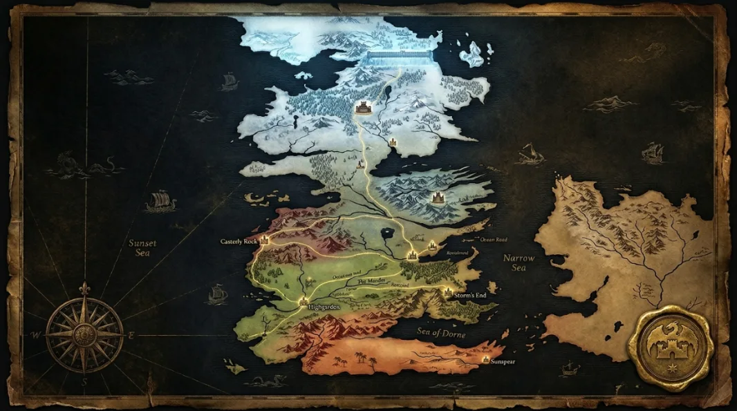
Westeros Map Complete Atlas of the Seven Kingdoms
The North · Riverlands · Crownlands · The Reach · Dorne · Beyond the Wall
The definitive fan atlas of the Westeros map — covering every region from the frozen wastes Beyond the Wall to the red sun-baked deserts of Dorne. This guide explains each region’s geography, ruling houses, major castles, key roads, battle routes, and why the continent’s shape drives every war, alliance, and betrayal in Game of Thrones and House of the Dragon.
The Westeros map depicts the western continent of the Known World in Game of Thrones and A Song of Ice and Fire. Westeros stretches from the lands Beyond the Wall in the far north down to Dorne in the south and contains nine main regions: the North, Riverlands, Vale, Westerlands, Crownlands, Reach, Stormlands, Iron Islands, and Dorne. Its capital is King’s Landing. Other major seats of power include Winterfell, Dragonstone, Casterly Rock, Highgarden, Storm’s End, Pyke, and Sunspear.
Explore Westeros on the Interactive Map
Use this focused ThroneAtlas map section to explore the major Westeros locations, houses, battles and route markers connected to the Seven Kingdoms. Search by name, filter by category, and click any pin to open related guide links.
Westeros at a Glance
Eight essential facts that make Westeros’s geography — and its politics — immediately easier to understand.
The Complete Westeros Map
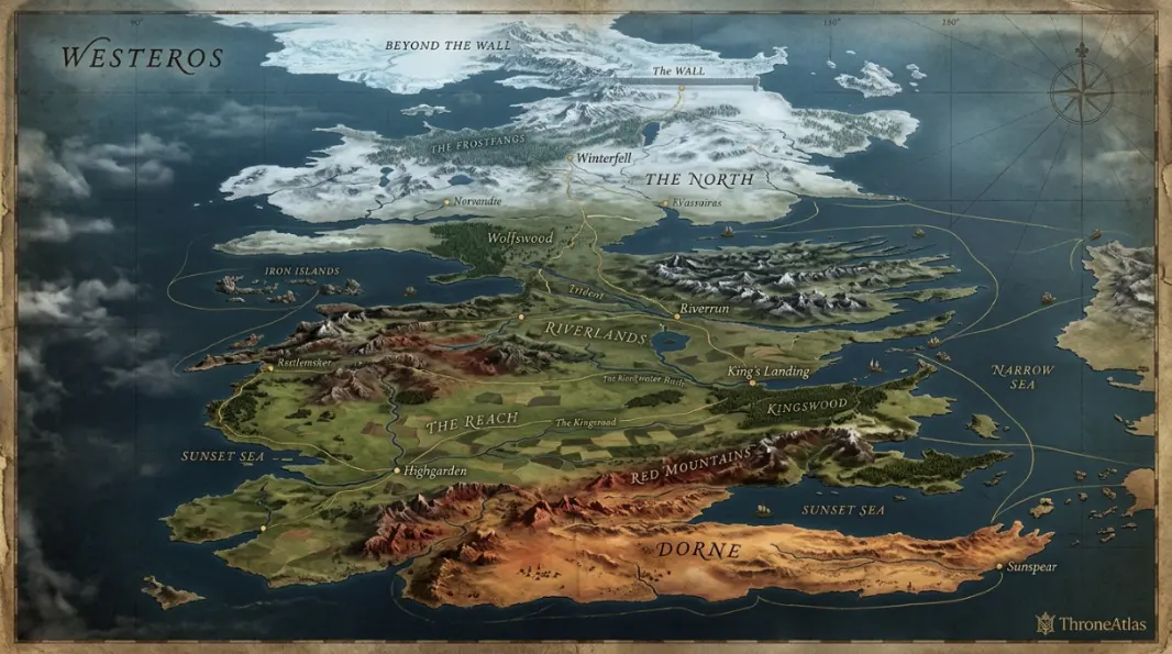
A stylized ThroneAtlas atlas showing major regions, seats of power, the Wall, the Narrow Sea, and the continent’s most pivotal story locations.
Explore Westeros by Region
Select a region to learn its ruling house, seat of power, climate, strategic role on the map, and connected atlas pages.
The North
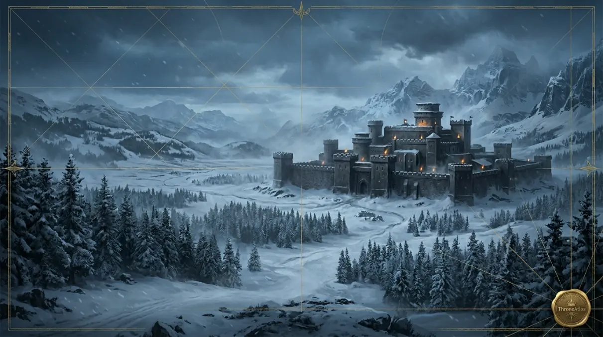
The North is the largest region of Westeros — larger than all the southern kingdoms combined — and is ruled historically from Winterfell by House Stark. It’s cold, vast, ancient, and culturally distinct. The North’s real importance on the map is threefold: it guards the continent’s oldest memory, it shields everything south of it from what lies beyond the Wall, and its sheer size makes it nearly impossible for any foreign army to fully occupy.
Key Takeaways — Westeros Map
- Westeros is divided into nine main regions, each with a dominant ruling house, distinct climate, and strategic function.
- The continent is roughly 3,000 miles long north to south — comparable in scale to South America in the real world.
- The King’s Road is the main overland artery, running from Castle Black at the Wall to King’s Landing in the Crownlands.
- King’s Landing (population ~500,000) sits on Blackwater Bay and serves as the political, economic, and symbolic capital of the realm.
- The North is the largest single region and is bigger than all other kingdoms combined, which is why it’s so difficult to control.
- Westeros is separated from Essos by the Narrow Sea, which is roughly 300 miles wide at its narrowest point near Dragonstone.
- Geography is destiny in Westeros: the Riverlands are always a battlefield because they sit at the center; Dorne is never fully conquered because mountains and desert make invasion too costly.
What the Westeros Map Actually Shows
The Westeros map shows a long, narrow continent divided into nine regions, each with its own ruling house, climate, and strategic character. Understanding the map explains why armies move the way they do, why certain alliances form, and why specific regions suffer disproportionately in every major war.
At first glance, the Westeros map looks like a long uneven blade of land cutting down the western side of the Known World. Study it for five more minutes and something clicks: this continent is engineered like a story machine. The North is too large to easily control. The Riverlands sit at the dead center, so every war ends up passing through them. The Crownlands hold the capital but not enough food to survive without trade partners. The Westerlands hold gold. The Reach holds grain. Dorne holds distance, heat, and mountain walls. The Wall holds back the oldest threat in the story.
That’s why this map matters — not as a decorative prop, but as the operating logic behind everything. If you understand the geography, you understand the pressure behind the politics. You see why Winterfell feels isolated even from the rest of the North. You see why King’s Landing is perpetually vulnerable to naval attack. You understand why Dragonstone is simultaneously close to power and apart from it, why controlling the Wall changes everything about what the North means.
Where Is Westeros Located in the Known World?
Westeros lies on the western edge of the Known World, separated from the eastern continent of Essos by the Narrow Sea. It runs from the unmapped lands Beyond the Wall in the far north down to Dorne’s southern deserts and the Summer Sea. Its western coast faces the Sunset Sea, which remains largely uncharted.
Westeros lies west of Essos, the much larger eastern continent, separated by the Narrow Sea. At its narrowest point — near Dragonstone and Braavos — the Narrow Sea is roughly 300 miles wide. This distance is short enough that fleets can cross in days but wide enough that it forms a genuine strategic boundary. Control the Narrow Sea and you control the flow of armies, trade, and information between the two continents.
The continent’s overall shape creates natural story lanes. Its eastern coast connects the capital directly to Dragonstone, Driftmark, and the Free Cities beyond. The King’s Road creates one great inland corridor from King’s Landing up through the Riverlands and into the North. The western coastline gives the Iron Islands their raiding power. The Neck — a narrow marshy bottleneck where the continent pinches in between the North and the Riverlands — restricts overland movement between the two halves of the continent. These aren’t incidental details. They’re the map’s load-bearing walls.
How Big Is Westeros Compared to Real Places?
Westeros is roughly the same size as South America. The continent spans approximately 3,000 miles from the Wall in the north to Dorne’s southern coast, and about 900 miles at its widest east-to-west point. The North alone is comparable in area to Western Europe.
George R. R. Martin has confirmed that Westeros was modeled partly on Britain — specifically the British Isles turned upside down — but at a much larger scale. The full continent is roughly the size of South America, stretching around 3,000 miles from the lands Beyond the Wall down to the Dornish coast. That scale is what makes political control so difficult: armies move slowly, ravens take days, and winter can cut regions off entirely.
| Region | Ruling House | Strategic Value | Real-World Scale (approx.) |
|---|---|---|---|
| The North | House Stark | Continental shield; controls access to the Wall | ~Size of Western Europe |
| The Riverlands | House Tully (contested) | Central crossroads; every army passes through | ~Size of France |
| The Vale | House Arryn | Mountain fortress; self-protecting | ~Size of the UK |
| The Westerlands | House Lannister | Gold mines; fund alliances and armies | ~Size of Spain |
| The Crownlands | Royal authority | Seat of the Iron Throne; the capital | ~Size of Portugal |
| The Reach | House Tyrell | Breadbasket of the realm; feeds armies | ~Size of France |
| The Stormlands | House Baratheon | Eastern coast defense; proximity to capital | ~Size of Poland |
| Dorne | House Martell | Desert defense; never fully conquered | ~Size of Spain |
| Iron Islands | House Greyjoy | Naval raiding base; western sea control | ~Size of Ireland |
The Seven Kingdoms of Westeros — Explained on the Map
The Seven Kingdoms is a political term, not a geographic one. Before Aegon Targaryen’s conquest around 300 years before the main story, Westeros was divided into independent kingdoms. After his conquest, “Seven Kingdoms” became the collective name — though the true administrative regions number nine, not seven.
The North
The North is the ancestral territory of House Stark, governed from Winterfell, one of the continent’s oldest and most culturally resonant castles. It’s colder, more isolated, and more spiritually tied to the old gods than any southern kingdom. Its map importance comes from three things: its enormous size, its emotional distance from the political south, and its role as the only inhabited region between everything else and the supernatural threat beyond the Wall. When Stark armies march south, they must cross hundreds of miles of their own territory before encountering another kingdom’s land.
The Riverlands
If the Westeros map has a tragic center, it’s the Riverlands. Positioned between the North, the Vale, the Westerlands, the Reach, and the Crownlands, the Riverlands can’t avoid being fought over. Riverrun, Harrenhal, the Twins, and the Trident all become strategic prizes because armies need to cross or control them. House Tully’s dilemma is pure geography: they sit where everyone else needs to be.
The Vale of Arryn
The Vale is tucked behind the Mountains of the Moon and accessible only through defended passes, with the Eyrie perched above everything at the top. On the map it looks close to the Riverlands and Crownlands — it is close — but in practice those mountains create political insulation. This is why the Vale can stay out of conflicts for extended periods. Armies can’t march in easily. That mountain barrier is as much a policy tool as it is a geographic feature.
The Westerlands
House Lannister’s territory isn’t the largest on the map, but it’s the wealthiest. The gold and silver mines beneath Casterly Rock funded Lannister power for generations — though by the time of Game of Thrones, those mines are running dry, a fact the Lannisters work hard to conceal. The Westerlands’ western coast gives them naval access, while their border with the Riverlands creates the main friction point during the War of the Five Kings.
The Crownlands
The Crownlands are small in area but enormous in political weight. King’s Landing sits on Blackwater Bay, accessible by sea from multiple directions — which is both its economic strength and its greatest military vulnerability. Dragonstone, the Targaryen island fortress, sits at the mouth of Blackwater Bay. On the map, it looks like an extension of the Crownlands. In terms of legacy and symbolism, it’s a world apart.
The Reach
The Reach is what feeds Westeros. Fertile, warm, and governed from Highgarden by House Tyrell, the Reach supplies grain to King’s Landing and the armies that march through it. In a prolonged war or a hard winter, whoever controls the Reach controls who eats. Oldtown — the continent’s oldest major city and seat of the Citadel — adds cultural and intellectual authority to the Reach’s economic power. It’s the wealthiest region after the Crownlands in terms of population and output.
The Stormlands
Storm’s End is one of the legendary castles of Westeros, and the Stormlands built their identity around surviving what the map puts them through: coastal storms, proximity to enemies, and the burden of being the southeastern shield for the capital. House Baratheon rose to prominence here, and the region’s rugged character shaped one of the saga’s most important dynasties.
Dorne
Dorne is the strategic outlier on the Westeros map. Shielded by the Red Mountains in the northwest and the sea on three sides, Dorne resisted Targaryen conquest — twice. Only through marriage, not war, did it eventually join the Seven Kingdoms. That history explains everything about Dornish culture: the sense of separateness, the independent legal traditions, and the lingering resentment that drives their involvement in later political conflicts.
Major Castles on the Westeros Map and What They Represent
The major castles on the Westeros map — Winterfell, King’s Landing, Dragonstone, Casterly Rock, Highgarden, Storm’s End, Pyke, and Sunspear — each represent something more than military fortification. They are symbols of house identity, regional power, and the particular kind of control each family has built over centuries.
Each major castle on the Westeros map is shorthand for a kind of power. Winterfell means northern continuity and endurance. King’s Landing means royal performance and vulnerability. Dragonstone means Targaryen legacy and proximity to fire. Casterly Rock means inherited gold and institutional dominance. Highgarden means abundance and soft power. Storm’s End means survival against impossible odds. Pyke means defiance and sea raiding. Sunspear means cultural independence and long memory.
- Winterfell: Stark seat, emotional center of the North, built over hot springs that keep the castle warm through winter.
- King’s Landing: Capital city of ~500,000 people; seat of the Red Keep, the Iron Throne, and all court politics.
- Dragonstone: Targaryen island fortress; controls Blackwater Bay and houses Westeros’s largest supply of dragonglass.
- Casterly Rock: Lannister seat; a castle built into a massive gold-bearing cliff on the Westerlands coast.
- Highgarden: Tyrell seat; the wealthiest, most architecturally refined castle in the Reach.
- Storm’s End: Baratheon seat; legendarily built to withstand any storm, it has never fallen by siege.
- Pyke: Greyjoy seat on the Iron Islands; a castle spread across several sea stacks connected by rope bridges.
- Sunspear: Martell seat in Dorne; a palace city of the Old Ghis style that was never conquered by Targaryen dragons.
- Castle Black: The Night’s Watch headquarters at the Wall; its 700-foot ice barrier is Westeros’s northernmost line of defense.
The King’s Road — The Map’s Most Important Route
The King’s Road is the main overland route connecting Castle Black at the Wall to King’s Landing in the south. It runs roughly 1,500 miles through the North, across the Neck, through the Riverlands, and into the Crownlands. Travel from Winterfell to King’s Landing takes approximately one month on horseback under normal conditions.
The King’s Road isn’t just a road — it’s a narrative device. In the opening of Game of Thrones, it’s the route that drags the Stark family from their isolated northern world into the treacherous political gravity of King’s Landing. Every mile southward represents a step deeper into danger. The emotional weight of that journey is written into the geography: the further south the Starks travel, the further they are from everything that makes them who they are.
Distance matters because Westeros treats travel as costly — at least in the books and early seasons. A raven message takes time. An army marching 1,500 miles through variable terrain and potential hostile territory takes much longer. Winter conditions can seal off the North entirely. This is why political decisions in Westeros always carry a lag: by the time reinforcements arrive, battles are over and allegiances have shifted.
The Wall — The Northern Boundary That Changes Everything
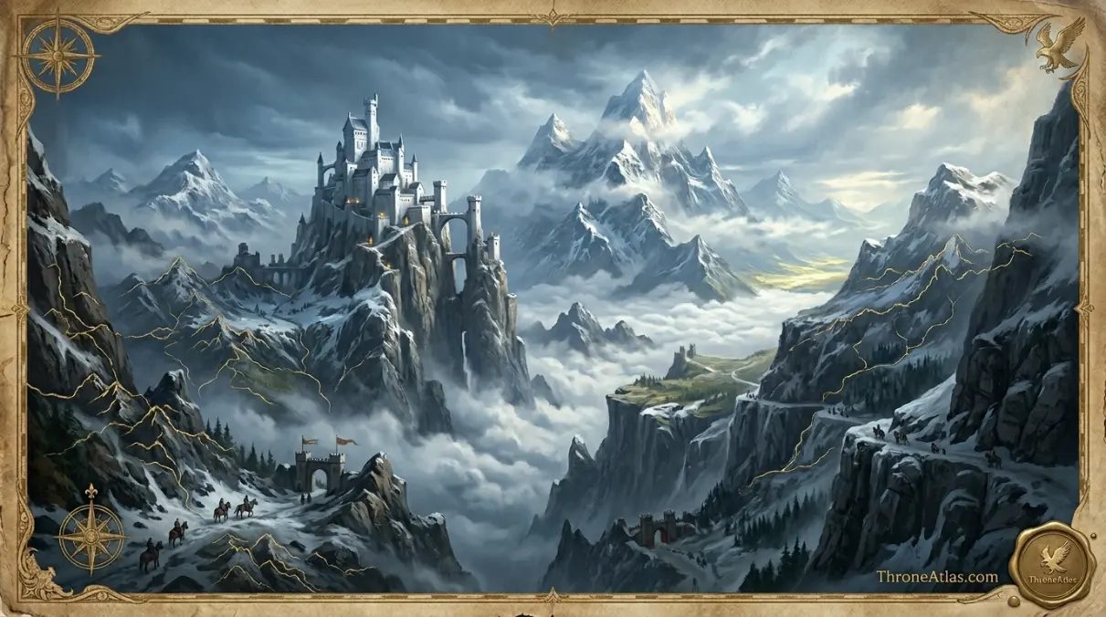
The Wall is a massive fortification of ice and ancient magic running 300 miles east to west across the northern boundary of the Seven Kingdoms. It stands approximately 700 feet tall at its highest. The Night’s Watch, founded roughly 8,000 years before the main story, is sworn to defend it. Castle Black is its primary headquarters, with 18 other forts spaced along its length.
On the Westeros map, the Wall is a single line. In the story, it’s a concept. It defines what “the known world” means for everyone south of it. The North’s cultural character — the old gods, the direwolves, the isolation, the sense that threats are not just political but ancient and existential — flows directly from the fact that the Starks have lived closest to this border for thousands of years. Everyone else in Westeros has had the luxury of forgetting. The North never could.
Westeros in Game of Thrones vs House of the Dragon
The Westeros map is the same in both Game of Thrones and House of the Dragon, but the political landscape is radically different. House of the Dragon is set approximately 170 years before Game of Thrones, when Targaryen rule is still intact. The civil war called the Dance of the Dragons turns Dragonstone, King’s Landing, Harrenhal, and the Riverlands into the main arenas of conflict.
In Game of Thrones, the map is already fractured by the time we join it. The realm fragments after Robert Baratheon’s death, and the map becomes a battlefield across multiple regions simultaneously. In House of the Dragon, the Targaryen civil war — the Dance of the Dragons, roughly 170 years before Game of Thrones — creates a different kind of fracture: a family split, not a realm split. Two claimants. Two dragon fleets. Dragonstone vs King’s Landing, separated by a short sea crossing but an insurmountable political gulf.
Harrenhal becomes especially interesting in House of the Dragon. On the map it sits in the center of the Riverlands, which makes it both strategically valuable and strategically cursed: whoever holds Harrenhal commands the center of the continent, but whoever holds Harrenhal also tends to be drawn into every conflict that crosses those central plains. The Riverlands, again, become the continent’s wound.
Book vs Show: How the Map Experience Differs
The broad geography of Westeros is consistent across the books, the official companion maps, and the show’s opening title sequence. The experience of it is not. George R. R. Martin’s novels treat travel as slow, exhausting, and filled with logistical friction. Characters note distances, worry about supply lines, and make decisions based on what’s possible given the map’s constraints. The show — especially in later seasons — compresses those distances for dramatic pacing.
Neither approach is wrong. They serve different storytelling goals. What matters for map readers is understanding the difference: the show reflects cinematic time, not geographic time. When a character appears to move from Winterfell to Dragonstone between scenes, the map hasn’t changed. Only the camera has. The distances, the climates, the bottlenecks, the strategic logic — those remain constant, and they remain the best tool for understanding why the story unfolds the way it does.
Why the Westeros Map Makes the Politics Make Sense
The deepest argument for studying the Westeros map is a simple one: the geography explains the drama. The North is isolated, so Starks have an insular, loyal culture. The Riverlands are vulnerable, so Tullys are used to forming alliances rather than fighting alone. The Vale is protected, so Arryns can afford to be cautious. The Westerlands are rich, so Lannisters learned to buy what they couldn’t take. The Crownlands hold the throne but not enough food, so every king needs allies. The Reach feeds everyone, so Tyrells are sought after in every war. Dorne is defended by terrain, so Martells can say no when others can’t.
This is what separates Westeros from a generic fantasy setting. The map doesn’t just tell you where things are. It tells you who these people had to become to survive where they were placed. The map teaches the characters, and the characters teach the map.
Winterfell to King’s Landing — The Route That Starts the Story
The journey from the Stark seat south to the capital covers roughly 1,500 miles and crosses three distinct regions. It turns a family matter into a continent-wide crisis.
Characters, Houses, and Events Connected to This Map
The Westeros map gains full meaning through the people, houses, and events that animate its geography.
Character Journey Maps
Follow Jon Snow from Winterfell to Castle Black and Beyond the Wall, Arya Stark across the Riverlands and to Braavos, and Daenerys Targaryen from Essos to Dragonstone and the capital.
House Territory Maps
Explore how House Stark, House Targaryen, House Lannister, and six other great houses control specific regions — and why those regions shape house character as much as house character shapes the regions.
Battle & Event Maps
Use the Westeros map to understand Aegon’s Conquest (~300 BC), the War of the Five Kings, the Red Wedding at the Twins, the Battle of the Bastards, the Long Night at Winterfell, and the burning of King’s Landing by Drogon.
Westeros Map — Common Questions Answered
The most frequently searched questions about the Westeros map, geography, and regions — answered directly.
Westeros is the western continent of the Known World in Game of Thrones and A Song of Ice and Fire. It contains the Seven Kingdoms, the Iron Throne, the Wall, King’s Landing, Winterfell, Dragonstone, Dorne, and the central political conflict of the story. The continent spans roughly 3,000 miles from Beyond the Wall in the north to Dorne in the south.
The nine main regions of Westeros are: the North (House Stark, Winterfell), the Riverlands (House Tully, Riverrun), the Vale of Arryn (House Arryn, the Eyrie), the Westerlands (House Lannister, Casterly Rock), the Crownlands (royal authority, King’s Landing), the Reach (House Tyrell, Highgarden), the Stormlands (House Baratheon, Storm’s End), the Iron Islands (House Greyjoy, Pyke), and Dorne (House Martell, Sunspear). Beyond the Wall is north of the Seven Kingdoms proper.
King’s Landing is located on the eastern coast of Westeros at the mouth of the Blackwater Rush river, in the Crownlands region, beside Blackwater Bay. It is the capital of the Seven Kingdoms and the site of the Red Keep and the Iron Throne. Its coastal position makes it accessible by sea from both the Narrow Sea and the Stormlands.
Winterfell is in the center of the North region, south of the Wall and north of the Neck. It sits at the confluence of two rivers and serves as the ancestral seat of House Stark. Roughly 1,500 miles separate Winterfell from King’s Landing on the King’s Road, which takes approximately one month to travel by horse and cart.
Not exactly. Westeros is the continent. The Seven Kingdoms is the political realm covering most of Westeros following Aegon I Targaryen’s conquest approximately 300 years before the main story. The name “Seven Kingdoms” is historical — it refers to the seven independent kingdoms that existed before Aegon’s conquest — but the actual administrative regions number nine, not seven.
Westeros is the western continent where the Seven Kingdoms, Iron Throne, and the Wall are located. Essos is the much larger eastern continent across the Narrow Sea, home to the Free Cities (Braavos, Pentos, Myr, etc.), the Dothraki Sea, Slaver’s Bay (Astapor, Yunkai, Meereen), Qarth, and the ruins of Old Valyria. The Narrow Sea between them is approximately 300 miles wide at its narrowest point.
Westeros is roughly the size of South America. The continent stretches approximately 3,000 miles north to south and about 900 miles east to west at its widest. George R. R. Martin based the shape partly on Britain but at continental scale. The North alone is comparable in area to Western Europe. This scale explains why political control of the whole continent is essentially impossible without dragons or overwhelming force.
Dragonstone is an island fortress located at the mouth of Blackwater Bay in the Narrow Sea, positioned just east of King’s Landing in the Crownlands. It was the ancestral seat of House Targaryen before Aegon’s Conquest and holds the largest known deposit of dragonglass (obsidian) in Westeros. Its proximity to the capital makes it one of the most strategically critical locations on the Westeros map.
The Wall is a massive fortification of ice and ancient magic that runs approximately 300 miles east to west across the northern boundary of the Seven Kingdoms, separating inhabited Westeros from the lands Beyond the Wall. It stands roughly 700 feet tall at its highest point. The Night’s Watch, an ancient order of sworn brothers, was founded approximately 8,000 years before the main story to man and defend it. Castle Black is the primary headquarters.
Dorne’s geography makes it the most defensible region on the Westeros map. The Red Mountains form a natural wall across its northwestern border. To the east, south, and west, Dorne is surrounded by sea. Internally, vast desert terrain makes supplying a large invading army almost impossible. Aegon Targaryen’s dragons couldn’t hold Dorne because his armies couldn’t survive in the landscape. Only through marriage alliance — not military conquest — did Dorne eventually join the Seven Kingdoms.
Related Maps, Houses, Routes, and Lore
Essential Maps
Character Routes
ThroneAtlas is an independent fan-made map and lore reference site. It is not affiliated with, endorsed by, or connected to HBO, Warner Bros. Discovery, George R. R. Martin, or any official Game of Thrones, House of the Dragon, or A Song of Ice and Fire property. All character names, location names, and house sigils are trademarks and intellectual property of their respective owners. This guide is published as transformative fan commentary under fair use principles.