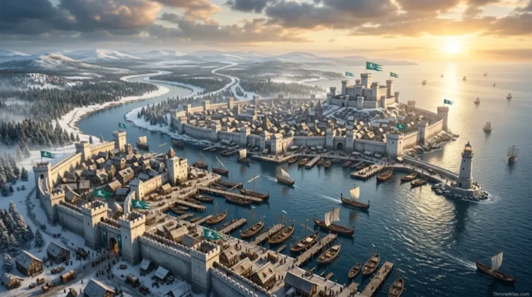
Dunk and Egg Journey Map: Every Known Route, Tourney & Adventure
Follow Ser Duncan the Tall and Egg through the confirmed geographic anchors of the published Tales of Dunk and Egg, while separating known destinations from route segments Martin leaves deliberately unsurveyed.
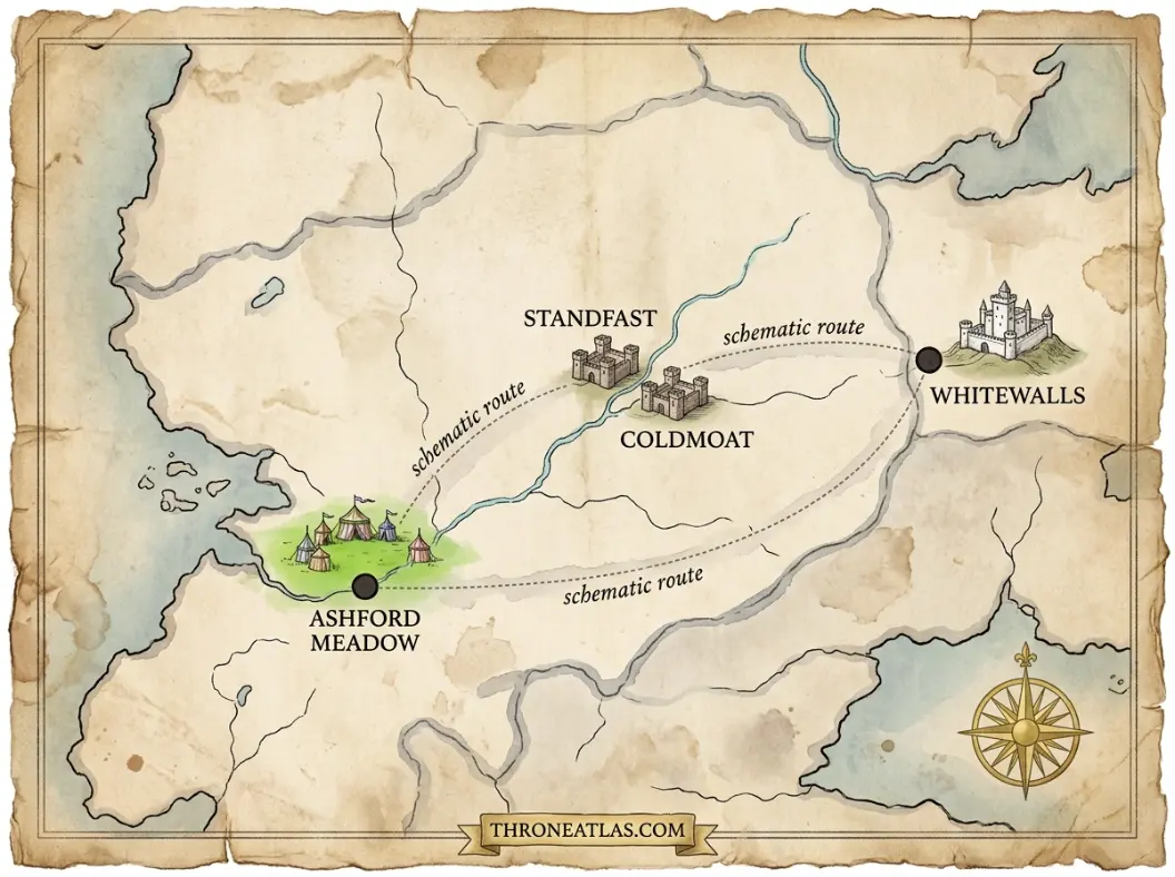
The Dunk and Egg journey map has three major published-story anchors: Ashford Meadow in The Hedge Knight, Standfast and Coldmoat in The Sworn Sword, and Whitewalls in The Mystery Knight. The exact roads between these destinations are only partly established, so a reliable atlas should map confirmed places strongly and treat connecting travel corridors as schematic rather than pretending to know every mile.
Dunk and Egg Journey Map at a Glance
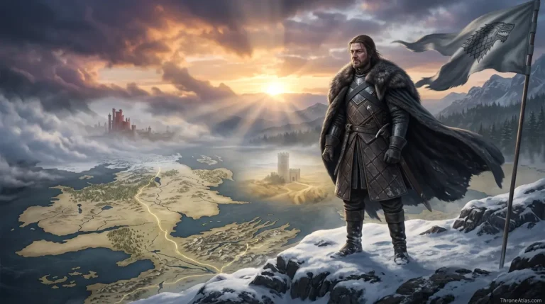
This visual map is the fast geographic reference for the guide below. It is designed to show the places, routes, borders, strongholds or battle zones that matter most to this topic before you move into the deeper lore and strategy.
In This Guide
- Visual Map at a Glance
- How to Read the Dunk and Egg Journey Map
- The Road to Ashford: Where Dunk’s Story Begins
- Ashford Meadow: The Journey’s First Great Anchor
- Leaving Ashford: Why the Missing Miles Matter
- Standfast and Coldmoat: The Sworn Sword Route
- Whitewalls: The Mystery Knight and a Hidden Political Map
- What the Three Published Journeys Reveal About Westeros
- Book Route vs HBO Route: Keep the Layers Separate
- Why Season 2 Expands the Map Beyond Ashford
- Where the Dunk and Egg Map Can Grow Next
Dunk and Egg Journey Map: Every Known Route, Tourney & Adventure: What Matters Most
Core route
Ashford Meadow → Standfast/Coldmoat → Whitewalls, with connecting roads shown schematically.
Story scale
The route favors minor roads, local holdings and tourney grounds rather than only famous capitals.
Ashford
The partnership between Dunk and Egg takes shape here during the Trial of Seven.
Standfast & Coldmoat
A drought and water dispute make neighboring holdings strategically important.
Whitewalls
A tourney conceals Blackfyre political activity beneath a local gathering.
Map rule
Confirmed destinations are solid nodes; unconfirmed connecting roads should be dotted or labeled interpretive.
HBO layer
Screen layouts can be mapped separately from book geography rather than merged as one canon.
Why it matters
The journey teaches a future king about Westeros at the scale of ordinary people and minor lords.
Places to Plot on the Map
| Location | Region / Zone | Why It Matters | Map Reading |
|---|---|---|---|
| Ashford Meadow | The Reach | First major adventure; Dunk meets Egg and enters the tourney. | Confirmed story anchor |
| Standfast | The Reach | Ser Eustace Osgrey’s modest seat and Dunk’s place of service. | Confirmed in The Sworn Sword |
| Coldmoat | The Reach | Lady Rohanne Webber’s stronger neighboring seat. | Confirmed in The Sworn Sword |
| Contested water | Reach countryside | The practical resource behind the local conflict. | Map as resource corridor |
| Whitewalls | Westeros | Tournament setting hiding Blackfyre plotting. | Confirmed in The Mystery Knight |
| Connecting roads | Multiple | The pair’s itinerant travel between adventures. | Schematic; exact route incomplete |
How to Read the Dunk and Egg Journey Map
The Dunk and Egg journey map should be read as a sequence of confirmed story destinations connected by partly undocumented roads. Ashford Meadow, Standfast and Coldmoat, and Whitewalls are firm anchors in the three published novellas; the exact mile-by-mile paths between them are not fully mapped in canon, so responsible route lines remain schematic.
Dunk and Egg are road characters. That sounds obvious, but it changes the kind of map this story needs. A Daenerys map can mark famous cities from Pentos to Meereen and then Dragonstone. A Robb Stark campaign map can plot armies against castles and river crossings. Dunk and Egg spend much of their lives in the spaces between those famous places: muddy roads, market tracks, orchards, small keeps, wells, camps, inns and fields where a traveler may not know what is waiting beyond the next hill.
That is why this atlas resists drawing a false precision line. George R. R. Martin gives us strong destination anchors and enough regional clues to understand the movement, but not a modern GPS itinerary. The correct visual language is therefore a chain of confirmed nodes joined by broad route corridors. Ashford Meadow anchors The Hedge Knight. Standfast and Coldmoat anchor The Sworn Sword. Whitewalls anchors The Mystery Knight. The journeys between them matter, but an exact road should be labeled interpretive unless the text establishes it.
This approach also preserves what makes the stories special. Dunk experiences Westeros from the ground. Distance is felt through hunger, weather, horse condition and money rather than through a king’s command table. Egg may be a prince in disguise, yet he learns the realm at walking and riding pace beside a man with no lands of his own. The map therefore becomes a social atlas as much as a geographic one.
The Road to Ashford: Where Dunk’s Story Begins
Dunk’s independent journey begins after the death of Ser Arlan of Pennytree, his elderly hedge-knight master. The precise roadside location of Ser Arlan’s death is not a famous named destination; what matters geographically is that Dunk turns south toward the tournament at Ashford Meadow in the Reach and chooses to test whether he can live as a knight on his own.
A careful map should not place Ser Arlan’s death at Pennytree simply because he is called “of Pennytree.” Pennytree belongs to Arlan’s identity and past, while the opening of Dunk’s own story takes place on the road after years of wandering service. That distinction is small, but it is exactly the kind of thing an atlas should protect. Names can look like coordinates when they are not.
Dunk’s decision to ride for Ashford establishes the first real direction of the series. A tournament is opportunity: food, possible employment, a chance to earn money, and perhaps the recognition required to make his uncertain knighthood meaningful. On a noble map, Ashford is not King’s Landing or Highgarden. On a hedge knight’s map, it can change a life. The road itself is the bridge between those two scales of importance.
Egg enters that geography before Dunk understands who he is. Their meeting turns a solitary route into a shared journey. From then on, the map has two layers: Dunk’s search for work and honor, and Egg’s disguised education in the kingdom his family rules. Every village and minor lord becomes part of a prince’s education precisely because he is not traveling in a royal procession.
Ashford Meadow: The Journey’s First Great Anchor
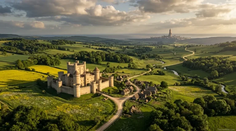
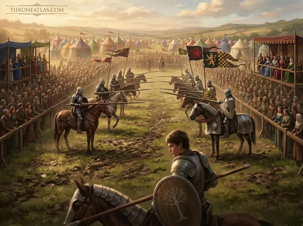
Ashford Meadow in the Reach is the first major fixed point on the Dunk and Egg route. It is where Dunk enters the tournament, takes Egg as his squire, clashes with Prince Aerion Targaryen, and becomes the center of a Trial of Seven that draws multiple branches of the royal family into a hedge knight’s dispute.
Ashford is the moment when a local map and a dynastic map collide. The Reach supplies the physical setting: a wealthy agricultural region capable of supporting a large tournament, roads bringing nobles and merchants from many directions, and open ground that can become a temporary town of tents, horses and spectators. House Targaryen supplies the political gravity. Princes who might otherwise be distant names are suddenly living within the same camp as Dunk.
The Trial of Seven changes the meaning of the meadow. What begins as tourney geography becomes judicial geography. A field designed for sport becomes a place where legal custom, royal power, personal loyalty and physical courage are tested in public. The event also permanently binds Dunk and Egg. After Ashford, they are no longer two strangers who happened to meet at a tourney; they are a knight-and-squire pair whose lives have already touched the succession politics of the realm.
For the route map, Ashford should therefore be larger than a normal waypoint. It is the origin point of the partnership. Readers who want the local layout can move to the dedicated Ashford Meadow map, while this journey page keeps the focus on what happens when the pair leave the site and return to the road.
Leaving Ashford: Why the Missing Miles Matter
After Ashford, Dunk and Egg continue traveling together, but the published stories do not document every road, village and overnight stop. The gap is meaningful: the pair live as itinerant travelers, and Martin often uses the unrecorded miles to imply months of ordinary service, hardship and learning between the major events readers see.
Fan maps are tempted to connect every story with a hard line because a line feels complete. In this series, the honest blank space is part of the story. Dunk is not following a royal itinerary preserved by maesters. He is looking for food and employment, choosing routes according to opportunity, season and rumor. Many of those decisions never become famous enough to enter chronicles.
Egg’s hidden status intensifies that ordinary movement. He does not travel with banners announcing Prince Aegon Targaryen. That means the pair can pass through places as minor people would: negotiating prices, sleeping rough, hearing local grievances and discovering how lordly decisions affect farmers and smallfolk. The royal family appears very different from a roadside ditch than it does from the Red Keep.
On ThroneAtlas, dotted corridors are therefore more accurate than a single asserted highway. They communicate direction without claiming a precision the source does not give us. If future Dunk and Egg stories establish additional stops, the map can grow organically rather than having to defend invented route details.
Standfast and Coldmoat: The Sworn Sword Route
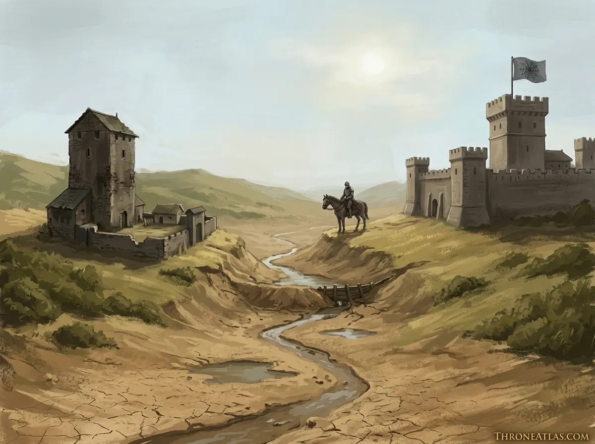
The second published Dunk and Egg story narrows the map to two neighboring holdings in the Reach: Standfast, associated with Ser Eustace Osgrey, and Coldmoat, ruled by Lady Rohanne Webber. A dispute over water in a drought turns this small local landscape into a lesson about memory, law, class and the long shadow of the Blackfyre Rebellion.
This is one of the best examples in the saga of geography creating plot without a giant battle. Water is the strategic resource. A stream, dam, well or channel can matter more to local survival than any famous castle. In a dry landscape, controlling flow is controlling crops, livestock and bargaining power. Dunk’s job is therefore not to conquer a kingdom but to understand why two neighboring holdings are close enough to depend on the same scarce resource and politically divided enough to fight over it.
Standfast is deliberately modest. That modesty matters because Ser Eustace’s identity is much larger than his current material power. Coldmoat represents a different kind of local strength: a better-resourced holding under a ruler whose practical authority collides with Osgrey nostalgia. The short distance between them makes the dispute personal. Nobody can simply retreat to another region.
The map also opens a historical layer beneath the current landscape. Memories of the Blackfyre Rebellion shape loyalties and resentments long after armies have gone. Dunk and Egg are literally riding across ground where political history still lives in households. A good map should therefore show not only two castles but the contested land and water between them.
Whitewalls: The Mystery Knight and a Hidden Political Map
Whitewalls is the principal location of The Mystery Knight, where a seemingly celebratory tournament conceals Blackfyre-aligned political plotting. For Dunk and Egg, the journey shows how a small gathering can become dangerous when geography allows conspirators, claimants, lords and wandering knights to meet away from the most visible centers of royal power.
Whitewalls demonstrates a recurring rule of Westerosi politics: not every rebellion begins in a capital. Remote or secondary estates can be valuable precisely because they sit below the attention threshold of the court. Guests arrive for a plausible public reason, while conversations, alliances and identities develop underneath the festivities. A tournament is both entertainment and networking infrastructure.
Dunk’s outsider status again becomes a mapping advantage. He notices who has arrived, who knows whom, and how people move through the event without beginning from the assumption that every noble is part of a formal political plan. Egg’s bloodline creates the opposite pressure: once identities and loyalties become clearer, the apparently local map reconnects to the Targaryen-Blackfyre struggle.
Whitewalls therefore belongs on both the journey map and a future Blackfyre political map. In the journey layer, it is another stop where Dunk tries to function as a hedge knight. In the dynastic layer, it is evidence that civil conflict can survive as a network long after a battlefield defeat.
What the Three Published Journeys Reveal About Westeros
Together, Ashford, Standfast/Coldmoat and Whitewalls reveal a Westeros that is politically connected but locally experienced. Royal princes, old rebellions and succession questions touch ordinary roads and minor holdings, while the people living there experience power through taxes, water, employment, justice and the behavior of nearby lords.
The great achievement of the Dunk and Egg geography is scale. The same continent that contains the Wall, Casterly Rock and the Iron Throne also contains a farmer worrying about water and a hedge knight worrying about his next meal. Both are Westeros. The map does not become less important when the story gets smaller; it becomes more intimate.
At Ashford, the royal family arrives in force and temporarily makes a meadow politically central. At Standfast and Coldmoat, national history survives as local grievance. At Whitewalls, a political network uses a private gathering as cover. These are three different ways the center reaches the margins. Egg experiences all of them while hiding the fact that he belongs to the center.
This helps explain why the later historical importance of Dunk and Egg feels earned. They do not know the realm only as an abstract collection of vassals. Their road life exposes them to the practical consequences of rulership. The journey map is therefore also a map of political education.
Book Route vs HBO Route: Keep the Layers Separate
The HBO adaptation can give viewers visual roads, camp positions and local layouts that the novellas describe differently or less precisely. ThroneAtlas treats screen geography as adaptation canon and the published novellas as book canon, keeping both useful without claiming that a television production layout permanently fixes every location in Martin’s written world.
This rule is especially useful for Ashford because a filmed tournament must be physically built. Cameras need entrances, tent rows, lists, crowd lanes and recognizable landmarks. Those production decisions create a coherent screen space. They can be mapped accurately as things viewers saw, but that does not turn them into a surveyed plan drawn by the author.
The same applies to roads. Television often compresses travel for pacing and may establish a visual sequence of departures and arrivals that readers imagined more broadly. Rather than arguing that one replaces the other, an atlas can mark the difference. “On screen, Dunk approaches from this side” and “in the novella, the broader regional placement is what can be stated confidently” are compatible observations.
This separation also future-proofs the page. As the HBO series moves into The Sworn Sword and later material, new visual information can be added as a screen layer without rewriting the literary route into something it never claimed to be.
Why Season 2 Expands the Map Beyond Ashford
HBO’s second season is expected to adapt The Sworn Sword, moving the visual center away from Ashford Meadow toward the smaller Reach holdings of Standfast and Coldmoat. That shift is important because it changes the map from a crowded royal tournament to a rural dispute shaped by drought, landholding and old Blackfyre loyalties.
For viewers who entered this world through Season 1, the scale change may feel surprising. The next adventure does not need to become bigger in the conventional fantasy sense. It becomes more local. That is the point. Dunk has left the temporary spectacle of Ashford and returned to the uncertain economy of hedge knighthood, where employment can mean serving a lord whose feud is barely visible on a kingdom-scale map.
Standfast and Coldmoat also give map-makers a chance to emphasize resources rather than prestige. The important lines are property boundaries, water access and the route between neighboring seats. Those details can explain a conflict more effectively than a continent view. At the same time, the Blackfyre past connects the local quarrel to national history.
A series hub should therefore keep Ashford as Season 1’s dominant node while extending the journey line rather than stretching the Ashford page to cover unrelated places. That internal architecture mirrors the story itself: one road, multiple self-contained geographic problems.
Where the Dunk and Egg Map Can Grow Next
The current journey map should remain anchored to published and aired material, then expand only when later stories or adaptations establish new travel. Martin has long described additional Dunk and Egg adventures beyond the three published novellas, but an atlas should not pre-map unwritten destinations as if they were confirmed episodes.
There is a difference between historical knowledge about the eventual lives of Ser Duncan and Aegon V and a documented adventure route. We know these characters become enormously important. That does not mean every famous place associated with their later offices belongs on a “journey” line for the early tales. A route map should earn each node through story evidence.
This disciplined approach prevents a common fan-reference problem: backfilling a character’s entire biography into an early adventure page until the search intent disappears. Someone searching for the Dunk and Egg journey wants to understand where the stories travel, not simply receive a list of every place connected to the future king.
As new seasons air or new novellas appear, ThroneAtlas can add dated layers, new route segments and dedicated location pages. The map then becomes a living index of the series while remaining trustworthy at every stage.
Roads, Castles and Tourney Stops
Continue Exploring ThroneAtlas
Dunk and Egg Journey Map: Every Known Route, Tourney & Adventure: FAQs
What is the Dunk and Egg journey map?
It maps the confirmed major destinations visited in the published Dunk and Egg novellas and, where relevant, their HBO adaptation. The strongest anchors are Ashford Meadow, Standfast, Coldmoat and Whitewalls; route lines between them should remain schematic where Martin does not state an exact road.
Where do Dunk and Egg first meet?
They meet in the context of the tournament at Ashford Meadow. Dunk initially encounters Egg as an unusually bold boy and later accepts him as a squire before learning the full significance of his Targaryen identity.
Does Ser Arlan die at Pennytree?
The story should not be mapped that way simply because he is called Ser Arlan of Pennytree. His death occurs on the road before Dunk rides for Ashford; Pennytree is associated with his identity and history, not a proven coordinate for that death scene.
Where is The Sworn Sword set?
The Sworn Sword centers on Standfast and nearby Coldmoat in the Reach. A drought and dispute over water turn the small distance between two holdings into the key geography of the story.
Where is The Mystery Knight set?
Its main fixed location is Whitewalls, where a tournament and gathering of nobles conceal deeper Blackfyre political activity. The story shows how a minor estate can become temporarily important to realm-wide politics.
Are all roads on fan maps canon?
No. Martin does not provide an exact mile-by-mile itinerary for every period of Dunk and Egg’s travel. Reliable maps distinguish confirmed locations from inferred connecting corridors instead of drawing speculative roads as facts.
Is the HBO route identical to the book route?
The broad story geography is related, but television necessarily creates visual approaches, camp layouts and travel transitions. ThroneAtlas treats these as an adaptation layer rather than using production choices to overwrite the literary geography.
Why does the journey matter to Egg?
Traveling without royal ceremony exposes Egg to small lords, drought, work, hunger, local justice and the memory of rebellion. It gives the future Aegon V a view of the realm very different from life inside a royal court.
Will the map expand in Season 2?
Yes. The second season is expected to adapt The Sworn Sword, which shifts the main geographic focus away from Ashford toward Standfast and Coldmoat in the Reach.
Is this the same as an A Knight of the Seven Kingdoms map?
The pages overlap but serve different intents. The series map explains each season’s major locations and setting; the journey map follows Dunk and Egg themselves across multiple adventures and keeps expanding as their route grows.
The Geography Behind the Story
The Dunk and Egg journey map has three major published-story anchors: Ashford Meadow in The Hedge Knight, Standfast and Coldmoat in The Sworn Sword, and Whitewalls in The Mystery Knight. The exact roads between these destinations are only partly established, so a reliable atlas should map confirmed places strongly and treat connecting travel corridors as schematic rather than pretending to know every mile. The deeper value of this page is not memorizing names. It is seeing how roads, rivers, coasts, castles, distance, food, dragons, armies, and old political borders determine what characters can realistically do next. That is the layer ThroneAtlas is built to make visible.