Flea Bottom Map: Streets, Hill of Rhaenys & King’s Landing Slums
A street-scale atlas of King’s Landing’s poorest district—where Flea Bottom sits beneath the Street of Flour on the eastern side of the Hill of Rhaenys, how its narrow alleys connect to the wider capital, and why class changes the way the same city is experienced.
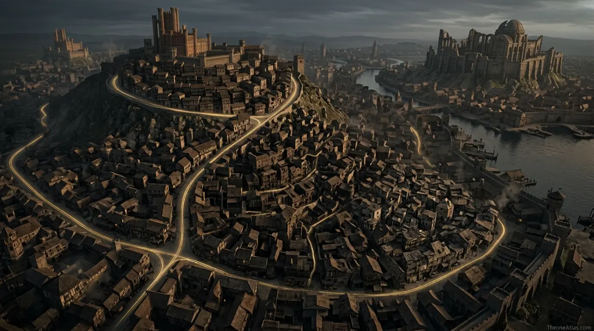
Flea Bottom is the poorest district of King’s Landing, a maze of narrow, unpaved alleys below the Street of Flour as the ground descends along the eastern side of the Hill of Rhaenys. It sits inside the capital’s broader network of hills, markets, gates and major roads, but its cramped layout and poverty make it feel like a different city from the Red Keep or Great Sept.
Flea Bottom Map — A District Inside the Capital
Flea Bottom is a micro-map, not a regional map. The useful scale is neighborhood relationship: Hill of Rhaenys above, Street of Flour as a boundary cue, alleys below, and routes outward toward the Dragonpit, city streets and markets.
Flea Bottom, Street of Flour & Hill of Rhaenys
Tap a marker to reveal why that place matters. Marker positions are interpretive unless the canon confidence note says otherwise.
Canon Confidence & What This Map Claims
Flea Bottom’s location below the Street of Flour on the east side of the Hill of Rhaenys is described clearly. The district is a maze rather than a surveyed grid, so individual alley geometry should be treated as illustrative unless specifically named in the text.
In This Guide
- Visual Atlas & Map
- Canon Confidence
- Map Index
- Where Is Flea Bottom in King’s Landing?
- Why Flea Bottom Is a Maze Instead of a Formal Street Grid
- Smallfolk, Food and the Social Geography of the Capital
- Daemon Targaryen and the Dance-Era Flea Bottom Map
- Flea Bottom During War, Riot and Shortage
- How Flea Bottom Connects to the Rest of King’s Landing
- Cartographer Field Notes
- Direct Answers
- Source & Canon Basis
- FAQs
Flea Bottom Map: What Matters Most
Flea Bottom is a district, not a separate town
It sits inside King’s Landing and should always be oriented against the capital map.
The Hill of Rhaenys is the key landmark
The district lies on the descending eastern side below the Street of Flour.
Street geometry reflects poverty
Narrow unpaved alleys and leaning buildings create a very different urban experience from royal districts.
Food is part of the local identity
Bowls of brown and cheap street food symbolize survival and crowd density more than court luxury.
The Dragonpit helps orientation
The Hill of Rhaenys above is crowned by the Dragonpit in later eras, giving map readers a strong vertical reference.
Smallfolk history matters here
Flea Bottom makes King’s Landing legible from below, not only from the perspective of rulers.
Daemon has a strong Dance-era connection
House of the Dragon and Fire & Blood associate him closely with the city’s lower districts and Prince of the City reputation.
Map precision has limits
A maze can be represented functionally without pretending every unnamed alley is canonically fixed.
Places, Zones & Connections to Plot
| Place | Zone | Why It Matters | How to Read It on the Map |
|---|---|---|---|
| Flea Bottom core | East side of Hill of Rhaenys | Poorest and most lawless district of King’s Landing. | Map as a dense neighborhood zone rather than a single pin. |
| Street of Flour | Above / boundary cue | Named street used to orient the district below it. | A strong edge reference for locating Flea Bottom within the capital. |
| Hill of Rhaenys | West / above district | One of King’s Landing’s three hills, later crowned by the Dragonpit. | Use elevation and slope to explain the “Bottom” relationship. |
| Dragonpit | Top of Hill of Rhaenys | Major landmark above the district in the wider city map. | Orientation anchor rather than part of Flea Bottom itself. |
| Street of the Sisters | Central capital corridor | Connects the Hill of Rhaenys toward Visenya’s Hill. | Shows how nearby major streets lead out of the maze. |
| Markets / food stalls | Within and around district | Cheap food and informal commerce support dense smallfolk life. | Represent as activity zones, not invented permanent businesses. |
| City gates and outer roads | Wider King’s Landing | Control movement between capital districts and routes beyond the walls. | Important for riots, crowds and movement even when not inside the district. |
| Red Keep | Aegon’s High Hill | Royal center contrasting sharply with Flea Bottom. | A useful social-distance marker inside the same city. |
Where Is Flea Bottom in King’s Landing?
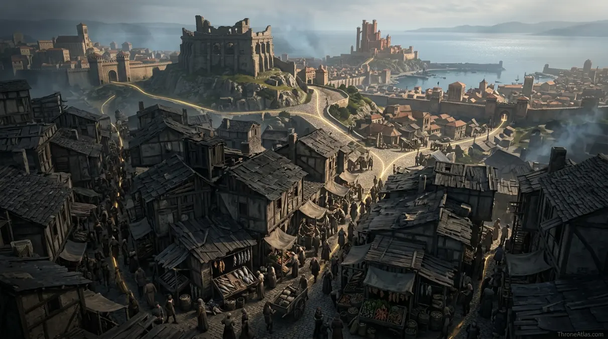
Flea Bottom lies below the Street of Flour as the city descends along the eastern side of the Hill of Rhaenys.
That sentence is more useful than a vague “near the center of King’s Landing” because it gives two map anchors: a named street and one of the capital’s three hills. Once the Hill of Rhaenys is located, Flea Bottom can be understood as the lower, crowded urban fabric below rather than as a floating slum somewhere outside the walls.
The Dragonpit later crowns the hill above, which gives modern map readers another strong reference point. Flea Bottom is not the Dragonpit district, but the vertical relationship matters. Royal and monumental architecture sits above or elsewhere in the city while the poorest inhabitants crowd into lower lanes.
That geography helps explain the name. “Bottom” is social, but it is also spatial. The district occupies low, cramped ground in a city whose elite landmarks dominate the three hills. The map turns a class metaphor into visible urban form.
Why Flea Bottom Is a Maze Instead of a Formal Street Grid
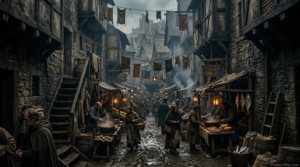
Flea Bottom is described as a tangle of narrow, unpaved alleys and cross-streets with buildings leaning close together, so its map should communicate density and irregular movement rather than clean royal planning.
This is a fundamentally different urban texture from broad processional streets or the open plazas around great monuments. A person entering Flea Bottom loses long sightlines. Corners come quickly, crowds compress movement, and the built environment feels improvised rather than monumental.
For characters, that can be dangerous or protective depending on who knows the district. An outsider with guards may find movement slow and visibility poor; a resident or street child can disappear into familiar lanes. The same geometry therefore changes the balance of power at human scale.
An accurate Flea Bottom map does not need twenty invented alley names. A dense schematic zone built around the few established anchors preserves the feeling of a maze while keeping the factual boundary honest.
Smallfolk, Food and the Social Geography of the Capital
Flea Bottom maps the everyday survival economy of King’s Landing: cheap food, crowded housing, informal work and people living far from the wealth displayed at court.
The famous “bowls of brown” are memorable because they reduce the capital’s economic hierarchy to a meal. In the Red Keep, food can be ceremonial. In Flea Bottom, food is about cost and availability. That difference belongs on a map because markets and density determine who can buy what, where and how often.
The district also reminds readers that King’s Landing is much larger than its ruling family. Hundreds of thousands of ordinary people experience war through prices, shortages, rumors, riots and crowd movement. A capital map focused only on the Red Keep, Great Sept and Dragonpit would erase most of the people who actually make the city function.
This is why Flea Bottom deserves a standalone page even though it is not a castle or battlefield. It gives ThroneAtlas a human-scale urban layer and supports queries that broader King’s Landing content cannot answer with the same specificity.
Daemon Targaryen and the Dance-Era Flea Bottom Map
Daemon Targaryen is closely associated with King’s Landing’s lower city during the Dance era, especially through his City Watch role and “Prince of the City” reputation.
That connection gives Flea Bottom unusual importance in House of the Dragon searches. Daemon’s authority is not limited to court chambers. His control of the City Watch puts him into the streets, taverns and districts where royal decisions become physical policing.
The adaptation may choose specific alleys, brothels or routes for scenes that the written history leaves more general. ThroneAtlas should label those as screen geography when using them, because a television production must create a concrete street even where the source only establishes a district.
The broader point survives both continuities: Daemon understands King’s Landing from a lower level than many nobles. Flea Bottom helps explain why he can move between palace politics and city underworld networks with unusual ease.
Flea Bottom During War, Riot and Shortage
Because Flea Bottom contains dense poor populations, changes in food supply, security and political order can become visible there faster and more violently than in protected elite spaces.
King’s Landing depends on food arriving from outside the city. When war disrupts roads, fleets or regional alliances, the poorest households feel the pressure first. A map of the capital therefore connects Flea Bottom to infrastructure far beyond its alleys: gates, markets, roads from the Reach and Riverlands, and the Blackwater harbor.
Crowd movement matters too. Dense streets can transform rumor into mass action. When thousands of people move toward a gate, sept, hill or royal procession, urban geography controls where pressure builds and where authority can respond.
That is why a neighborhood map belongs inside a larger systems map. Flea Bottom may be only one district, but it can reveal the health of the entire capital. Hunger, policing and legitimacy become visible at street level before they appear in official proclamations.
How Flea Bottom Connects to the Rest of King’s Landing
Flea Bottom is best understood through nearby hills and major streets: the Hill of Rhaenys and Dragonpit above, larger cross-city routes beyond the maze, and the Red Keep and Great Sept as contrasting centers of royal and religious authority.
The dedicated King’s Landing map shows the full city. This page zooms in, but the links between scales must remain obvious. A user should be able to move from neighborhood to capital without learning a contradictory layout.
Visually, the three hills provide the simplest orientation. Rhaenys anchors Flea Bottom’s immediate neighborhood; Aegon’s High Hill holds the Red Keep; Visenya’s Hill holds the Great Sept. The streets between them turn topography into politics because crowds, guards and processions must move across real slopes and corridors.
That multi-scale structure is valuable for both readers and search engines. Flea Bottom becomes a child entity of the King’s Landing cluster, while linking naturally to Dragonpit, Red Keep, Cersei’s power map and Dance-era character pages without competing for the broad “King’s Landing map” query.
How Each Marker Changes the Map
These notes are deliberately practical. They explain what each point does to movement, power, trade, defense, religion or social life instead of repeating a list of place names.
Flea Bottom core
On the atlas, Flea Bottom core should not be treated as an isolated pin. Its position in East side of Hill of Rhaenys matters because Poorest and most lawless district of King’s Landing.. The practical map-reading question is therefore Map as a dense neighborhood zone rather than a single pin.. That relationship is more useful than pretending the world has modern surveyed coordinates.
Street of Flour
Street of Flour earns a place on this map for a different reason from a famous capital or battlefield. In Above / boundary cue, Named street used to orient the district below it.. When following characters, fleets, merchants or armies, read this point through the lens of A strong edge reference for locating Flea Bottom within the capital.; it explains what can realistically happen around it.
Hill of Rhaenys
A good map gives Hill of Rhaenys context, not just a label. Here the relevant geographic frame is West / above district. One of King’s Landing’s three hills, later crowned by the Dragonpit.. For route and strategy purposes, the important takeaway is Use elevation and slope to explain the “Bottom” relationship., which is why this location connects naturally to the surrounding markers.
Dragonpit
The cartographic value of Dragonpit comes from its relationship with the wider Top of Hill of Rhaenys network. Major landmark above the district in the wider city map.. In practical terms, Orientation anchor rather than part of Flea Bottom itself.. That makes the point meaningful even when the source material never provides exact mileage or a street-by-street survey.
Street of the Sisters
On the atlas, Street of the Sisters should not be treated as an isolated pin. Its position in Central capital corridor matters because Connects the Hill of Rhaenys toward Visenya’s Hill.. The practical map-reading question is therefore Shows how nearby major streets lead out of the maze.. That relationship is more useful than pretending the world has modern surveyed coordinates.
Markets / food stalls
Markets / food stalls earns a place on this map for a different reason from a famous capital or battlefield. In Within and around district, Cheap food and informal commerce support dense smallfolk life.. When following characters, fleets, merchants or armies, read this point through the lens of Represent as activity zones, not invented permanent businesses.; it explains what can realistically happen around it.
City gates and outer roads
A good map gives City gates and outer roads context, not just a label. Here the relevant geographic frame is Wider King’s Landing. Control movement between capital districts and routes beyond the walls.. For route and strategy purposes, the important takeaway is Important for riots, crowds and movement even when not inside the district., which is why this location connects naturally to the surrounding markers.
Red Keep
The cartographic value of Red Keep comes from its relationship with the wider Aegon’s High Hill network. Royal center contrasting sharply with Flea Bottom.. In practical terms, A useful social-distance marker inside the same city.. That makes the point meaningful even when the source material never provides exact mileage or a street-by-street survey.
Fast Answers About the Map
Inside King’s Landing, below the Street of Flour on the eastern side of the Hill of Rhaenys.
No. It is an internal district of King’s Landing.
The Hill of Rhaenys rises above the district; the Dragonpit is the major landmark on the hill.
For extreme poverty, cramped alleys, cheap food, crime and its connection to the everyday smallfolk of the capital.
Yes, the district is relevant to Daemon Targaryen’s King’s Landing story and the City Watch / lower-city setting.
The district’s broad location is known, but a complete canonical street grid is not. Detailed screen sets should be labeled as adaptation geography.
What This Atlas Is Based On
Flea Bottom has strong district-level anchors but weak evidence for a full street survey, making it an ideal page for explicit canon-confidence labeling.
- A Song of Ice and Fire: Flea Bottom location, alley character, smallfolk life and King’s Landing urban context.
- Fire & Blood: Dance-era city politics and Daemon’s relationship with King’s Landing.
- The World of Ice & Fire: Capital history and the three-hill framework.
- HBO adaptations: Used for screen-specific street staging only when clearly separated from book geography.
Continue Exploring ThroneAtlas Maps
Flea Bottom Map FAQs
Where exactly is Flea Bottom in King’s Landing?
It is below the Street of Flour as the city descends along the eastern side of the Hill of Rhaenys.
What is the Hill of Rhaenys?
One of King’s Landing’s three major hills. The Dragonpit stands on its summit, providing a useful landmark above Flea Bottom.
Why is it called Flea Bottom?
The name reflects the district’s low status and impoverished conditions, while “Bottom” also fits its lower position beneath the hill and major streets.
What are bowls of brown?
A cheap local food strongly associated with Flea Bottom in the novels, symbolizing the district’s poverty and survival economy.
Did Daemon Targaryen control Flea Bottom?
Not as a private territory, but his command of the City Watch and familiarity with the lower city make Flea Bottom closely associated with his “Prince of the City” phase.
Is Flea Bottom near the Dragonpit?
It lies on the lower eastern side of the same Hill of Rhaenys that is crowned by the Dragonpit, so the two are useful map references even though they are distinct places.
Is Flea Bottom close to the Red Keep?
Both are inside King’s Landing, but the Red Keep sits on Aegon’s High Hill and represents a very different social and topographic zone.
Why does Flea Bottom matter during war?
Poor dense districts are especially vulnerable to food shortages, unrest and policing pressure when war disrupts supply routes into the capital.
Is Flea Bottom book canon or show canon?
The district is firmly part of the book geography and is also depicted in screen adaptations. Exact street layouts can differ between the two.
How should a map show Flea Bottom accurately?
Show the district zone and established anchors—Street of Flour, Hill of Rhaenys and nearby major city landmarks—while keeping unnamed alleys illustrative rather than falsely canonical.
Flea Bottom Makes King’s Landing a Real City
Flea Bottom is where the capital stops being a collection of monuments and becomes a lived urban system. Its position beneath the Hill of Rhaenys, cramped lanes, cheap food, crowd density and vulnerability to shortages show how geography changes with class. On ThroneAtlas, that micro-map adds a layer the Red Keep alone can never provide.