Myr Map: Free City, Disputed Lands, Crafts & Trade Routes
A focused atlas of Myr, the southern mainland Free City famed for lenses, lace, carpets and skilled craftsmanship—and for its repeated wars with Lys and Tyrosh over the Disputed Lands.
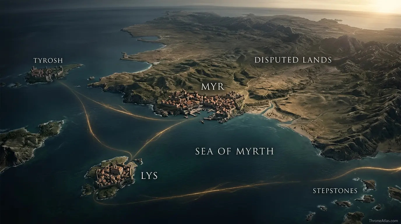
Myr is a coastal Free City in southern western Essos, positioned beside the Disputed Lands and near the island cities of Lys and Tyrosh. Unlike those two maritime rivals, Myr sits on the mainland, which gives it direct overland access to the contested interior while still functioning as a port. Its geography helps explain the long rivalry triangle and the rise of the Triarchy.
Myr Map — Mainland Access to the Disputed Lands
Myr is easiest to understand by comparing land and sea. It is a port, but unlike Lys and Tyrosh it also opens directly onto the mainland terrain the three cities repeatedly contest.
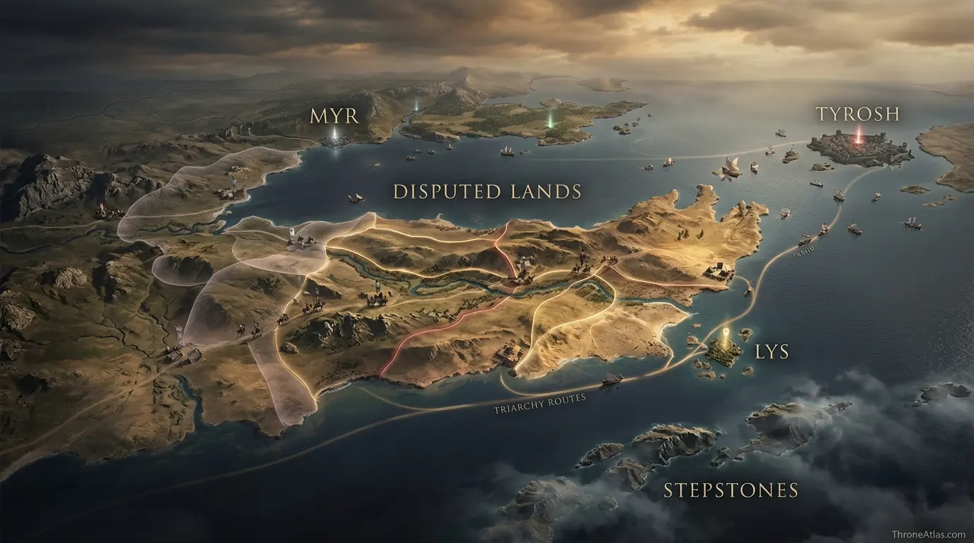
Myr, Disputed Lands, Lys & Tyrosh
Tap a marker to reveal why that place matters. Marker positions are interpretive unless the canon confidence note says otherwise.
Canon Confidence & What This Map Claims
Myr’s position on the southern Essos mainland and its relationship with the Disputed Lands, Lys and Tyrosh are well established. The exact boundaries of Myrish control change over time and should be represented as influence, not permanent national borders.
In This Guide
- Visual Atlas & Map
- Canon Confidence
- Map Index
- Where Is Myr on the Essos Map?
- Why the Disputed Lands Matter More to Myr Than a Fixed Border
- Myrish Crafts: Why Economic Geography Belongs on the Map
- Myr, Lys, Tyrosh and the Triarchy
- How Myr Connects to Westeros
- How to Read a Myr Map Without Inventing a City Plan
- Cartographer Field Notes
- Direct Answers
- Source & Canon Basis
- FAQs
Myr Map: What Matters Most
Myr is mainland, not island
That single fact changes how it can project power into the Disputed Lands.
It is also a port
Myr combines overland access with maritime trade rather than choosing one system.
Crafts are a major identity
Myrish lenses, lace, carpets and skilled manufacture connect the city to long-distance demand.
The Disputed Lands are next door
Myr’s wars with Lys and Tyrosh are grounded in immediate geography.
The Triarchy temporarily aligned rivals
Myr, Lys and Tyrosh could combine when shared interests outweighed competition.
Sellswords shape the frontier
Contested territory often attracts mercenary companies rather than stable feudal administration.
Volantis looms to the east
The older Free City has historically competed for influence in the same southern system.
Myr connects characters to geography
Thoros of Myr and other Myrish figures show how city identity travels far beyond the map pin.
Places, Zones & Connections to Plot
| Place | Zone | Why It Matters | How to Read It on the Map |
|---|---|---|---|
| Myr | Southern mainland coast | Craft-rich Free City and one of the three rivals around the Disputed Lands. | Use as the mainland anchor of the Myr–Lys–Tyrosh triangle. |
| Disputed Lands | Southwestern Essos interior | Repeatedly contested by neighboring city-states and sellsword armies. | Show as fluid influence rather than permanent Myrish territory. |
| Lys | Southern island | Commercial rival and former Triarchy partner. | A sea-based counterpart whose proximity keeps the rivalry tight. |
| Tyrosh | Island near Stepstones | Fortified rival guarding strategic sea approaches. | Completes the three-city conflict geometry around land and sea. |
| Sea of Myrth | Coastal waters | Maritime approach associated with Myr’s port geography. | Reminds readers that mainland Myr is still a sea-trading city. |
| Stepstones | Southwest / west | Contested islands affecting trade toward Westeros. | Important to Triarchy-era strategy even without being Myrish home territory. |
| Volantis | East / southeast | Large neighboring Free City with historical expansion into the region. | An external power capable of disrupting the three-city balance. |
| Overland caravan routes | North / east | Connections toward other Free Cities and interior Essos. | Myr’s mainland position makes land movement a larger part of its geography than Lys’s. |
Where Is Myr on the Essos Map?
Myr is a coastal city on the southern mainland of western Essos, adjacent to the Disputed Lands and positioned near Lys and Tyrosh.
This is the first fact that should anchor the page because it differentiates Myr from its two best-known rivals. Lys and Tyrosh are island cities. Myr sits on the continent. That means a Myrish army can move into disputed territory by land while the city still benefits from maritime trade and naval connections.
On a small world map, the three cities can look clustered almost on top of one another. At story scale, the important point is not exact mileage but strategic proximity. Their interests overlap because none is geographically remote from the same valuable borderland and shipping approaches.
Myr also sits within a wider southern Free Cities corridor influenced by Volantis to the east and the Stepstones to the southwest. It is therefore local and international at once: a mainland commercial city whose nearest problems are immediate, but whose trade and mercenary networks extend far beyond the coast.
Why the Disputed Lands Matter More to Myr Than a Fixed Border
The Disputed Lands are central to Myr because they are a nearby contested zone where control shifts through wars, alliances and sellsword contracts instead of settling into one permanent frontier.
Modern maps teach us to expect crisp national boundaries. That is the wrong visual language here. Myr’s relationship with the Disputed Lands is better represented by arrows, campaign corridors and shaded uncertainty. The history is precisely about the inability of one city to make its claim permanently uncontested.
Because Myr is on the mainland, these wars can feel more immediate than they do for an island rival. Roads, farms, camps and fortified positions can feed directly into the city’s strategic horizon. Yet sea power still matters because Lys and Tyrosh can bring ships, and because trade through the wider region can finance the conflict.
The region is also famous for sellsword activity. That turns mercenary companies into a form of mobile geography: whoever hires them can suddenly project force into an area without possessing a traditional feudal levy there. A ThroneAtlas map should make that fluidity visible rather than hiding it behind one colored polygon.
Myrish Crafts: Why Economic Geography Belongs on the Map
Myr is famous for skilled manufacture—especially lenses, lace, carpets and other fine crafts—so its importance comes from specialized production and trade as much as from military power.
A city can influence the world without controlling vast territory. Myrish lenses are a perfect example. They travel. The reputation of the craft can appear in distant courts and cities, allowing Myr to be present economically even when no Myrish army is nearby.
The same is true of textiles and fine goods. Workshops require skilled labor, supply inputs, buyers and shipping connections. Those relationships create an economic map layered over the political one. A coastal city with access to both land routes and sea lanes is well placed to participate in that network.
This matters for human readers because it gives the place texture beyond war. Myr is not only “the city that fights Lys and Tyrosh.” It is a productive urban center whose crafts help explain its wealth, bargaining power and visibility in stories set far away.
Myr, Lys, Tyrosh and the Triarchy
The Triarchy was a political alliance of Myr, Lys and Tyrosh that temporarily turned three habitual rivals into a coordinated regional power, especially around the Stepstones.
On the map, the alliance makes immediate sense. The three cities are close enough to share threats and trade interests. Joint fleets and resources could achieve more than each city acting alone, especially when pirates or outside powers interfered with the Stepstones.
But the same closeness also explains why cooperation was fragile. If all three want influence over the same land and routes, victory against an external enemy does not remove their internal competition. Geography creates both alliance logic and rivalry logic at the same time.
For House of the Dragon readers, this background clarifies why the Stepstones conflict is not an isolated pirate adventure. It sits inside a wider southern Essos political system in which Myr has a direct stake. The regional hub and battle maps can carry the campaign detail while this page owns Myr’s side of the story.
How Myr Connects to Westeros
Myr connects to Westeros through trade, mercenaries, religious figures, court relationships and historical wars, not through direct territorial rule.
Thoros of Myr is the most memorable personal connection for many readers. His identity is carried in his name even when he is far from his birthplace, which is a small example of how the Free Cities operate narratively: people move, and their city origins move with them.
Myrish goods also enter Westerosi life, reinforcing long-distance commercial contact. That means the Narrow Sea is not a cultural wall. Ports, merchants and sellsails make western Essos and the Seven Kingdoms part of one larger exchange zone.
The Defiance of Duskendale also brings Myrish association into Westerosi political memory through Serala of Myr. These individual connections are not map markers by themselves, but they show why a dedicated city page strengthens entity relationships across the atlas.
How to Read a Myr Map Without Inventing a City Plan
A responsible Myr map should be highly confident about regional position and deliberately modest about internal streets, because the published material gives far stronger macro geography than a complete urban survey.
That distinction strengthens the map rather than weakening it. Myr’s position relative to Lys, Tyrosh, the Disputed Lands, Volantis and Westeros is well established. A decorative street grid drawn from imagination would add visual detail while reducing factual reliability.
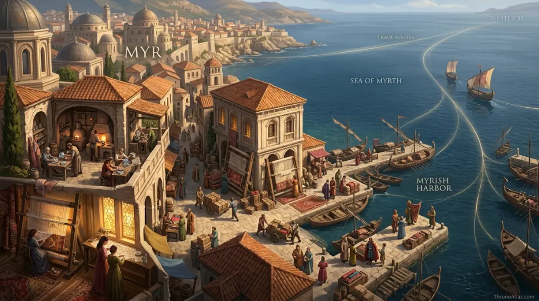
The atlas therefore emphasizes coastline, harbor approaches, workshops and major route directions without pretending that every internal lane is canonically mapped.
The durable geographic answer is the relationship between Myr, the disputed mainland and the surrounding southern Free Cities. Any added detail should support that relationship rather than manufacture precision for its own sake.
How Each Marker Changes the Map
These notes are deliberately practical. They explain what each point does to movement, power, trade, defense, religion or social life instead of repeating a list of place names.
Myr
On the atlas, Myr should not be treated as an isolated pin. Its position in Southern mainland coast matters because Craft-rich Free City and one of the three rivals around the Disputed Lands.. The practical map-reading question is therefore Use as the mainland anchor of the Myr–Lys–Tyrosh triangle.. That relationship is more useful than pretending the world has modern surveyed coordinates.
Disputed Lands
Disputed Lands earns a place on this map for a different reason from a famous capital or battlefield. In Southwestern Essos interior, Repeatedly contested by neighboring city-states and sellsword armies.. When following characters, fleets, merchants or armies, read this point through the lens of Show as fluid influence rather than permanent Myrish territory.; it explains what can realistically happen around it.
Lys
A good map gives Lys context, not just a label. Here the relevant geographic frame is Southern island. Commercial rival and former Triarchy partner.. For route and strategy purposes, the important takeaway is A sea-based counterpart whose proximity keeps the rivalry tight., which is why this location connects naturally to the surrounding markers.
Tyrosh
The cartographic value of Tyrosh comes from its relationship with the wider Island near Stepstones network. Fortified rival guarding strategic sea approaches.. In practical terms, Completes the three-city conflict geometry around land and sea.. That makes the point meaningful even when the source material never provides exact mileage or a street-by-street survey.
Sea of Myrth
On the atlas, Sea of Myrth should not be treated as an isolated pin. Its position in Coastal waters matters because Maritime approach associated with Myr’s port geography.. The practical map-reading question is therefore Reminds readers that mainland Myr is still a sea-trading city.. That relationship is more useful than pretending the world has modern surveyed coordinates.
Stepstones
Stepstones earns a place on this map for a different reason from a famous capital or battlefield. In Southwest / west, Contested islands affecting trade toward Westeros.. When following characters, fleets, merchants or armies, read this point through the lens of Important to Triarchy-era strategy even without being Myrish home territory.; it explains what can realistically happen around it.
Volantis
A good map gives Volantis context, not just a label. Here the relevant geographic frame is East / southeast. Large neighboring Free City with historical expansion into the region.. For route and strategy purposes, the important takeaway is An external power capable of disrupting the three-city balance., which is why this location connects naturally to the surrounding markers.
Overland caravan routes
The cartographic value of Overland caravan routes comes from its relationship with the wider North / east network. Connections toward other Free Cities and interior Essos.. In practical terms, Myr’s mainland position makes land movement a larger part of its geography than Lys’s.. That makes the point meaningful even when the source material never provides exact mileage or a street-by-street survey.
Fast Answers About the Map
On the southern mainland coast of western Essos, beside the Disputed Lands and near Lys and Tyrosh.
No. Myr is a mainland coastal city.
Fine craftsmanship including lenses, lace and carpets, as well as trade and political rivalry.
Lys and Tyrosh are its traditional rivals there.
Yes. Myr allied with Lys and Tyrosh in the Triarchy.
Thoros of Myr is one of the best-known Myrish characters in A Song of Ice and Fire and Game of Thrones.
What This Atlas Is Based On
Myr is a good example of why atlas accuracy sometimes means refusing false street-level precision and focusing on the better-established regional network.
- A Song of Ice and Fire: Myrish characters, goods, trade references and political context.
- Fire & Blood: Triarchy and Stepstones history linking Myr to major Targaryen-era events.
- The World of Ice & Fire: Free City origins, regional geography and political relationships.
- Published Free Cities maps: Used for the city’s mainland position and its relationship with the Disputed Lands and neighboring cities.
Continue Exploring ThroneAtlas Maps
Myr Map FAQs
Where is Myr in Game of Thrones?
Myr lies on the southern coast of western Essos beside the Disputed Lands and near the island Free Cities of Lys and Tyrosh.
Is Myr one of the Free Cities?
Yes. Myr is one of the Nine Free Cities.
What are Myrish lenses?
Myr is famous for skilled lensmaking and fine glasswork. References to Myrish lenses in distant places reflect the city’s reputation for specialized craft.
Why does Myr fight Lys and Tyrosh?
All three compete for influence over the nearby Disputed Lands and related trade interests.
What is the Sea of Myrth?
It is the body of water associated with the coastal region around Myr, reinforcing the city’s maritime connections.
Was Myr controlled by Volantis?
Volantis expanded aggressively after the Doom and at times dominated parts of the southern Free Cities system, including Myr, before resistance broke that expansion.
Does Myr have a role in House of the Dragon history?
Yes through the Triarchy and the regional politics behind the Stepstones conflict.
Is Thoros from Myr?
Yes. His name reflects his origin in the Free City of Myr.
Is Myr closer to Lys or Braavos?
Myr is part of the southern Free Cities cluster and is far more directly connected geographically to Lys and Tyrosh than to northern Braavos.
How exact is this map?
Regional placement is canon-based. Internal street arrangements and shifting influence in the Disputed Lands are intentionally schematic.
Myr Is the Mainland Corner of a Three-City Rivalry
Myr’s identity becomes much clearer on a map. It is a mainland port beside contested territory, unlike island rivals Lys and Tyrosh; it combines land access with maritime trade; and its craft economy gives it influence beyond war. The Disputed Lands, Triarchy and Stepstones all make more sense once Myr’s position is fixed.