Lucerys Velaryon Journey Map: Dragonstone to Storm’s End
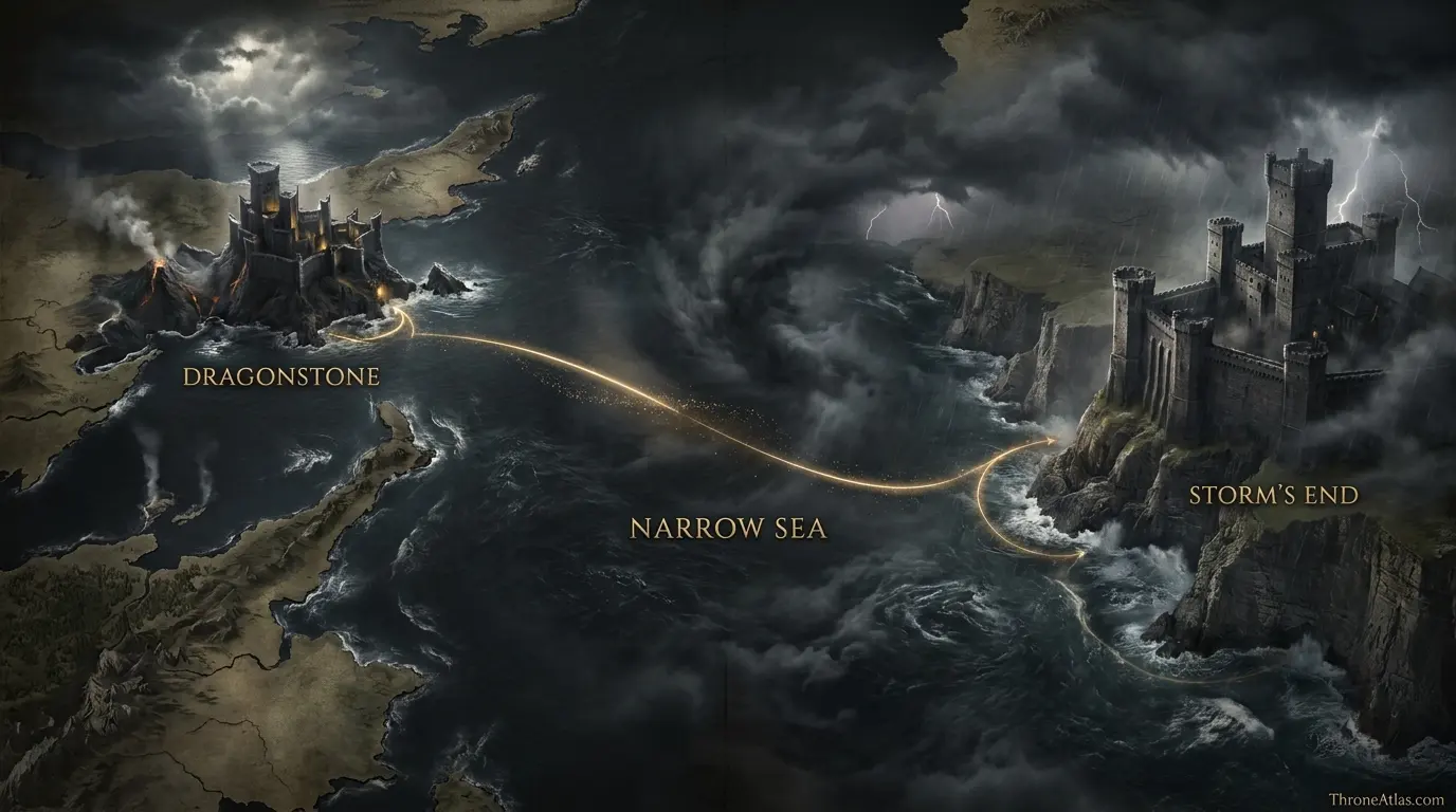
Follow Prince Lucerys Velaryon’s final mission from Dragonstone to Storm’s End, then into the storm over Shipbreaker Bay where Arrax and Vhagar turned a diplomatic errand into one of the Dance’s defining tragedies.
Read the Map by Place, Route and Confidence
Interactive Lucerys Velaryon Journey Map: Dragonstone to Storm’s End
This schematic is a reading aid, not an official cartographic plate. Tap a marker to see why that location matters. The connecting route is intentionally simplified so confirmed geography is not confused with an invented exact path.
Map Navigator
Six Things the Map Makes Clear
1. Map Takeaway
The map is built around envoy route and final dragonflight, not a generic Westeros overview.
2. Map Takeaway
Confirmed places are separated from reconstructed corridors so the page does not overstate precision.
3. Map Takeaway
The strongest geographic anchors are Dragonstone, Narrow Sea and Cliffs Below Storm’s End.
4. Map Takeaway
Political, military and environmental geography are explained together instead of being reduced to a pin list.
5. Map Takeaway
Book chronology and adaptation material are kept separate whenever they do not align exactly.
6. Map Takeaway
The map is designed to connect naturally with the surrounding ThroneAtlas location, house, battle and journey pages.
Key Places on the Lucerys Velaryon Journey Map
| Location | Map confidence | Why it matters |
|---|---|---|
| Dragonstone | Confirmed | Starting point of Rhaenyra’s diplomatic mission and the Black council’s island stronghold. |
| Narrow Sea | Reconstructed | The broad water crossing between Dragonstone and the stormlands; exact aerial line is not stated. |
| Stormlands Coast | Regional | A useful approach zone for understanding the weather-exposed eastern shore. |
| Storm’s End | Confirmed | Borros Baratheon’s castle and the diplomatic destination shared by Lucerys and Aemond. |
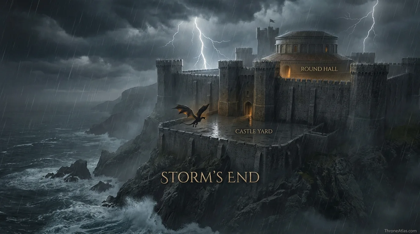
| Round Hall | Confirmed setting | The meeting space where Borros heard the rival messages and rejected Rhaenyra’s request. |
| Castle Yard | Confirmed setting | Arrax waited here while Lucerys prepared to depart under Baratheon protection. |
| Shipbreaker Bay | Confirmed | The storm-lashed waters outside Storm’s End where Vhagar overtook Arrax. |
| Cliffs Below Storm’s End | Confirmed | Arrax’s remains later washed ashore beneath the castle’s cliffs. |
A location marked “reconstructed” is not a guess presented as fact. It means the surrounding event is attested but the surviving narrative does not give enough spatial detail to place a modern-style coordinate. That distinction is especially important for ancient battles, aerial pursuits, siege camps and long sea voyages.
How the Story Moves Across the Map
Why Dragonstone matters
Dragonstone is more than the first pin on Lucerys’s route. It is the operational heart of Rhaenyra’s cause at the moment she needs the great houses to choose sides. Sending her sons as envoys turns family loyalty into geography: Jacaerys flies north, while Lucerys takes the shorter but more dangerous southern assignment. The island’s location in Blackwater Bay makes a direct flight toward the stormlands plausible, but the sources never survey the path. A responsible map therefore begins with the political fact—Dragonstone to Storm’s End—rather than pretending there was a known chain of intermediate waypoints.
From an atlas perspective, this section is best read through the relationship between Dragonstone and Stormlands Coast. The first anchors the narrative in a named place, while the second shows how the consequences spread into a wider political or military space. That relationship is more useful than forcing the episode into an artificial straight line, because Westerosi history is shaped by roads, seas, fortifications, weather, alliances and the time required to move information as much as by raw distance.
The diplomatic logic of Storm’s End
Storm’s End is the destination because House Baratheon can materially alter the balance of the civil war. Borros controls a major castle, stormland levies, coastal approaches and a house tied by blood to the Targaryens. Lucerys arrives with a reminder of old oaths; Aemond arrives with a marriage offer. The geography of the meeting matters because both envoys reach the same fortress from rival centers of power. Storm’s End becomes a pressure point where military geography and marriage politics occupy the same room.
From an atlas perspective, this section is best read through the relationship between Narrow Sea and Storm’s End. The first anchors the narrative in a named place, while the second shows how the consequences spread into a wider political or military space. That relationship is more useful than forcing the episode into an artificial straight line, because Westerosi history is shaped by roads, seas, fortifications, weather, alliances and the time required to move information as much as by raw distance.
Why the weather changes the map
The final leg cannot be read like a calm point-to-point journey. The sources emphasize a violent storm. Arrax is smaller and more agile than Vhagar, but the weather works against the younger dragon. A map should therefore show Shipbreaker Bay as a hazardous zone rather than a clean straight line. Wind, rain, cliffs and open water matter because the chase is not happening over predictable roads. The environment is part of the event, and that is why the last markers belong to a bay and coastline rather than to a neatly named battlefield.
From an atlas perspective, this section is best read through the relationship between Stormlands Coast and Round Hall. The first anchors the narrative in a named place, while the second shows how the consequences spread into a wider political or military space. That relationship is more useful than forcing the episode into an artificial straight line, because Westerosi history is shaped by roads, seas, fortifications, weather, alliances and the time required to move information as much as by raw distance.
Aemond and Vhagar enter the route
Lucerys’s map overlaps with Aemond’s only at the end, but that overlap changes the political meaning of the entire journey. Inside Storm’s End, Borros prevents bloodshed under his roof. Outside it, the protection ends. Aemond mounts Vhagar and pursues the younger envoy. The result is an asymmetric dragon encounter: an enormous veteran dragon against the much smaller Arrax. For an atlas, the useful distinction is between the confirmed pursuit zone and the unknown exact maneuvering in the storm.
From an atlas perspective, this section is best read through the relationship between Storm’s End and Castle Yard. The first anchors the narrative in a named place, while the second shows how the consequences spread into a wider political or military space. That relationship is more useful than forcing the episode into an artificial straight line, because Westerosi history is shaped by roads, seas, fortifications, weather, alliances and the time required to move information as much as by raw distance.
Book chronicle and screen adaptation
Fire & Blood presents the event through an in-world historical record that preserves rumors around Lucerys’s fate while treating his death with Arrax as the credible conclusion. House of the Dragon dramatizes the chase directly and gives the dragons’ behavior a more immediate causal role. The screen version and the chronicle reach the same essential geographic endpoint—Storm’s End and Shipbreaker Bay—but differ in how intention and control are framed. This page keeps those layers separate rather than blending them into one supposedly exact account.
From an atlas perspective, this section is best read through the relationship between Round Hall and Shipbreaker Bay. The first anchors the narrative in a named place, while the second shows how the consequences spread into a wider political or military space. That relationship is more useful than forcing the episode into an artificial straight line, because Westerosi history is shaped by roads, seas, fortifications, weather, alliances and the time required to move information as much as by raw distance.
Why the journey matters beyond its length
Lucerys travels a much shorter route than many Thrones characters, yet few journeys produce a larger strategic shock. The failed embassy leaves the Blacks without Baratheon support, the death of an envoy destroys any remaining illusion that the conflict can be contained, and the killing of a prince intensifies the cycle of retaliation. On the map, the distance is compact. In the war, the consequence is continental. That contrast is exactly why a dedicated journey map earns its place beside the broader Dance of the Dragons atlas.
From an atlas perspective, this section is best read through the relationship between Castle Yard and Cliffs Below Storm’s End. The first anchors the narrative in a named place, while the second shows how the consequences spread into a wider political or military space. That relationship is more useful than forcing the episode into an artificial straight line, because Westerosi history is shaped by roads, seas, fortifications, weather, alliances and the time required to move information as much as by raw distance.
What Changes When You Read the Story Spatially
Read from the first marker to the last and the map becomes a sequence of changing pressures rather than a simple itinerary. Dragonstone establishes the opening context, while Cliffs Below Storm’s End shows where the central arc resolves. Between those points, the map distinguishes sites named directly in the histories from zones added only to make the geography legible. That distinction prevents a smooth-looking route from being mistaken for a surveyed road or flight path.
Dragonstone and Narrow Sea serve different functions on this page. Starting point of Rhaenyra’s diplomatic mission and the Black council’s island stronghold. The broad water crossing between Dragonstone and the stormlands; exact aerial line is not stated. Seeing them together helps explain why lucerys velaryon journey map is best treated as a spatial argument: the story depends on what each place enables, restricts or exposes, not merely on the order in which names appear in a chronology.
Stormlands Coast and Storm’s End serve different functions on this page. A useful approach zone for understanding the weather-exposed eastern shore. Borros Baratheon’s castle and the diplomatic destination shared by Lucerys and Aemond. Seeing them together helps explain why lucerys velaryon journey map is best treated as a spatial argument: the story depends on what each place enables, restricts or exposes, not merely on the order in which names appear in a chronology.
Round Hall and Castle Yard serve different functions on this page. The meeting space where Borros heard the rival messages and rejected Rhaenyra’s request. Arrax waited here while Lucerys prepared to depart under Baratheon protection. Seeing them together helps explain why lucerys velaryon journey map is best treated as a spatial argument: the story depends on what each place enables, restricts or exposes, not merely on the order in which names appear in a chronology.
The broader value of this atlas is context. A named castle or bay can look isolated in prose, but once it is placed beside nearby regions, rival seats and movement corridors, the choices of rulers and commanders become easier to understand. Distance creates delay. Water creates risk. Fortresses concentrate power. Roads channel armies. Dragons ignore some of those limits while introducing others. The map is useful because it lets those constraints appear together.
That is also why ThroneAtlas avoids false precision. Westerosi sources often preserve destination names while omitting exact road segments, camp positions or mile-by-mile paths. A responsible reconstruction should tell readers where certainty ends. The result may look less absolute than a fictional GPS trace, but it is more faithful to how the geography is actually described.
Canon Confidence & Reconstruction Limits
This page separates firm geographic anchors from interpretive connectors. The goal is to make the map useful without upgrading inference into canon.
Four Details Worth Watching
Dragonstone
Starting point of Rhaenyra’s diplomatic mission and the Black council’s island stronghold. Its placement on this atlas is intended to clarify the wider story without claiming precision beyond the source record.
Stormlands Coast
A useful approach zone for understanding the weather-exposed eastern shore. Its placement on this atlas is intended to clarify the wider story without claiming precision beyond the source record.
Round Hall
The meeting space where Borros heard the rival messages and rejected Rhaenyra’s request. Its placement on this atlas is intended to clarify the wider story without claiming precision beyond the source record.
Shipbreaker Bay
The storm-lashed waters outside Storm’s End where Vhagar overtook Arrax. Its placement on this atlas is intended to clarify the wider story without claiming precision beyond the source record.
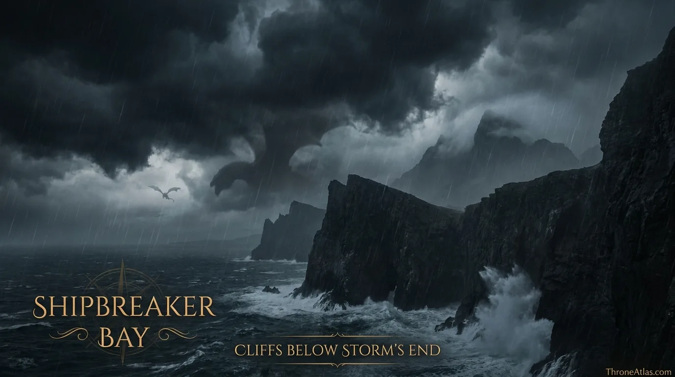
The visual layer should reinforce the text rather than merely decorate it. When you replace these image URLs with final artwork using the same filenames, keep the labels readable on mobile and avoid placing invented borders, distances or roads where the source record is uncertain.
Fast Answers About This Map
Lucerys Velaryon’s best-attested final route runs from Dragonstone to Storm’s End as Queen Rhaenyra’s envoy. After Lord Borros Baratheon refused his appeal, Lucerys left on Arrax during a severe storm. Aemond Targaryen followed on Vhagar, and Arrax was destroyed above Shipbreaker Bay. The major locations are secure; the exact flight track across the narrow sea and the precise point of the aerial clash are not.
Dragonstone is the opening anchor, but Cliffs Below Storm’s End is equally important because it shows where the main geographic arc reaches its consequence.
No. Named destinations and major event locations come from the source record, while connecting lines are schematic unless a specific road, river or route is directly established.
Use the confidence labels. They distinguish fixed places from probable regions and explanatory reconstructions, which is especially important for battles, dragonflights and ancient migrations.
What This Atlas Is Based On
- Fire & Blood for Lucerys’s embassy, Storm’s End encounter and the fight above Shipbreaker Bay.
- The World of Ice & Fire and published Westeros maps for Dragonstone, Stormlands and Blackwater geography.
- House of the Dragon for the screen adaptation, treated separately from the book chronicle.
- Where sources disagree or omit exact coordinates, the page labels the uncertainty rather than silently choosing one version.
Continue Exploring ThroneAtlas
These connected pages expand the same geography from different angles—regional maps for physical context, character routes for movement, house maps for political control and battle maps for moments when the landscape directly shapes the outcome.
Lucerys Velaryon Journey Map: Dragonstone to Storm’s End FAQs
Where did Lucerys Velaryon fly from?
He left Dragonstone as an envoy for Queen Rhaenyra Targaryen.
Where was Lucerys going?
His mission was to Storm’s End to seek the support of Lord Borros Baratheon.
What dragon did Lucerys ride?
Lucerys rode Arrax, a young dragon much smaller than Vhagar.
Why was Aemond at Storm’s End?
Aemond was there as an envoy for Aegon II and offered a marriage alliance to House Baratheon.
Did Borros Baratheon support Rhaenyra?
No. He rejected Lucerys’s appeal and favored the Green offer.
Where did Arrax and Vhagar fight?
Their encounter took place above the storm-lashed waters of Shipbreaker Bay outside Storm’s End.
Was Lucerys’s exact flight path recorded?
No. The origin, destination and final battle zone are known, but the precise route is not.
Was Lucerys’s body found?
The historical account treats his death as certain, but his body is not securely recovered in the principal chronicle.
Is the TV version identical to Fire & Blood?
No. The adaptation changes how intention and dragon control are dramatized while preserving the central geography.
Why is this journey important?
It transforms a diplomatic mission into an irreversible escalation of the Dance of the Dragons.
These questions focus on the distinctions most likely to matter when reading the lucerys velaryon journey map: what is directly named, what is inferred from regional geography, and what should remain uncertain. Where the chronicles preserve competing versions, ThroneAtlas keeps the disagreement visible rather than selecting the most dramatic account simply because it produces a cleaner map.
Why This Geography Matters
Lucerys Velaryon’s best-attested final route runs from Dragonstone to Storm’s End as Queen Rhaenyra’s envoy. After Lord Borros Baratheon refused his appeal, Lucerys left on Arrax during a severe storm. Aemond Targaryen followed on Vhagar, and Arrax was destroyed above Shipbreaker Bay. The major locations are secure; the exact flight track across the narrow sea and the precise point of the aerial clash are not.
Seen as a map rather than a list of names, the story becomes easier to follow because movement, control and consequence share the same frame. That is the purpose of this atlas: not to replace the books or screen adaptation, but to make their geography legible.