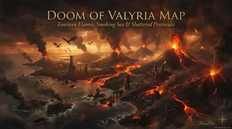
Nymeria Journey Map: Rhoyne to Dorne by Ten Thousand Ships
Trace Queen Nymeria’s extraordinary migration from the fallen Rhoynar cities through the southern seas to Dorne, where exile became conquest, alliance and a new Dornish dynasty.
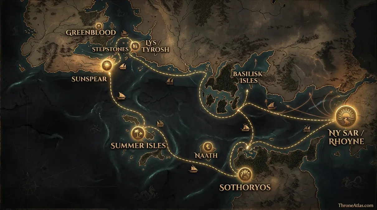
Read the Map by Place, Route and Confidence
Interactive Nymeria Journey Map: Rhoyne to Dorne by Ten Thousand Ships
This schematic is a reading aid, not an official cartographic plate. Tap a marker to see why that location matters. The connecting route is intentionally simplified so confirmed geography is not confused with an invented exact path.
Map Navigator
Six Things the Map Makes Clear
1. Map Takeaway
The map is built around long-distance migration route, not a generic Westeros overview.
2. Map Takeaway
Confirmed places are separated from reconstructed corridors so the page does not overstate precision.
3. Map Takeaway
The strongest geographic anchors are Ny Sar / Rhoyne, Basilisk Isles and Sunspear / Sandship.
4. Map Takeaway
Political, military and environmental geography are explained together instead of being reduced to a pin list.
5. Map Takeaway
Book chronology and adaptation material are kept separate whenever they do not align exactly.
6. Map Takeaway
The map is designed to connect naturally with the surrounding ThroneAtlas location, house, battle and journey pages.
Key Places on the Nymeria Journey Map
| Location | Map confidence | Why it matters |
|---|---|---|
| Ny Sar / Rhoyne | Origin region | Nymeria’s Rhoynar homeland and the river civilization shattered by Valyrian war. |
| Basilisk Isles | Confirmed stage | An early refuge attempt exposed the migrants to corsairs and danger. |
| Sothoryos | Confirmed stage | The Rhoynar tried to settle at places including Basilisk Point, Zamettar and Yeen. |
| Naath | Confirmed stage | The fleet was welcomed but disease forced another departure. |
| Summer Isles | Confirmed stage | A long stop included the place later called the Isle of Women. |
| Stepstones | Diaspora stage | Some less seaworthy ships settled or were left along the islands during the final westward movement. |
| Lys / Tyrosh | Diaspora stage | Some Rhoynar ended up in the Free Cities and surrendered to slavers rather than die at sea. |
| Greenblood | Final landfall | The surviving fleet reached Dorne near the mouth of the Greenblood. |
| Sunspear / Sandship | Dynastic destination | Nymeria allied with and married Mors Martell, transforming Dornish politics. |
A location marked “reconstructed” is not a guess presented as fact. It means the surrounding event is attested but the surviving narrative does not give enough spatial detail to place a modern-style coordinate. That distinction is especially important for ancient battles, aerial pursuits, siege camps and long sea voyages.
How the Story Moves Across the Map
The route begins with defeat, not exploration
Nymeria’s journey is a refugee migration born from military catastrophe. The Rhoynar have already suffered devastating defeat against Valyrian dragonlords, and the people she gathers are disproportionately women, children and the elderly. That changes how the route should be read. These are not well-supplied explorers choosing scenic stops. Each marker represents a search for survival under pressure from disease, slavers, hostile environments and the long reach of Valyrian power.
From an atlas perspective, this section is best read through the relationship between Ny Sar / Rhoyne and Sothoryos. The first anchors the narrative in a named place, while the second shows how the consequences spread into a wider political or military space. That relationship is more useful than forcing the episode into an artificial straight line, because Westerosi history is shaped by roads, seas, fortifications, weather, alliances and the time required to move information as much as by raw distance.
Ten thousand ships is a memory scale, not a harbor count
The tradition speaks of ten thousand ships, while at least one in-world source considers the number inflated. A strong map preserves the famous phrase without treating it as a verified inventory. The important geographic truth is enormous displacement: a river people leaves its homeland by sea and remains mobile for years. The route line therefore represents collective memory and known stages, not a single fleet sailing in perfect formation.
From an atlas perspective, this section is best read through the relationship between Basilisk Isles and Naath. The first anchors the narrative in a named place, while the second shows how the consequences spread into a wider political or military space. That relationship is more useful than forcing the episode into an artificial straight line, because Westerosi history is shaped by roads, seas, fortifications, weather, alliances and the time required to move information as much as by raw distance.
The Basilisk Isles and Sothoryos show how badly refuge fails
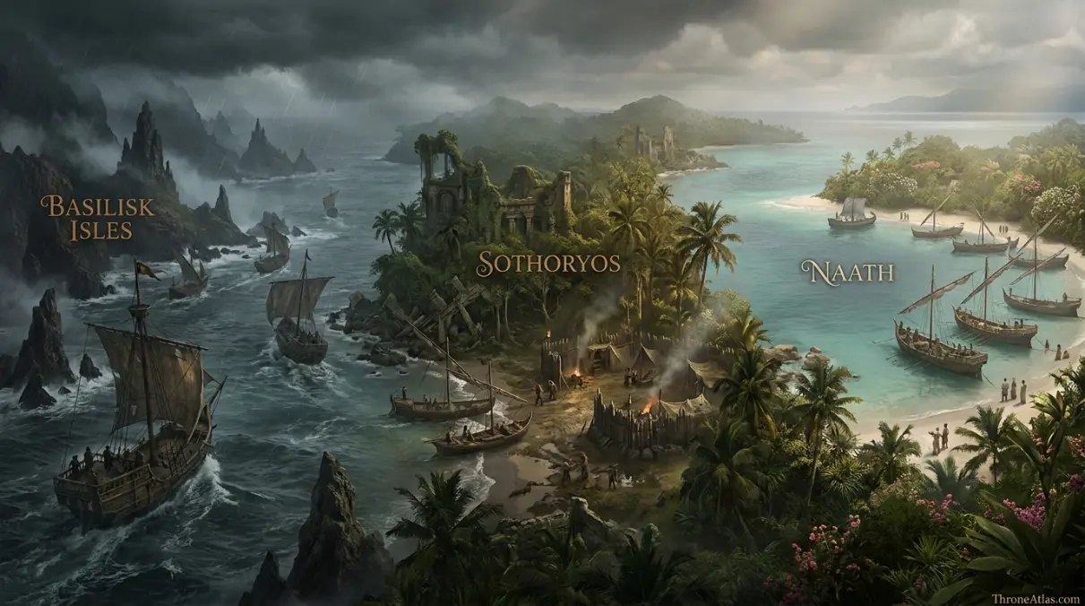
The early southern stages are disasters. Corsairs threaten the Rhoynar in the Basilisk Isles, and attempts to live in Sothoryos expose them to disease, slavers and environments they cannot master. Zamettar and Yeen become symbols of failed settlement. Mapping these stops makes Nymeria’s eventual arrival in Dorne more meaningful because it is not the first landfall. It is the first place where survival can become a political future.
From an atlas perspective, this section is best read through the relationship between Sothoryos and Summer Isles. The first anchors the narrative in a named place, while the second shows how the consequences spread into a wider political or military space. That relationship is more useful than forcing the episode into an artificial straight line, because Westerosi history is shaped by roads, seas, fortifications, weather, alliances and the time required to move information as much as by raw distance.
Naath and the Summer Isles extend the wandering years
Naath offers welcome but also deadly disease to outsiders. The Summer Isles provide another pause, including a prolonged settlement on an island remembered as the Isle of Women, yet food and political constraints prevent permanence. These stops show the migration stretching across the southern world. The Rhoynar are not simply crossing from east to west; they are testing one refuge after another and losing people at every stage.
From an atlas perspective, this section is best read through the relationship between Naath and Stepstones. The first anchors the narrative in a named place, while the second shows how the consequences spread into a wider political or military space. That relationship is more useful than forcing the episode into an artificial straight line, because Westerosi history is shaped by roads, seas, fortifications, weather, alliances and the time required to move information as much as by raw distance.
The fleet fragments before Dorne
Not everyone who leaves the Rhoyne arrives at the Greenblood. Some ships settle in the Stepstones. Others reach Lys or Tyrosh and fall into slavery. Another group attempts to return east and is destroyed. The migration is therefore a branching map, not one heroic arrow. This page uses secondary markers for those dispersals so the familiar Nymeria-to-Dorne story does not erase the people who disappear along the way.
From an atlas perspective, this section is best read through the relationship between Summer Isles and Lys / Tyrosh. The first anchors the narrative in a named place, while the second shows how the consequences spread into a wider political or military space. That relationship is more useful than forcing the episode into an artificial straight line, because Westerosi history is shaped by roads, seas, fortifications, weather, alliances and the time required to move information as much as by raw distance.
The Greenblood converts migration into state-building
The final landfall near the Greenblood changes the nature of the story. Nymeria marries Mors Martell and has the remaining ships burned, making return impossible and signaling permanent settlement. Rhoynar manpower, customs and political ideas strengthen House Martell, and the alliance eventually defeats rival Dornish kings. The endpoint is not merely Sunspear on a map. It is the creation of a new political culture whose Rhoynish legacy still shapes Dorne centuries later.
From an atlas perspective, this section is best read through the relationship between Stepstones and Greenblood. The first anchors the narrative in a named place, while the second shows how the consequences spread into a wider political or military space. That relationship is more useful than forcing the episode into an artificial straight line, because Westerosi history is shaped by roads, seas, fortifications, weather, alliances and the time required to move information as much as by raw distance.
What Changes When You Read the Story Spatially
A map becomes useful when it explains why movement between the pins changes the story. Ny Sar / Rhoyne establishes the opening context, while Sunspear / Sandship shows where the central arc resolves. Between those points, the map distinguishes sites named directly in the histories from zones added only to make the geography legible. That distinction prevents a smooth-looking route from being mistaken for a surveyed road or flight path.
Ny Sar / Rhoyne and Basilisk Isles serve different functions on this page. Nymeria’s Rhoynar homeland and the river civilization shattered by Valyrian war. An early refuge attempt exposed the migrants to corsairs and danger. Seeing them together helps explain why nymeria journey map is best treated as a spatial argument: the story depends on what each place enables, restricts or exposes, not merely on the order in which names appear in a chronology.
Sothoryos and Naath serve different functions on this page. The Rhoynar tried to settle at places including Basilisk Point, Zamettar and Yeen. The fleet was welcomed but disease forced another departure. Seeing them together helps explain why nymeria journey map is best treated as a spatial argument: the story depends on what each place enables, restricts or exposes, not merely on the order in which names appear in a chronology.
Summer Isles and Stepstones serve different functions on this page. A long stop included the place later called the Isle of Women. Some less seaworthy ships settled or were left along the islands during the final westward movement. Seeing them together helps explain why nymeria journey map is best treated as a spatial argument: the story depends on what each place enables, restricts or exposes, not merely on the order in which names appear in a chronology.
The broader value of this atlas is context. A named castle or bay can look isolated in prose, but once it is placed beside nearby regions, rival seats and movement corridors, the choices of rulers and commanders become easier to understand. Distance creates delay. Water creates risk. Fortresses concentrate power. Roads channel armies. Dragons ignore some of those limits while introducing others. The map is useful because it lets those constraints appear together.
That is also why ThroneAtlas avoids false precision. Westerosi sources often preserve destination names while omitting exact road segments, camp positions or mile-by-mile paths. A responsible reconstruction should tell readers where certainty ends. The result may look less absolute than a fictional GPS trace, but it is more faithful to how the geography is actually described.
Canon Confidence & Reconstruction Limits
This page separates firm geographic anchors from interpretive connectors. The goal is to make the map useful without upgrading inference into canon.
Four Details Worth Watching
Ny Sar / Rhoyne
Nymeria’s Rhoynar homeland and the river civilization shattered by Valyrian war. Its placement on this atlas is intended to clarify the wider story without claiming precision beyond the source record.
Sothoryos
The Rhoynar tried to settle at places including Basilisk Point, Zamettar and Yeen. Its placement on this atlas is intended to clarify the wider story without claiming precision beyond the source record.
Summer Isles
A long stop included the place later called the Isle of Women. Its placement on this atlas is intended to clarify the wider story without claiming precision beyond the source record.
Lys / Tyrosh
Some Rhoynar ended up in the Free Cities and surrendered to slavers rather than die at sea. Its placement on this atlas is intended to clarify the wider story without claiming precision beyond the source record.
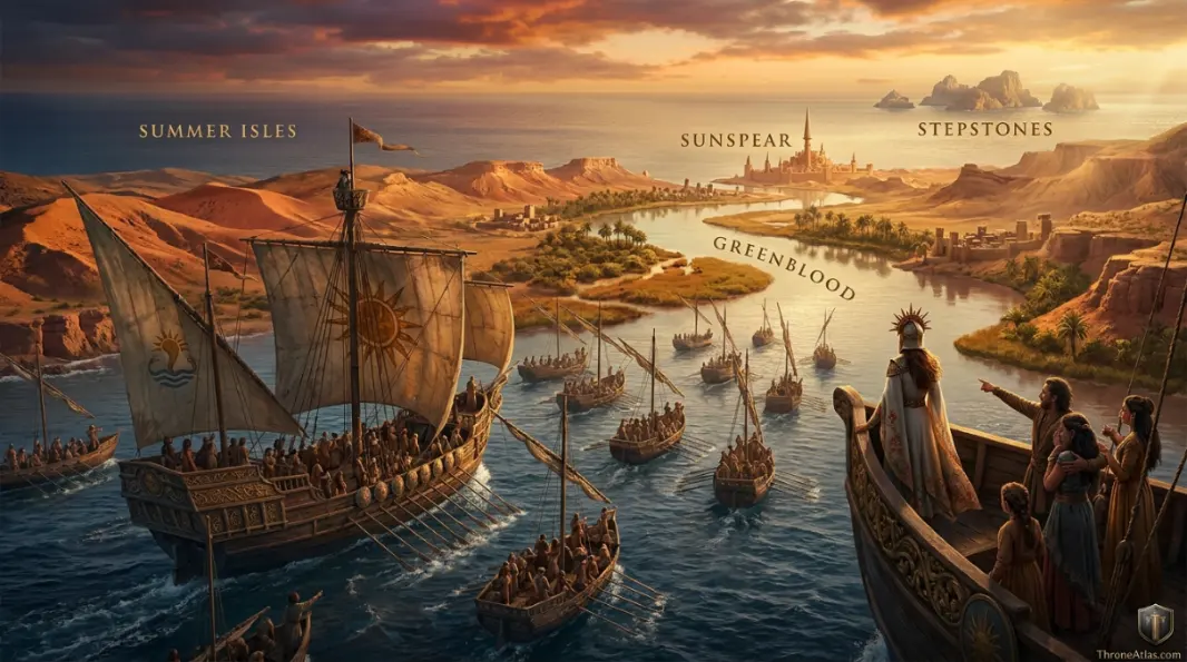
The visual layer should reinforce the text rather than merely decorate it. When you replace these image URLs with final artwork using the same filenames, keep the labels readable on mobile and avoid placing invented borders, distances or roads where the source record is uncertain.
Fast Answers About This Map
Nymeria’s migration begins after Valyria crushes the Rhoynar in the Second Spice War. She leads surviving Rhoynar away from the Rhoyne in a fleet remembered as ten thousand ships. The journey reaches the Basilisk Isles, Sothoryos, Naath and the Summer Isles before the survivors finally land near the mouth of the Greenblood in Dorne. Nymeria marries Mors Martell, burns the remaining fleet and helps create a unified Dornish principality. Several stopovers are legendary in detail, so the route is best read as a sequence of attested regions rather than a precise sailing track.
Ny Sar / Rhoyne is the opening anchor, but Sunspear / Sandship is equally important because it shows where the main geographic arc reaches its consequence.
No. Named destinations and major event locations come from the source record, while connecting lines are schematic unless a specific road, river or route is directly established.
Use the confidence labels. They distinguish fixed places from probable regions and explanatory reconstructions, which is especially important for battles, dragonflights and ancient migrations.
What This Atlas Is Based On
- The World of Ice & Fire for Nymeria, the Rhoynar flight, southern stopovers and settlement in Dorne.
- A Feast for Crows for surviving Rhoynish culture along the Greenblood and Dornish context.
- Published known-world maps for the Rhoyne, Basilisk Isles, Sothoryos, Summer Isles, Stepstones and Dorne.
- Where sources disagree or omit exact coordinates, the page labels the uncertainty rather than silently choosing one version.
Continue Exploring ThroneAtlas
These connected pages expand the same geography from different angles—regional maps for physical context, character routes for movement, house maps for political control and battle maps for moments when the landscape directly shapes the outcome.
Nymeria Journey Map: Rhoyne to Dorne by Ten Thousand Ships FAQs
Who was Nymeria?
Nymeria was a Rhoynar princess who led survivors of the Valyrian wars into exile and eventually settled in Dorne.
Why did the Rhoynar leave the Rhoyne?
They fled after Valyrian dragonlords crushed Rhoynar resistance in the Second Spice War.
Were there really ten thousand ships?
The number is legendary and may be exaggerated, but it conveys the enormous scale of the migration.
Where did Nymeria travel before Dorne?
Major remembered stages include the Basilisk Isles, Sothoryos, Naath and the Summer Isles.
Did all the Rhoynar reach Dorne?
No. Disease, slavery, ship losses and splinter groups reduced and scattered the migration.
Where did Nymeria land in Dorne?
Near the mouth of the Greenblood, close to the lands of House Martell.
Who did Nymeria marry?
She married Mors Martell.
Why did Nymeria burn her ships?
The act symbolized that the Rhoynar would remain in Dorne rather than return to Essos.
What changed after the Rhoynar arrived?
The Martell–Rhoynar alliance grew dramatically stronger and eventually unified Dorne under princely rule.
Is this sailing route exact?
No. The map connects the best-known stages of a legendary migration, not an exact nautical log.
These questions focus on the distinctions most likely to matter when reading the nymeria journey map: what is directly named, what is inferred from regional geography, and what should remain uncertain. Where the chronicles preserve competing versions, ThroneAtlas keeps the disagreement visible rather than selecting the most dramatic account simply because it produces a cleaner map.
Why This Geography Matters
Nymeria’s migration begins after Valyria crushes the Rhoynar in the Second Spice War. She leads surviving Rhoynar away from the Rhoyne in a fleet remembered as ten thousand ships. The journey reaches the Basilisk Isles, Sothoryos, Naath and the Summer Isles before the survivors finally land near the mouth of the Greenblood in Dorne. Nymeria marries Mors Martell, burns the remaining fleet and helps create a unified Dornish principality. Several stopovers are legendary in detail, so the route is best read as a sequence of attested regions rather than a precise sailing track.
Seen as a map rather than a list of names, the story becomes easier to follow because movement, control and consequence share the same frame. That is the purpose of this atlas: not to replace the books or screen adaptation, but to make their geography legible.