House Connington Map: Griffin’s Roost, Cape Wrath & Lost Stormlands
A territorial atlas of a house whose geography changed with its fortunes — from the red cliffs of Griffin’s Roost to the lands stripped away after Robert’s Rebellion.
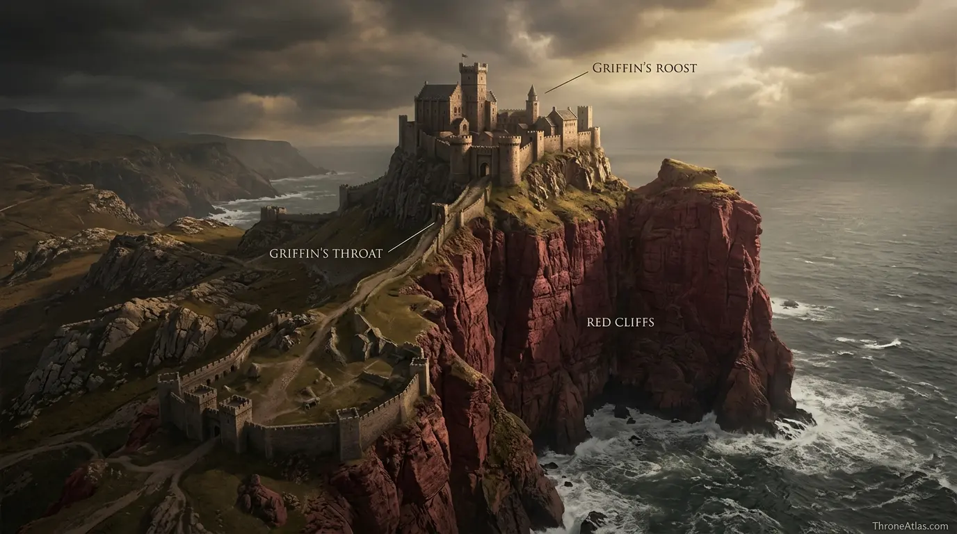
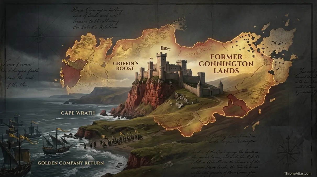
House Connington is seated at Griffin’s Roost on Cape Wrath in the Stormlands. The castle stands on a high crag with red cliffs protecting three sides and a narrow landward approach known as the griffin’s throat. The family once held much larger lands, but after Robert’s Rebellion it lost most of its territory and lordly standing.
A Castle That Stayed Put While the House Shrunk
This atlas separates the fixed geography of Griffin’s Roost from the changing political geography of House Connington. The castle, Cape Wrath and rainwood remain stable; the family’s former territorial reach, confiscations and later Golden Company return belong to different historical layers.
Canon Confidence & What This Map Claims
ThroneAtlas separates confirmed geography from useful reconstruction so a clean digital map never appears more certain than the underlying source.
Read the Map From Anchors to Story
- Visual Atlas
- Canon Confidence
- Key Takeaways
- Locations & Route Table
- The Most Important Feature on a House Connington Map Is Change
- Griffin’s Roost: Red Cliffs and a Narrow Landward Approach
- Cape Wrath and the Rainwood: Why the Region Shapes the House
- From Robert’s Rebellion to Exile: How Defeat Redrew the House
- The Golden Company Return and the Cape Wrath Foothold
- How to Map Lost Lands Without Drawing False Borders
- Fast Answers
- Sources & Method
- FAQs
How House Connington’s Map Changes Over Time
Griffin’s Roost is the constant
The castle remains the essential geographic anchor through rise, punishment, exile and return.
Natural defense is unusually strong
Cliffs protect three sides while the griffin’s throat concentrates landward access.
Cape Wrath shapes every campaign
Forests, coast and broken terrain make the region different from open central Westeros.
The house once held far more land
Connington power cannot be read from its later reduced estate alone.
Robert’s victory changed the political map
The family lost most of its lands and status after supporting the Targaryens.
Jon Connington turns exile into a return route
His later campaign brings the house name back to its ancestral seat with the Golden Company.
Nearby castles become operationally important
Rain House, Crow’s Nest and other Cape Wrath seats help explain the regional campaign network.
Historic borders remain approximate
The scale of loss is clear, but a perfect boundary polygon is not supplied by canon.
Places, Routes & Strategic Connections
| Map Anchor | Type | Why It Matters |
|---|---|---|
| Griffin’s Roost | Castle | The ancestral seat of House Connington on a high crag in Cape Wrath. |
| Griffin’s Throat | Terrain | The narrow landward ridge providing the castle’s principal approach. |
| Red Cliffs | Terrain | Steep red cliffs protecting three sides of Griffin’s Roost and giving the seat natural defense. |
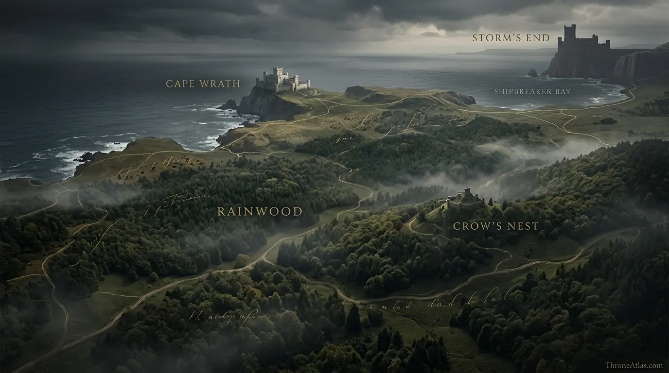
| Cape Wrath | Region | The southeastern Stormlands region in which the Connington seat is located. |
| Rainwood | Terrain | The heavily wooded neighboring zone that shapes travel and campaigning in Cape Wrath. |
| Storm’s End | Political | The great Baratheon seat and the major political anchor of the Stormlands. |
| Crow’s Nest | Castle | A nearby Stormlands castle useful for understanding later Golden Company operations in the region. |
| Former Connington Lands | Territory | A schematic historical sphere representing the much larger lands held before the family’s punishment. |
The Most Important Feature on a House Connington Map Is Change
Many noble-house maps can be drawn as a stable relationship between a castle and the lands around it. House Connington requires a different approach because its territorial history changes dramatically while its ancestral seat remains fixed. Griffin’s Roost is constant; the political space attached to the Connington name is not.
Before Robert’s Rebellion, House Connington was a more powerful Stormlands family with extensive lands. Jon Connington’s close association with Prince Rhaegar Targaryen elevated him further, eventually making him Hand of the King during the rebellion. His defeat at the Battle of the Bells, however, helped bring down both his career and his house’s standing.
After the war, Robert Baratheon stripped House Connington of much of its territory and status. The family retained Griffin’s Roost but on dramatically reduced terms. A map made only from the later situation can therefore understate what the house had been.
This is why the atlas uses a historical territory marker rather than a hard border. The source material makes the contraction unmistakable but does not give a modern parcel-by-parcel survey of the old estate. The useful visual is comparative: a once broader Stormlands sphere narrowed around an ancestral castle.
That contraction also gives Jon Connington’s later return special emotional weight. He is not simply invading a random part of Westeros with the Golden Company. He comes back to the seat from which his identity and disgrace originate.
House Connington’s map is consequently a map of memory as much as land. The red cliffs and castle do not move, but what those places mean changes with loyalty, defeat, confiscation, exile and attempted restoration.
Griffin’s Roost: Red Cliffs and a Narrow Landward Approach
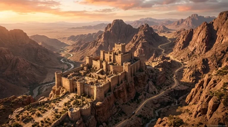
Griffin’s Roost is one of those fictional castles whose topography explains its defensive character more effectively than a list of towers ever could. The seat stands on a high crag, with red cliffs defending three sides. The principal landward approach crosses a narrow ridge known as the griffin’s throat.
That arrangement creates a naturally constrained attack route. An enemy cannot simply surround the castle on level ground and approach every wall equally. Cliff faces make several sides difficult or impossible to assault directly, concentrating danger on the landward neck.
For defenders, this reduces the number of approaches that need the greatest attention. For attackers, it creates a choke point. Siege engines, troops and supplies have to operate in terrain shaped by elevation and narrow access. The sea and cliffs may provide additional possibilities, but they also impose their own hazards.
The castle’s placement fits the wider Stormlands habit of fortifications that work with severe natural landscapes. Storm’s End uses its immense walls and exposed coastal site; Griffin’s Roost uses crag, cliff and ridge. The fortification is therefore best read as an engineered addition to an already defensible landform.
The red cliffs are also visually distinctive. They make Griffin’s Roost geographically memorable rather than interchangeable with every other noble seat. A proper atlas should preserve that identity.
Because canon describes the defensive concept more clearly than exact dimensions, the interactive map shows the griffin’s throat and cliff zone schematically. The purpose is to answer how the castle works, not to invent a blueprint. The central fact is strong enough: to reach Griffin’s Roost by land, the narrow approach matters.
Cape Wrath and the Rainwood: Why the Region Shapes the House
Griffin’s Roost belongs to Cape Wrath, a southeastern part of the Stormlands where coast, forest and broken country create a distinct campaigning environment. The nearby rainwood adds dense woodland to that geography. These features matter whenever armies move through the region.
Forested terrain restricts visibility and makes large formations harder to coordinate than on open plains. Roads and clearings become more important. Coastal castles may be reachable by sea, but shore conditions and hostile fleets complicate that option. A commander operating in Cape Wrath therefore has to think about routes, not just destinations.
House Connington’s older lands existed within this environment. The family’s power was not simply a colored patch on a political map; it was control over roads, villages, wooded territory and approaches around a defensible coastal seat. When most of those holdings were confiscated, the practical resource base of the house shrank along with the ceremonial status.
Cape Wrath later becomes especially important during Jon Connington’s return with the Golden Company. Rather than beginning with a direct march on King’s Landing, the campaign secures positions in the Stormlands. Castles and local routes provide footholds. The region’s geography can fragment defense and reward rapid seizure of strategic seats.
This is why nearby points such as Crow’s Nest, Rain House and the rainwood belong in the same mental map even though they are not all Connington possessions. They explain the operational neighborhood.
For readers, the key is to zoom out one level. Griffin’s Roost is the house seat, but Cape Wrath is the environment that makes the seat militarily and politically meaningful.
From Robert’s Rebellion to Exile: How Defeat Redrew the House
Jon Connington’s career ties the family’s territorial collapse directly to Robert’s Rebellion. As a close friend and supporter of Prince Rhaegar, he became one of the Targaryen regime’s important commanders. His tenure as Hand culminated in the campaign around Stoney Sept and the Battle of the Bells.
The defeat was not geographically close to Griffin’s Roost, but its consequences reached home. A military failure in the Riverlands helped destroy Connington influence in the Stormlands. That is an important reminder that political maps can be redrawn by events hundreds of miles away.
After the Targaryens fell, Robert Baratheon punished the house. Jon himself went into exile, and House Connington lost most of its lands and its lordly stature. The remaining family retained the ancestral seat on reduced terms.
For mapmaking, this is where a timeline layer becomes more useful than a single static border. “House Connington territory” means something different before the rebellion and after it. A reader studying Rhaegar’s era should not assume the later reduced estate represents the family’s earlier power.
The punishment also carries symbolic force because Robert is himself the dominant lord of the Stormlands before becoming king. The victorious regional power reorganizes the status of a local house that backed his Targaryen enemies.
Jon Connington’s exile then creates a long geographic break between man and home. His story ranges far beyond Westeros before eventually bending back toward Cape Wrath. The map of House Connington therefore has two dimensions: the shrinking territory around Griffin’s Roost and the expanding personal route of the exiled lord who never stops defining himself through that lost seat.
The Golden Company Return and the Cape Wrath Foothold
When Jon Connington returns to Westeros with the Golden Company and the young man presented as Aegon Targaryen, Cape Wrath becomes an operational theatre rather than merely family history. Griffin’s Roost is retaken, and nearby Stormlands positions come into play as the invaders establish a foothold.
The geography suits a force that needs secure bases before attempting larger political goals. A castle provides stores, defensive shelter and symbolic legitimacy. Holding the ancestral Connington seat also sends a message: exile is ending, and old loyalties may be reactivated.
Other castles in the wider region matter because no single fortress controls every route. Crow’s Nest, Rain House and additional Stormlands seats form a network of possible resistance or capture. The Golden Company’s campaign can therefore be read as a sequence of nodes rather than a straight arrow from landing beach to capital.
The rainwood and Cape Wrath terrain complicate response. Dense country can conceal movement and divide defenders. Coastal access can help an invading force move men and supplies if ships remain available. Local knowledge becomes valuable.
For Jon personally, the return to Griffin’s Roost carries a weight that a purely strategic reading misses. The seat represents family honor, punishment and the life he lost. Retaking it is both military and restorative.
This page keeps those layers together. The marker for Griffin’s Roost is a castle on the map, but it is also a narrative hinge connecting Rhaegar’s generation with the later Aegon campaign. Cape Wrath becomes the place where memory turns back into action.
How to Map Lost Lands Without Drawing False Borders
House Connington presents a common challenge in historical fantasy mapping: the text clearly says a family once controlled more land, but it does not provide a polygon suitable for a modern GIS layer. The wrong response is to invent a crisp boundary and color it with unwarranted certainty.
The better approach is to separate anchor points from territorial interpretation. Griffin’s Roost is a high-confidence point. Cape Wrath and the rainwood are high-confidence regional references. The family’s formerly much larger holdings are a high-confidence historical fact. Their exact edge against every neighboring lord is not.
That is why the atlas uses a “former lands” sphere rather than a cadastral border. It communicates scale and direction without pretending to know where every medieval-style property line ran.
The same method applies after Robert’s Rebellion. We can confidently say the house was reduced severely and lost most of its lands and status. We should be careful about drawing an exact surviving estate unless the text specifies it.
This distinction makes the map more useful, not less. Readers can understand why House Connington mattered, why punishment was significant and why Griffin’s Roost survived as the core identity of the line.
It also prevents a common fan-map problem in which visual neatness outruns evidence. Fictional worlds invite precise-looking maps, but precision is only valuable when the source supports it. Here, uncertainty is itself part of the history: we know the house fell far more clearly than we know the exact geometry of every confiscated field.
Fast Answers About the Map
House Connington is based at Griffin’s Roost in Cape Wrath in the Stormlands.
It is the ancestral castle of House Connington, built on a high crag with red cliffs protecting three sides.
It is the narrow landward ridge or approach leading toward Griffin’s Roost.
No. The house once held much more territory before being heavily punished after Robert’s Rebellion.
The family had supported the Targaryens, and Jon Connington was closely tied to Prince Rhaegar and the royal cause.
Yes, in the book storyline he returns with the Golden Company and retakes his ancestral seat.
Yes. It lies in the Cape Wrath region of the Stormlands near the rainwood.
No. The former territorial sphere is shown schematically because canon does not provide surveyed boundaries.
What This Atlas Is Based On
- George R. R. Martin’s A Song of Ice and Fire novels for Jon Connington, Griffin’s Roost and the Golden Company campaign.
- The World of Ice & Fire and related published material for House Connington’s role in Robert’s Rebellion and later punishment.
- Published Westeros maps for Cape Wrath, the rainwood, Storm’s End and the regional Stormlands framework.
- Former territorial reach is represented approximately because exact historical boundaries are not fully specified.
Continue Exploring ThroneAtlas Maps
House Connington Map FAQs
Where is Griffin’s Roost?
Griffin’s Roost is in Cape Wrath in the southeastern Stormlands.
Who rules Griffin’s Roost?
It is the ancestral seat of House Connington, though the family’s status changes significantly across the timeline.
Why is Griffin’s Roost difficult to attack?
The castle stands on a high crag with red cliffs on three sides and a narrow landward approach.
What is Cape Wrath?
Cape Wrath is a coastal region of the Stormlands associated with forested country, castles and approaches near the rainwood.
How much land did House Connington lose?
The family lost the great majority of its former holdings and status after Robert’s Rebellion.
Was Jon Connington Hand of the King?
Yes. Aerys II appointed him Hand during Robert’s Rebellion before dismissing him after the Battle of the Bells.
Does House Connington support the Targaryens?
Jon Connington was a committed supporter of Rhaegar and later returns to Westeros backing the young claimant presented as Aegon Targaryen.
What is the griffin’s throat?
It is the narrow ridge forming the main landward access toward Griffin’s Roost.
Is the house’s former territory shown exactly?
No. The atlas indicates a historical sphere because the source does not define every old boundary.
Why is Griffin’s Roost important to Jon Connington?
It is his ancestral home and the geographic symbol of the family status he lost after the rebellion.
Why This Geography Matters
House Connington’s geography tells a story of contraction and return. Griffin’s Roost stays fixed on its red-cliffed crag while the family’s lands and status collapse after Robert’s Rebellion. Years later, the same castle becomes a foothold for Jon Connington’s return to Westeros with the Golden Company.