House Peake Map: Starpike, Lost Castles & Dornish Marches Power
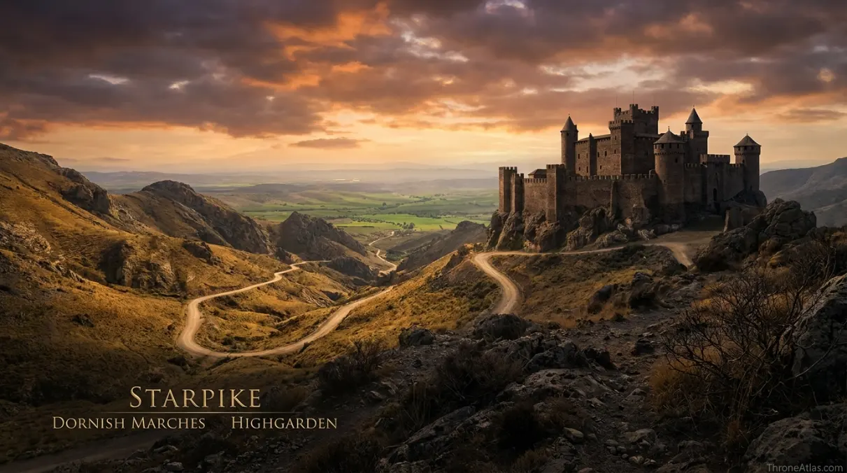
A historical territory map of a Reach house whose three-castle identity survives in heraldry long after politics reduced it to Starpike.
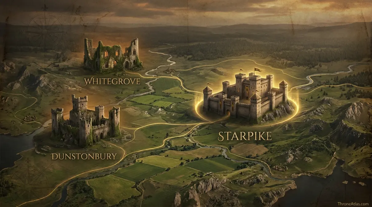
House Peake is a noble house of the Reach seated at Starpike in the Dornish Marches. The family once held three castles — Starpike, Dunstonbury and Whitegrove — reflected by the three castles on its sigil. It lost Dunstonbury and Whitegrove after supporting Daemon Blackfyre in the First Blackfyre Rebellion.
Three Castles Explain the Rise and Fall of House Peake
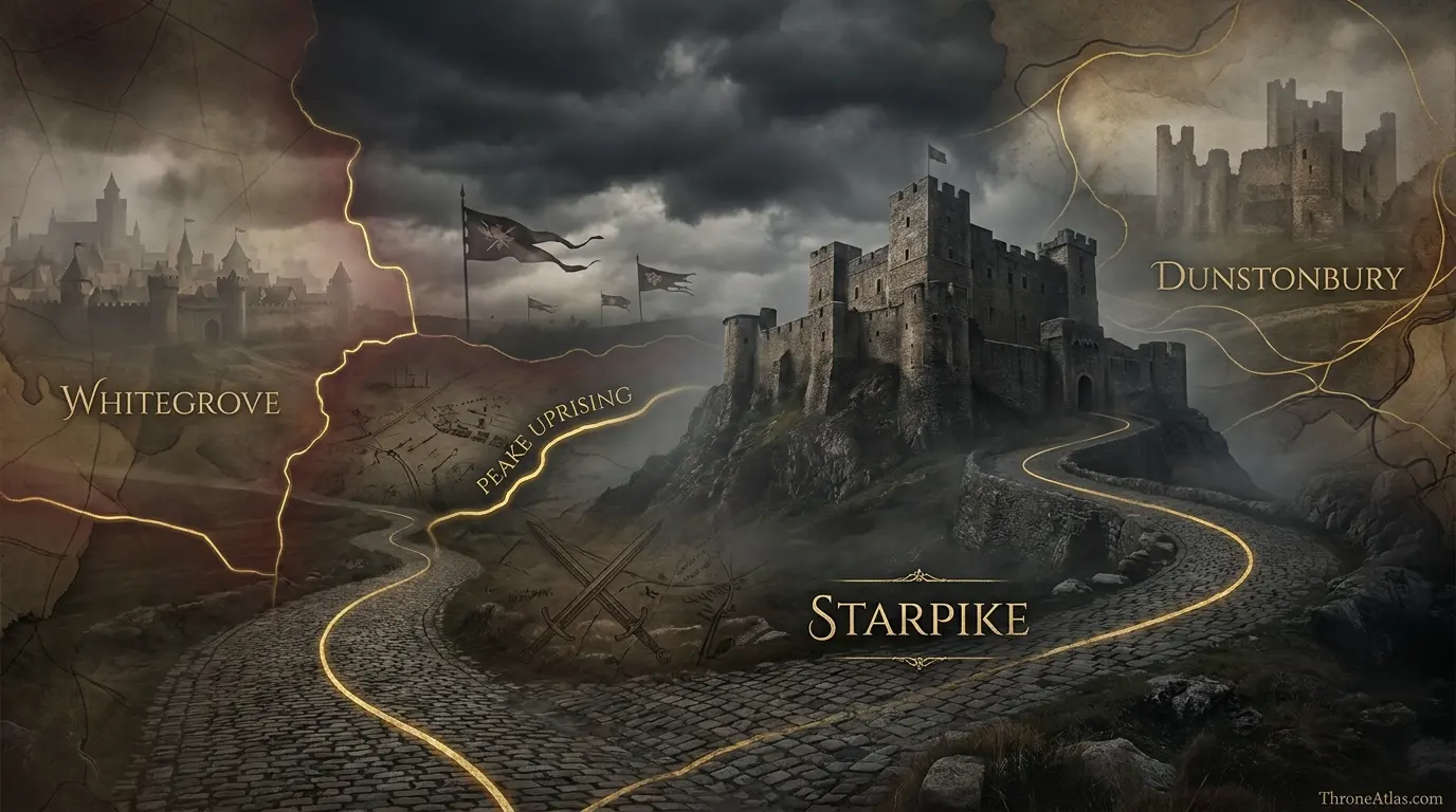
The atlas shows Starpike as the surviving seat and Dunstonbury and Whitegrove as historical anchors. The Dornish Marches, Reach heartland and Highgarden provide regional context, while the Blackfyre losses and Peake Uprising reveal how political decisions repeatedly changed the house’s map.
Canon Confidence & What This Map Claims
ThroneAtlas separates confirmed geography from useful reconstruction so a clean digital map never appears more certain than the underlying source.
Read the Map From Anchors to Story
- Visual Atlas
- Canon Confidence
- Key Takeaways
- Locations & Route Table
- Three Castles, One Surviving Seat
- Starpike and the Dornish Marches Setting
- Dunstonbury and the Memory of Older Reach Power
- Whitegrove and the Cost of Blackfyre Loyalty
- The Peake Uprising Brings the Crown to Starpike
- Mapping Peake Prestige Across Generations
- Fast Answers
- Sources & Method
- FAQs
House Peake’s Map Is Written Into Its Sigil
Three castles define older power
Starpike, Dunstonbury and Whitegrove represent a broader Peake territorial past.
Only Starpike remains the central seat
Royal punishment after Blackfyre support stripped the house of two castles.
The house belongs to the Reach
Peake ambitions operate within the larger political sphere centered on Highgarden.
Starpike has marcher geography
Its southern frontier context links the house to the military culture of the Dornish Marches.
Blackfyre loyalty had territorial consequences
Political defeat became literal land loss.
The Peake Uprising returns conflict to the seat
King Maekar I’s death at Starpike makes the castle a major historical event location.
Dunstonbury carries older Manderly memory
Its ownership history connects Peake geography with another important Reach-to-North house story.
Historic spheres are safer than hard borders
The castles are real anchors; the exact shape of former Peake dominion is not fully specified.
Places, Routes & Strategic Connections
| Map Anchor | Type | Why It Matters |
|---|---|---|
| Starpike | Castle | The surviving ancestral seat of House Peake in the Reach and the principal anchor after the family’s losses. |
| Dunstonbury | Former Seat | A former Peake castle later associated with House Manderly’s older Reach history. |
| Whitegrove | Former Seat | Another former Peake castle lost after the First Blackfyre Rebellion. |
| Dornish Marches | Frontier | The frontier environment that gives Starpike its marcher context. |
| Reach Heartland | Region | The wider agricultural and political realm to which House Peake belongs. |
| Highgarden | Political | The Tyrell seat and major political center of the Reach. |
| Blackfyre Losses | Event | A historical layer marking the confiscations that followed Peake support for Daemon Blackfyre. |
| Peake Uprising | Event | The later rebellion in 233 AC in which King Maekar I was killed at Starpike. |
Three Castles, One Surviving Seat
House Peake is unusually suited to map-based history because the family’s heraldry preserves a geographic fact. Its arms display three castles, recalling the three great seats once associated with the house: Starpike, Dunstonbury and Whitegrove. Political decline is therefore visible not only in chronicles but in the family’s own symbol.
Starpike remains the essential anchor. It is the current seat and the place most directly tied to the Peake name in later history. Dunstonbury and Whitegrove, however, reveal that the house once possessed a wider material base. Multiple castles mean more than prestige. They imply lands, incomes, retainers, strategic depth and influence across more than one local district.
The First Blackfyre Rebellion changes that map. House Peake supports Daemon Blackfyre against Daeron II. When the Blackfyre cause fails, the crown punishes the family, and Dunstonbury and Whitegrove are taken away. The loss is both political and geographic.
A static map labeled simply “House Peake — Starpike” therefore understates the older house. A historical atlas needs at least two layers: the three-castle past and the reduced post-rebellion present.
This is a recurring Westerosi pattern. Noble power is rooted in land, so royal punishment often redraws maps. Titles can be reduced, castles transferred and incomes broken apart. House Peake provides one of the clearest examples because the family keeps remembering the lost seats.
The three markers on this page are not decorative. They are the core argument: to understand House Peake, you must see what it once held and what it was forced to keep living without.
Starpike and the Dornish Marches Setting
Starpike sits in the Reach but belongs to the broader marcher environment near Dorne. That placement gives House Peake a different geographic character from houses surrounded by the rich, gentler heartlands closer to Highgarden.
The Dornish Marches are historically militarized. Mountain routes, frontier raids and the long memory of wars with Dorne shape noble culture on both sides. A castle in this environment has to serve as more than an administrative seat. It is part of a network built to observe, defend and mobilize.
Starpike’s name itself evokes strong fortification, but the map should resist inventing architectural details that the sources do not fully provide. The more important fact is regional: the seat stands within a frontier zone where movement through the southern Reach has strategic consequences.
This context helps explain why House Peake repeatedly appears in martial and rebellious politics. Geography does not cause ambition, but marcher houses often possess strong military traditions and defensible seats. Their local power can give them confidence disproportionate to their formal rank.
Highgarden remains the great political center of the Reach, and that relationship matters. House Peake’s story involves tension between local aristocratic ambition and larger royal or regional authority. A marcher castle can feel powerful at home while still existing inside a kingdom-scale hierarchy.
On the atlas, Starpike therefore sits between two conceptual directions: north and west toward the Reach’s richer political heartland, and south toward the frontier. That dual identity is more useful than treating it as simply another point in a list of Reach castles.
Dunstonbury and the Memory of Older Reach Power
Dunstonbury is important because it connects House Peake to a longer chain of ownership and political memory. The castle is not merely “the second lost Peake seat.” It also has associations with House Manderly before that family’s exile from the Reach and later rise at White Harbor in the North.
That history shows how castles can carry multiple dynastic stories across centuries. A modern reader may think of House Manderly as quintessentially northern, yet their older roots lie in the Reach. Dunstonbury helps make that migration visible.
For House Peake, possession of the castle contributed to the era in which the family controlled three important seats. Losing it after Blackfyre support reduced the house’s reach and detached one of the symbols still remembered on its arms.
The exact boundaries around Dunstonbury during Peake possession are not mapped in detail. What matters is the castle as a node of land, income and status. A house that can draw resources from several such nodes is more resilient than one dependent on a single seat.
This is why confiscation works as punishment. Taking a castle is not just removing a building. It removes the villages, fields, rights and political leverage associated with that place.
Dunstonbury’s layered ownership also warns against coloring it permanently for one house on a timeline-free map. The correct answer to “who owns Dunstonbury?” depends on when the question is asked.
The atlas therefore labels it as a former Peake seat within a historical layer. That preserves both the family’s three-castle past and the later reality that Starpike stands alone as the core Peake stronghold.
Whitegrove and the Cost of Blackfyre Loyalty
Whitegrove is the other major piece of the Peake family’s lost geography. Like Dunstonbury, it was removed from Peake control after the First Blackfyre Rebellion. Together, the two confiscations demonstrate how badly the family’s choice of claimant damaged its material power.
The rebellion forced noble houses across Westeros to choose between Daeron II and Daemon Blackfyre. House Peake backed Daemon. When Daemon died and the rebellion failed at the Redgrass Field, loyalist victory created winners and losers far from the battlefield.
House Peake became one of those losers. The consequences reached back into the Reach and changed which castles the family held. This is why the Blackfyre Rebellion deserves to be mapped not only as armies and battles but also as an aftershock of land transfers.
Whitegrove’s exact local terrain receives less narrative attention than Starpike, so the atlas should not pretend otherwise. Its importance on this page is historical and political. It is a fixed name representing lost capacity.
The family’s three-castle sigil turns that loss into a permanent visual memory. Even generations later, the arms recall a territorial order that no longer exists.
For readers studying Westerosi politics, this is an excellent example of how heraldry, geography and dynastic grievance reinforce each other. A banner can become a map of resentment.
House Peake’s later actions make more sense in that context. Ambitious descendants inherit not only a castle and name but also a story about what the family used to possess. Geography can become grievance when every old seat has a name.
The Peake Uprising Brings the Crown to Starpike
The Peake Uprising of 233 AC returns the family’s conflict with royal authority directly to Starpike. Unlike the First Blackfyre Rebellion, whose decisive battlefield lies elsewhere, this later uprising makes the ancestral seat itself a major event location.
King Maekar I Targaryen dies during the conflict at Starpike. That fact gives the castle significance well beyond House Peake genealogy. A marcher seat becomes the site of a king’s death, tying local rebellion to the succession politics of the whole realm.
From a mapping perspective, this is the moment when the “house map” and “battle map” overlap. The same fortress that anchors everyday family power becomes a military objective. Roads into the marches, local terrain and defensibility suddenly matter at kingdom scale.
The uprising also reinforces a long pattern of Peake resistance and ambition. It would be simplistic to claim geography causes rebellion, but the possession of a strong seat in a frontier region provides a practical foundation from which defiance can occur.
The event marker on this atlas is intentionally centered on Starpike rather than drawing invented troop formations. The sources establish where the uprising culminated and what happened to Maekar. They do not provide enough tactical detail to justify a modern battlefield reconstruction with precise unit coordinates.
That restraint keeps the historical importance intact. The key fact is powerful on its own: after earlier losses reduced House Peake to a smaller territorial base, the surviving seat still became dangerous enough to draw a king into fatal conflict.
Mapping Peake Prestige Across Generations
House Peake’s history stretches across different eras, and the map becomes more useful when read as a sequence rather than a snapshot. At one stage, the family is a multi-castle power. After Blackfyre defeat, it is reduced. Later figures continue to pursue influence at court and in rebellion. The geography remains one of the resources through which those ambitions operate.
Unwin Peake’s prominence during the regency of Aegon III shows that losing castles did not erase the family’s ability to seek royal influence. Later Peakes remain connected with Blackfyre politics and rebellion. Gormon Peake’s role in the First Blackfyre Rebellion is part of the chain that explains the confiscations.
What persists across these generations is the memory of status. Starpike is the surviving base, but the family identity continues to reference Dunstonbury and Whitegrove. That is why the atlas keeps all three seats visible even though only one represents the later political reality.
A clean map can easily suggest that possession is permanent. History says otherwise. Castles change hands, titles rise and fall, and royal punishment can turn yesterday’s core territory into tomorrow’s lost inheritance.
The safest visual language is therefore to distinguish “seat,” “former seat” and “historical event.” Those categories tell the reader what kind of claim each marker represents.
House Peake is a particularly strong case for this method because the evidence supports the anchors more clearly than it supports a continuous boundary around them. The atlas does not fill gaps with invented arrows or borders. It lets the three castles, the marcher setting and the chronology carry the story.
Fast Answers About the Map
House Peake is a Reach house seated at Starpike in the Dornish Marches.
Starpike, Dunstonbury and Whitegrove are the three castles historically associated with House Peake.
No. Dunstonbury and Whitegrove were lost after the First Blackfyre Rebellion.
The family supported Daemon Blackfyre and was punished after his rebellion failed.
Starpike remains the principal Peake seat.
The crown fought House Peake at Starpike in 233 AC, and King Maekar I died during the conflict.
The house belongs to the Reach, though Starpike lies in the marcher frontier influenced by proximity to Dorne.
Not precisely. The castles are established anchors, while exact historical estate boundaries are incomplete.
What This Atlas Is Based On
- George R. R. Martin’s Dunk and Egg stories and A Song of Ice and Fire material for House Peake and Blackfyre-era references.
- The World of Ice & Fire and Fire & Blood for the Peake Uprising, Maekar I and the family’s wider historical role.
- Published maps for the Reach, Dornish Marches, Highgarden and broad castle relationships.
- Former territorial extent is shown through historical anchors rather than invented exact borders.
Continue Exploring ThroneAtlas Maps
House Peake Map FAQs
Where is Starpike?
Starpike is in the Reach, within the broader Dornish Marches frontier region.
Who owns Starpike?
Starpike is the ancestral and surviving principal seat of House Peake.
Why are there three castles on the Peake sigil?
They represent Starpike, Dunstonbury and Whitegrove, the three castles once held by the family.
When did House Peake lose Dunstonbury and Whitegrove?
The castles were taken from the family after its support for Daemon Blackfyre in the First Blackfyre Rebellion.
Was House Peake a Blackfyre supporter?
Yes. Important Peakes supported the Blackfyre cause, with major consequences for the family.
What was the Peake Uprising?
It was a rebellion in 233 AC centered on House Peake, during which King Maekar I died at Starpike.
Is Dunstonbury connected to House Manderly?
Yes. Dunstonbury also carries older associations with House Manderly before that family’s history shifted north.
Is House Peake a marcher house?
Starpike’s location gives the family strong Dornish Marches context within the Reach.
Does the map show a single old Peake border?
No. The atlas uses the three castles as historical anchors because exact former borders are not fully documented.
Why is House Peake geographically important?
Its history shows how castle ownership, royal punishment, frontier position and dynastic rebellion can repeatedly redraw a noble house’s power.
Why This Geography Matters
House Peake’s geography is a record of lost power. Starpike survives, while Dunstonbury and Whitegrove remain as historical anchors remembered on the family’s arms. Blackfyre defeat and the later Peake Uprising show how royal politics repeatedly changed the meaning of those castles.