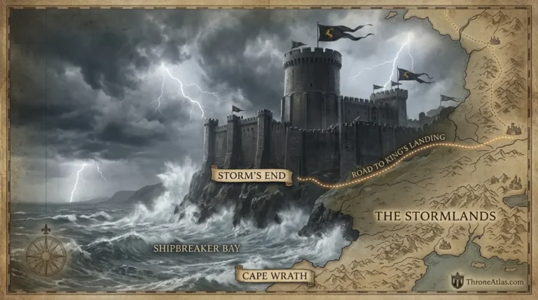
War of the Ninepenny Kings Map: Stepstones, Tyrosh & Maelys Blackfyre
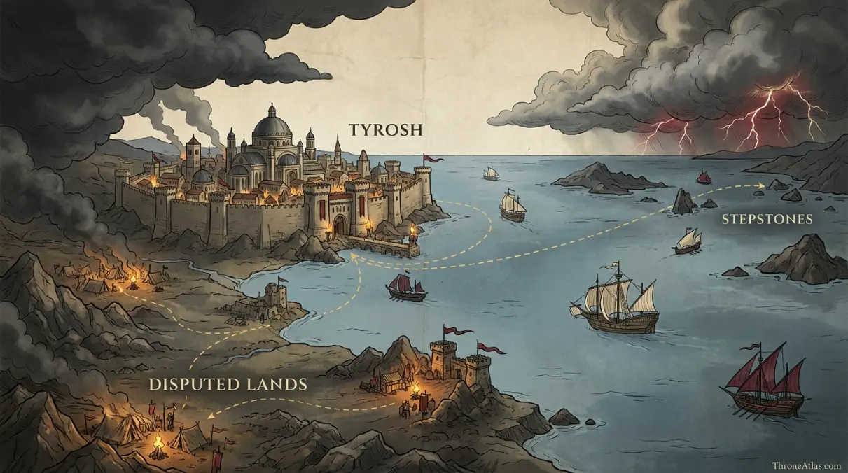
Trace the Band of Nine from conquest in the Disputed Lands and Tyrosh to the Stepstones, where Westerosi armies carried the war offshore and ended the Blackfyre male line.
Read the Map by Place, Route and Confidence
Interactive War of the Ninepenny Kings Map: Stepstones, Tyrosh & Maelys Blackfyre
This schematic is a reading aid, not an official cartographic plate. Tap a marker to see why that location matters. The connecting route is intentionally simplified so confirmed geography is not confused with an invented exact path.
Map Navigator
Six Things the Map Makes Clear
1. Map Takeaway
The map is built around island campaign and invasion-prevention map, not a generic Westeros overview.
2. Map Takeaway
Confirmed places are separated from reconstructed corridors so the page does not overstate precision.
3. Map Takeaway
The strongest geographic anchors are Disputed Lands, Tyrosh and Maelys’s Final Battle.
4. Map Takeaway
Political, military and environmental geography are explained together instead of being reduced to a pin list.
5. Map Takeaway
Book chronology and adaptation material are kept separate whenever they do not align exactly.
6. Map Takeaway
The map is designed to connect naturally with the surrounding ThroneAtlas location, house, battle and journey pages.
Key Places on the War Of The Ninepenny Kings Map
| Location | Map confidence | Why it matters |
|---|---|---|
| Disputed Lands | Band of Nine rise | The coalition first established power in the contested territory between the Free Cities. |
| Tyrosh | Confirmed conquest | The Band of Nine captured and sacked Tyrosh, placing Alequo Adarys in power. |
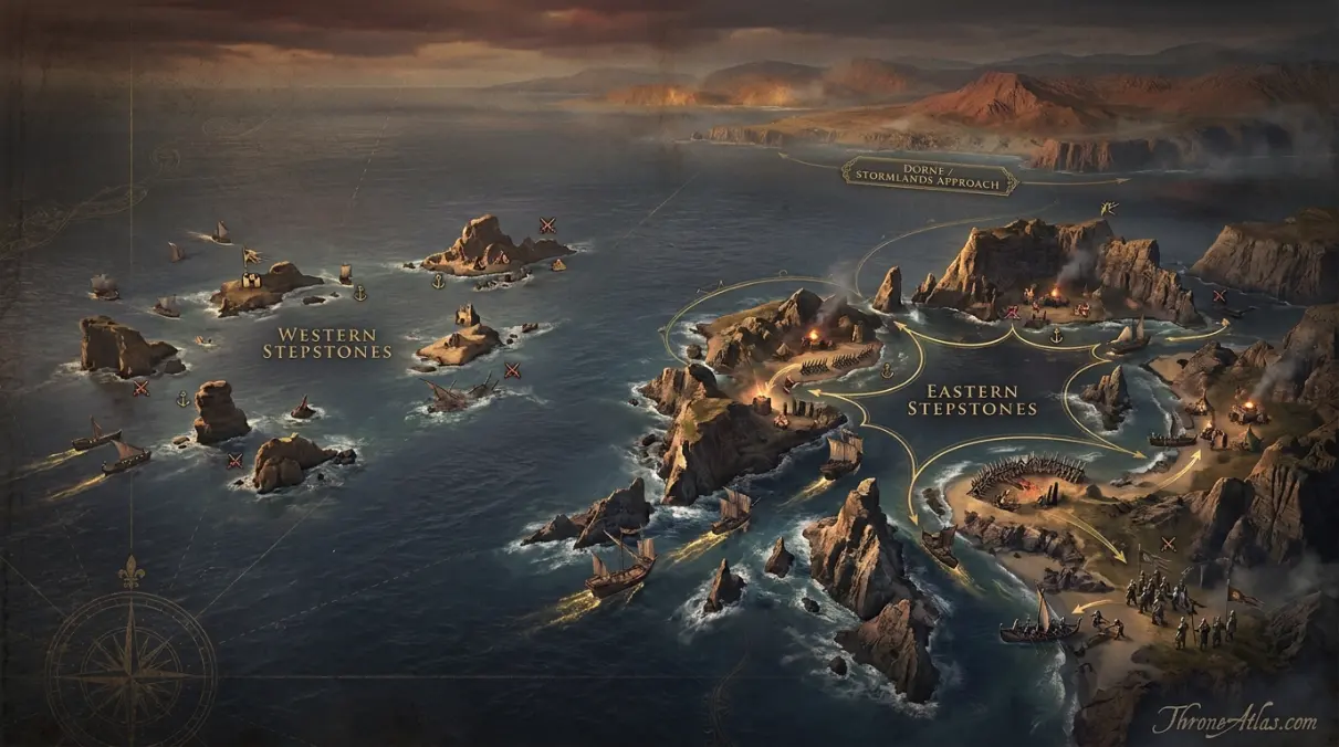
| Stepstones | Primary theater | The island chain seized as the forward base for the threatened invasion of Westeros. |
| Eastern Stepstones | Campaign zone | Represents the dispersed island fighting; exact battle-by-battle coordinates are limited. |
| Western Stepstones | Campaign zone | The side of the chain closest to Westerosi approaches and shipping lanes. |
| Dorne / Stormlands Approach | Strategic context | Nearby coasts explain why the island occupation became an immediate threat. |
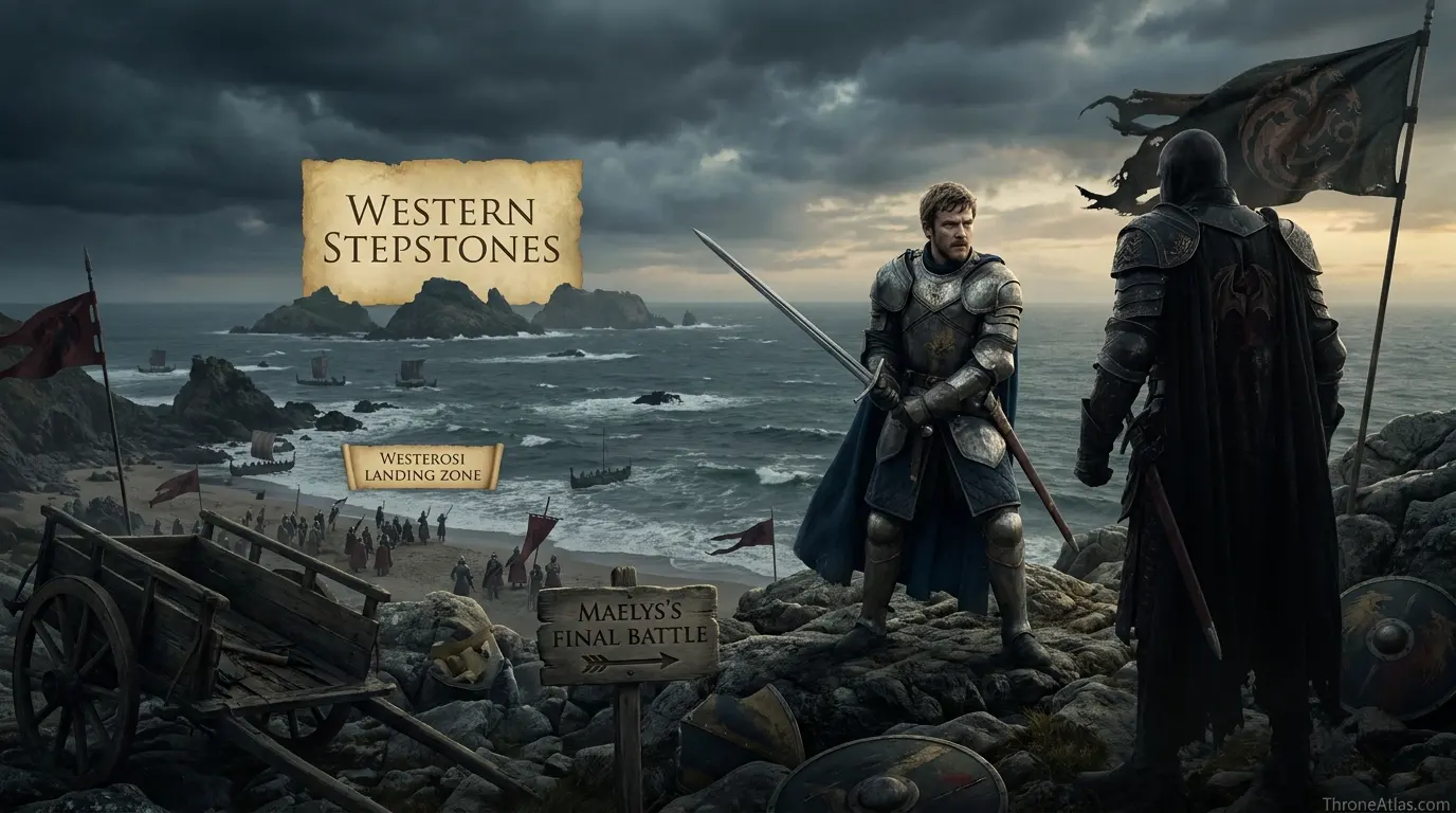
| Westerosi Landing Zone | Reconstructed | Crown forces crossed into the islands; exact initial landing points are not fully preserved. |
| Maelys’s Final Battle | Approximate | The war’s decisive personal encounter with Barristan occurred in the Stepstones, not at a fixed mapped coordinate. |
A location marked “reconstructed” is not a guess presented as fact. It means the surrounding event is attested but the surviving narrative does not give enough spatial detail to place a modern-style coordinate. That distinction is especially important for ancient battles, aerial pursuits, siege camps and long sea voyages.
How the Story Moves Across the Map
Why the Band of Nine mattered before Westeros intervened
The Ninepenny Kings begin as an Essosi coalition of ambitious captains, merchants, pirates and exiles promising to win kingdoms for one another. Their danger becomes real when they succeed. They take territory in the Disputed Lands, capture Tyrosh and then seize the Stepstones. Each move pushes them closer to Westeros. On a map, the story is a westward sequence: continental foothold, Free City, island bridge, threatened kingdom.
From an atlas perspective, this section is best read through the relationship between Disputed Lands and Stepstones. The first anchors the narrative in a named place, while the second shows how the consequences spread into a wider political or military space. That relationship is more useful than forcing the episode into an artificial straight line, because Westerosi history is shaped by roads, seas, fortifications, weather, alliances and the time required to move information as much as by raw distance.
The Stepstones are the key to the entire war
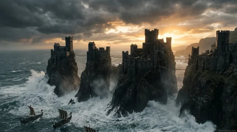
The Stepstones sit between Dorne and Essos, scattering shipping channels across a chain of difficult islands. Whoever controls them can menace trade and stage movement toward the narrow sea. For Maelys Blackfyre, the islands offer the nearest practical platform for a return to Westeros. For Jaehaerys II, that makes them the place to stop the invasion before it starts. The war is therefore defensive in grand strategy even though the Iron Throne’s army crosses the sea offensively.
From an atlas perspective, this section is best read through the relationship between Tyrosh and Eastern Stepstones. The first anchors the narrative in a named place, while the second shows how the consequences spread into a wider political or military space. That relationship is more useful than forcing the episode into an artificial straight line, because Westerosi history is shaped by roads, seas, fortifications, weather, alliances and the time required to move information as much as by raw distance.
A rare war in which Westeros fights abroad
Unlike rebellions that erupt inside the Seven Kingdoms, the War of the Ninepenny Kings is fought offshore. Great houses send men to a foreign island theater, and an entire generation of nobles gains shared campaign experience there. That includes figures who later matter greatly in Robert’s Rebellion and the reigns that follow. Mapping the western coast beside the Stepstones helps explain why the war belongs to Westerosi political memory even though its main battlefields are outside Westeros.
From an atlas perspective, this section is best read through the relationship between Stepstones and Western Stepstones. The first anchors the narrative in a named place, while the second shows how the consequences spread into a wider political or military space. That relationship is more useful than forcing the episode into an artificial straight line, because Westerosi history is shaped by roads, seas, fortifications, weather, alliances and the time required to move information as much as by raw distance.
The campaign cannot be reduced to one battlefield pin
The sources describe a war across the Stepstones rather than one perfectly surveyed clash. Different contingents fight through the island chain; commanders fall; fleets and landings matter. A useful atlas therefore shows a campaign zone with multiple island nodes instead of inventing a single “Ninepenny battlefield.” Where the narrative gives only the archipelago, the map should preserve that scale.
From an atlas perspective, this section is best read through the relationship between Eastern Stepstones and Dorne / Stormlands Approach. The first anchors the narrative in a named place, while the second shows how the consequences spread into a wider political or military space. That relationship is more useful than forcing the episode into an artificial straight line, because Westerosi history is shaped by roads, seas, fortifications, weather, alliances and the time required to move information as much as by raw distance.
Barristan Selmy and the death of Maelys
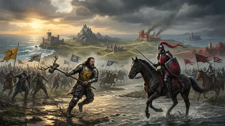
The war’s best-known personal moment comes when the young Barristan Selmy cuts his way to Maelys the Monstrous and kills him. That death destroys the male Blackfyre line and removes the one member of the Band whose promised kingdom is the Seven Kingdoms. The atlas marks the encounter as an approximate Stepstones location because its narrative importance is certain while its exact island coordinate is not.
From an atlas perspective, this section is best read through the relationship between Western Stepstones and Westerosi Landing Zone. The first anchors the narrative in a named place, while the second shows how the consequences spread into a wider political or military space. That relationship is more useful than forcing the episode into an artificial straight line, because Westerosi history is shaped by roads, seas, fortifications, weather, alliances and the time required to move information as much as by raw distance.
Why the aftermath matters to later history
The war forges relationships among nobles, creates veterans and helps shape the generation that will later divide during Robert’s Rebellion. Barristan’s fame rises; houses from across the realm share service; Septon Meribald’s later memories remind readers that ordinary soldiers carry the damage long after songs focus on knights. The map is therefore not only the final Blackfyre campaign. It is a meeting ground for the political generation that inherits the realm.
From an atlas perspective, this section is best read through the relationship between Dorne / Stormlands Approach and Maelys’s Final Battle. The first anchors the narrative in a named place, while the second shows how the consequences spread into a wider political or military space. That relationship is more useful than forcing the episode into an artificial straight line, because Westerosi history is shaped by roads, seas, fortifications, weather, alliances and the time required to move information as much as by raw distance.
What Changes When You Read the Story Spatially
The location names matter, but the spaces between them matter just as much. Disputed Lands establishes the opening context, while Maelys’s Final Battle shows where the central arc resolves. Between those points, the map distinguishes sites named directly in the histories from zones added only to make the geography legible. That distinction prevents a smooth-looking route from being mistaken for a surveyed road or flight path.
Disputed Lands and Tyrosh serve different functions on this page. The coalition first established power in the contested territory between the Free Cities. The Band of Nine captured and sacked Tyrosh, placing Alequo Adarys in power. Seeing them together helps explain why war of the ninepenny kings map is best treated as a spatial argument: the story depends on what each place enables, restricts or exposes, not merely on the order in which names appear in a chronology.
Stepstones and Eastern Stepstones serve different functions on this page. The island chain seized as the forward base for the threatened invasion of Westeros. Represents the dispersed island fighting; exact battle-by-battle coordinates are limited. Seeing them together helps explain why war of the ninepenny kings map is best treated as a spatial argument: the story depends on what each place enables, restricts or exposes, not merely on the order in which names appear in a chronology.
Western Stepstones and Dorne / Stormlands Approach serve different functions on this page. The side of the chain closest to Westerosi approaches and shipping lanes. Nearby coasts explain why the island occupation became an immediate threat. Seeing them together helps explain why war of the ninepenny kings map is best treated as a spatial argument: the story depends on what each place enables, restricts or exposes, not merely on the order in which names appear in a chronology.
The broader value of this atlas is context. A named castle or bay can look isolated in prose, but once it is placed beside nearby regions, rival seats and movement corridors, the choices of rulers and commanders become easier to understand. Distance creates delay. Water creates risk. Fortresses concentrate power. Roads channel armies. Dragons ignore some of those limits while introducing others. The map is useful because it lets those constraints appear together.
That is also why ThroneAtlas avoids false precision. Westerosi sources often preserve destination names while omitting exact road segments, camp positions or mile-by-mile paths. A responsible reconstruction should tell readers where certainty ends. The result may look less absolute than a fictional GPS trace, but it is more faithful to how the geography is actually described.
Canon Confidence & Reconstruction Limits
This page separates firm geographic anchors from interpretive connectors. The goal is to make the map useful without upgrading inference into canon.
Four Details Worth Watching
Disputed Lands
The coalition first established power in the contested territory between the Free Cities. Its placement on this atlas is intended to clarify the wider story without claiming precision beyond the source record.
Stepstones
The island chain seized as the forward base for the threatened invasion of Westeros. Its placement on this atlas is intended to clarify the wider story without claiming precision beyond the source record.
Western Stepstones
The side of the chain closest to Westerosi approaches and shipping lanes. Its placement on this atlas is intended to clarify the wider story without claiming precision beyond the source record.
Westerosi Landing Zone
Crown forces crossed into the islands; exact initial landing points are not fully preserved. Its placement on this atlas is intended to clarify the wider story without claiming precision beyond the source record.
The visual layer should reinforce the text rather than merely decorate it. When you replace these image URLs with final artwork using the same filenames, keep the labels readable on mobile and avoid placing invented borders, distances or roads where the source record is uncertain.
Fast Answers About This Map
The War of the Ninepenny Kings was fought in 260 AC after the Band of Nine seized Tyrosh and the Stepstones and threatened Westeros on behalf of Maelys Blackfyre. King Jaehaerys II sent a Westerosi host to the islands rather than wait for invasion. Fighting remained centered on the Stepstones, where major lords and young knights—including Barristan Selmy—served. Barristan killed Maelys, ending the male Blackfyre line and breaking the alliance’s Westerosi objective.
Disputed Lands is the opening anchor, but Maelys’s Final Battle is equally important because it shows where the main geographic arc reaches its consequence.
No. Named destinations and major event locations come from the source record, while connecting lines are schematic unless a specific road, river or route is directly established.
Use the confidence labels. They distinguish fixed places from probable regions and explanatory reconstructions, which is especially important for battles, dragonflights and ancient migrations.
What This Atlas Is Based On
- The World of Ice & Fire for the Band of Nine, Tyrosh, Stepstones campaign and Maelys Blackfyre.
- A Storm of Swords and later character histories for memories of service in the war.
- Published maps of the Stepstones, Dorne and western Essos for campaign orientation.
- Where sources disagree or omit exact coordinates, the page labels the uncertainty rather than silently choosing one version.
Continue Exploring ThroneAtlas
These connected pages expand the same geography from different angles—regional maps for physical context, character routes for movement, house maps for political control and battle maps for moments when the landscape directly shapes the outcome.
War of the Ninepenny Kings Map: Stepstones, Tyrosh & Maelys Blackfyre FAQs
When was the War of the Ninepenny Kings?
The main Westerosi campaign took place in 260 AC.
Who were the Ninepenny Kings?
They were the Band of Nine, an alliance of ambitious rulers, mercenaries and pirates seeking kingdoms.
Why was Maelys Blackfyre involved?
As a Blackfyre pretender, the kingdom promised to him was the Seven Kingdoms of Westeros.
What did the Band of Nine capture?
They gained territory in the Disputed Lands, captured Tyrosh and seized the Stepstones.
Where was the war fought?
The Westerosi war against the Band was fought primarily in the Stepstones.
Who ruled Westeros at the time?
King Jaehaerys II Targaryen sent forces to meet the threat.
Who killed Maelys the Monstrous?
Ser Barristan Selmy killed Maelys in combat.
Did the Band invade mainland Westeros?
No. The crown struck in the Stepstones before the planned invasion could reach the Seven Kingdoms.
Was this a Blackfyre Rebellion?
It is part of the Blackfyre conflict and is often informally called the Fifth Blackfyre Rebellion, though the books use War of the Ninepenny Kings.
Why is the map important?
It shows how control of the Stepstones turned an Essosi coalition into a direct threat to Westeros.
These questions focus on the distinctions most likely to matter when reading the war of the ninepenny kings map: what is directly named, what is inferred from regional geography, and what should remain uncertain. Where the chronicles preserve competing versions, ThroneAtlas keeps the disagreement visible rather than selecting the most dramatic account simply because it produces a cleaner map.
Why This Geography Matters
The War of the Ninepenny Kings was fought in 260 AC after the Band of Nine seized Tyrosh and the Stepstones and threatened Westeros on behalf of Maelys Blackfyre. King Jaehaerys II sent a Westerosi host to the islands rather than wait for invasion. Fighting remained centered on the Stepstones, where major lords and young knights—including Barristan Selmy—served. Barristan killed Maelys, ending the male Blackfyre line and breaking the alliance’s Westerosi objective.
Seen as a map rather than a list of names, the story becomes easier to follow because movement, control and consequence share the same frame. That is the purpose of this atlas: not to replace the books or screen adaptation, but to make their geography legible.