Battle of the Goldroad MapThe Loot Train Attack, Reach Road Movement and Dragon Warfare in the Open Field
The Reach / Goldroad · Open road near the Reach route · Daenerys’s Westeros campaign
This complete Battle of the Goldroad map explains the location, route logic, political stakes, nearby places, and story connections that make this page important inside the wider ThroneAtlas atlas.
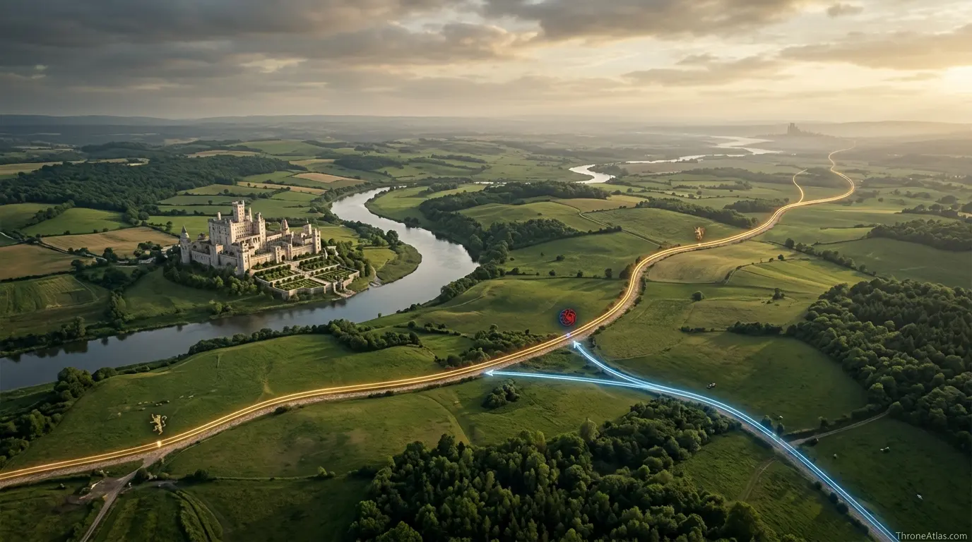
The Battle of the Goldroad map shows the Lannister army moving wealth and grain from Highgarden toward King’s Landing when Daenerys attacks with Drogon and Dothraki riders. The location matters because it is an open-road battle, not a castle siege. The map should show Highgarden, the Reach road network, the direction toward King’s Landing, Daenerys’s interception route, Jaime’s command position, and the supply consequences of losing a loot train to dragonfire.

Maester Aldric
Maester Aldric prepares map-based guides to Westeros, Essos, noble houses, battle routes, character journeys, and historical geography across Game of Thrones, House of the Dragon, and the wider published lore. Each guide is organized for readers who want clear geography, careful chronology, and useful internal connections between castles, houses, battles, routes, and lore events.
Battle of the Goldroad Map Fast Facts
Key map details before the full reading.
Page Index
- Quick Answer
- Fast Facts
- Tactical Map Guide
- Battle Sequence
- Route Logic
- Commanders and Stakes
- Aftermath
- Book and Show Notes
- Common Map Mistakes
- Related Atlas Network
- FAQ
Tactical Map Guide
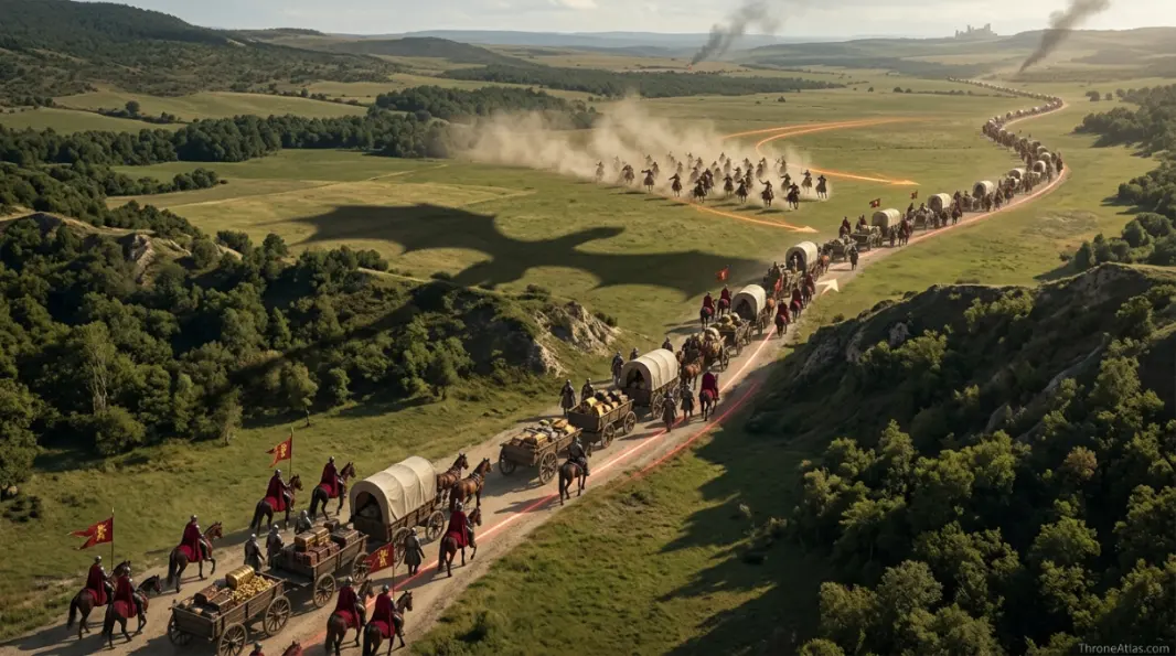
The visual reading begins with the anchor point, then expands outward through roads, rivers, coastlines, castles, cities, factions, and story consequences. A useful map for Battle of the Goldroad map should not only name Open road near the Reach route; it should explain why that place affects movement and power.
Battle Sequence and Map Flow
The Battle of the Goldroad map should be read as movement first and spectacle second. Every important battle or rebellion has a geographic order: forces gather, routes narrow, commanders make assumptions, supplies move, scouts report, and the field or city forces the conflict into a shape. The key to understanding Battle of the Goldroad Map is to follow how Lannister, Targaryen, Dothraki interact around Open road near the Reach route and Highgarden, King’s Landing, Blackwater region.
This page treats the event as a map sequence because readers often remember the dramatic moment but miss the route logic that created it. A battle may be won by a charge, a dragon, a gate, a river, a harbor, or a betrayal, but the conditions for that moment usually form earlier on the map. Supply lines, marching columns, island crossings, defensive walls, and political messages all build the battlefield before the first sword is raised.
| Phase | Map Movement | Reader Takeaway |
|---|---|---|
| Pressure Builds | Forces or claims converge around Open road near the Reach route and nearby routes. | The event begins before the visible clash because geography makes conflict likely. |
| Route Narrows | Roads, rivers, islands, gates, or harbors limit the choices of commanders. | The map explains why certain decisions seem bold, desperate, or unavoidable. |
| Clash Point | Lannister, Targaryen, Dothraki meet at the key location. | The dramatic moment is the result of movement, terrain, and timing. |
| Aftermath | News, hostages, supplies, claims, or survivors move outward. | The map changes after the event because power no longer flows the same way. |
Route Logic and Tactical Geography
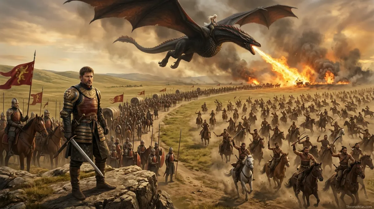
Route logic is the heart of the Battle of the Goldroad map. A battle map should show where forces start, where they intend to go, what they must cross, and where they become vulnerable. On a fantasy map this is especially important because names can be far apart in a reader’s memory. When the route is drawn clearly, the event stops feeling like a sudden scene and starts feeling like a consequence of terrain and political choice.
For Battle of the Goldroad Map, the main route questions are simple but important. Which side is moving? Which side is defending or intercepting? What road, harbor, castle, island, or river defines the confrontation? What is being protected: a throne, a food supply, a hostage, a city, a family name, or a claim? Answering those questions turns the page into a useful atlas rather than a recap.
- Why the battle is really about supply rather than territory.
- How open terrain favors Dothraki speed and dragon terror.
- Jaime’s point of view as a commander seeing a new kind of war.
- The route from Highgarden to the capital as the battle’s backbone.
- Why the loot train matters after the sack of Highgarden.
- The difference between winning a castle and controlling a road.
Commanders, Houses and Stakes
Commanders do not operate in empty space. They carry the limitations of their houses, armies, ships, roads, and political promises. A ruler may want a quick victory but be slowed by supply. A castle may look secure but become useless if a hostage opens the gate. A fleet may command the sea but fail inland. A dragon may break normal rules of warfare, yet it still needs a target and a route. The Battle of the Goldroad map should make those pressures visible.
The main powers in this event are Lannister, Targaryen, Dothraki. Their stakes are tied to Supply lines, dragon shock, royal finance. That is why the battle or rebellion matters beyond the immediate casualty count. The outcome changes how nearby places are read, how future routes are secured, and how later pages in the atlas connect to this one.
Command Pressure
Leaders must respond to terrain, timing, and the political cost of delay around Open road near the Reach route.
House Stakes
Lannister, Targaryen, Dothraki are tied to the conflict through loyalty, ambition, survival, wealth, or revenge.
Map Outcome
Supply lines, dragon shock, royal finance changes how nearby castles, roads, harbors, and claims are understood afterward.
Aftermath and Wider Atlas Impact
The best reason to map Battle of the Goldroad Map is that the aftermath travels. News moves to courts. Survivors carry trauma or proof. Gold, grain, ships, hostages, or dragons may be lost. A claimant may gain confidence. A defeated house may submit on paper while resentment survives in the region. That outward movement is why an event page should link to location pages, house pages, and later route maps.
After the event, the surrounding atlas network changes. Highgarden, King’s Landing, Blackwater region become more than nearby names; they become part of the explanation for what was gained, lost, protected, or exposed. A page that stops at the battlefield misses the larger map consequence. A page that follows the aftermath shows why the event remains important several chapters or seasons later.
Book and Show Notes
Book and screen versions often emphasize different things. The written histories may give clearer political background, while the show may provide stronger visual memory for a charge, siege, dragon attack, or council decision. A careful map should keep the stable geography in view and avoid claiming false precision where the source leaves room for interpretation.
For the Battle of the Goldroad map, the safest reading is to separate confirmed route logic from cinematic compression. The map should show the places, direction, forces, and consequences that remain important, while recognizing that exact distances, road curves, and battlefield spacing are often simplified in adaptation.
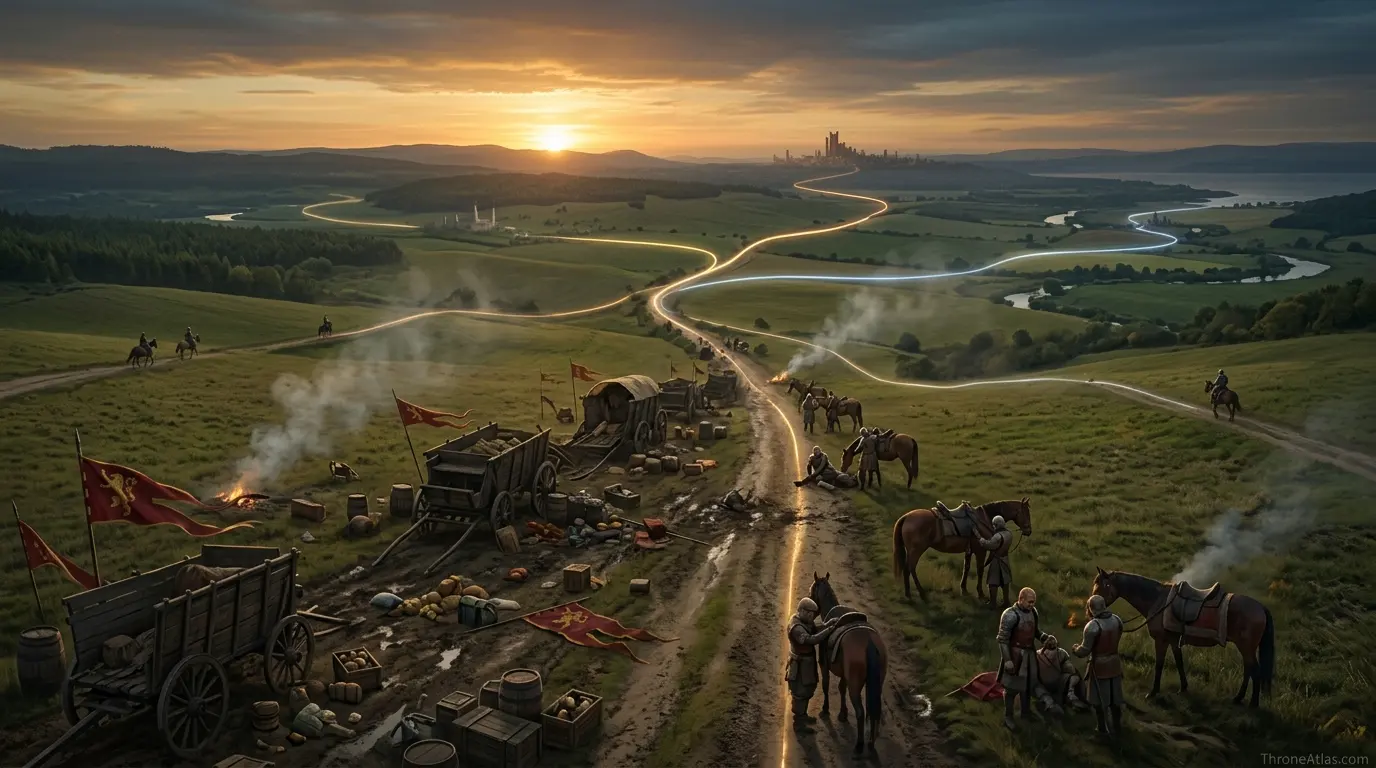
The final cartographic lesson of Battle of the Goldroad Map is that fantasy geography works best when it explains choice. Location shapes which allies can arrive, which enemies can threaten, which messages can travel, and which claims become believable. In that sense, Battle of the Goldroad map is not only a reference page; it is a reading path through power, memory, and movement.
The final cartographic lesson of Battle of the Goldroad Map is that fantasy geography works best when it explains choice. Location shapes which allies can arrive, which enemies can threaten, which messages can travel, and which claims become believable. In that sense, Battle of the Goldroad map is not only a reference page; it is a reading path through power, memory, and movement.
The final cartographic lesson of Battle of the Goldroad Map is that fantasy geography works best when it explains choice. Location shapes which allies can arrive, which enemies can threaten, which messages can travel, and which claims become believable. In that sense, Battle of the Goldroad map is not only a reference page; it is a reading path through power, memory, and movement.
The final cartographic lesson of Battle of the Goldroad Map is that fantasy geography works best when it explains choice. Location shapes which allies can arrive, which enemies can threaten, which messages can travel, and which claims become believable. In that sense, Battle of the Goldroad map is not only a reference page; it is a reading path through power, memory, and movement.
The final cartographic lesson of Battle of the Goldroad Map is that fantasy geography works best when it explains choice. Location shapes which allies can arrive, which enemies can threaten, which messages can travel, and which claims become believable. In that sense, Battle of the Goldroad map is not only a reference page; it is a reading path through power, memory, and movement.
The final cartographic lesson of Battle of the Goldroad Map is that fantasy geography works best when it explains choice. Location shapes which allies can arrive, which enemies can threaten, which messages can travel, and which claims become believable. In that sense, Battle of the Goldroad map is not only a reference page; it is a reading path through power, memory, and movement.
The final cartographic lesson of Battle of the Goldroad Map is that fantasy geography works best when it explains choice. Location shapes which allies can arrive, which enemies can threaten, which messages can travel, and which claims become believable. In that sense, Battle of the Goldroad map is not only a reference page; it is a reading path through power, memory, and movement.
Reader Map Reading
The deeper value of the Battle of the Goldroad Map is that it gives readers a way to connect scattered story memory into one geographic frame. Many fans remember a castle name, a character moment, a council scene, a siege, a betrayal, or a line of dialogue before they remember where it belongs. A map page closes that gap. It shows the reader how a local place connects to the roads, regions, coasts, rivers, armies, houses, and claims that shape the larger story.
This is especially important because the world of Westeros and Essos is built around uneven movement. A message by raven can outrun a rider. A fleet can reach a coast that an army cannot easily march toward. A mountain pass can make a nearby place feel distant. A river crossing can turn a simple journey into a strategic decision. A court command may be politically powerful but geographically slow. When the map is read through those limits, the page becomes more useful than a name list.
The best approach is to read the page in three passes. First, identify the anchor point and its region. Second, look at the nearby places that create pressure, opportunity, or danger. Third, follow the consequences outward. A house may matter because of a court office, a border road, a port, an old rivalry, or a famous character. A battle may matter because it changes supplies, morale, hostages, succession, or the confidence of a ruler. In both cases, the map reveals why the story moves the way it does.
How This Page Fits the Larger Atlas
No ThroneAtlas page should feel cut off from the rest of the world. The strongest reading comes from moving from this page into the neighboring maps, then into the house and route pages that explain who controls those places. For example, a castle page becomes clearer when linked to its ruling house. A house page becomes clearer when linked to its seat, rivals, and battlefield commitments. A battle page becomes clearer when linked to the roads and castles that made the conflict possible.
That is why this guide includes both local detail and wider connections. The local detail helps the reader answer the immediate question. The wider connections help the reader keep exploring without losing the thread. A reader who begins with Battle of the Goldroad Map may next need a regional map, a nearby castle guide, a related battle, or a character journey. The page is designed to support that movement naturally.
Distance, Scale and Careful Reading
Fantasy maps often look exact, but the story does not always give modern survey precision. A careful atlas should avoid claiming exact mile counts or fixed travel times unless the source gives enough support. It is safer and more helpful to explain direction, relative distance, terrain difficulty, and political risk. A short route across friendly ground is not the same as a short route through mountains, hostile castles, raiders, winter roads, or contested coastlines.
When reading the Battle of the Goldroad Map, keep that difference in mind. The map is reliable as a guide to relationship and movement. It shows which places belong together in story logic and which routes or regions shape decisions. It should not be treated as a modern road atlas where every curve, bridge, wall, and gate has been measured. The strength of this page is its ability to show clear relationships while respecting the limits of the fictional geography.
Why Small Places Can Have Large Consequences
One of the most common mistakes in reading the map is assuming that only great castles matter. In Westeros, smaller seats, roads, harbors, river crossings, and border houses can change the outcome of a much larger conflict. A minor lord may hold a pass. A narrow crossing may delay an army. A coastal town may become a landing point. A hostage may turn a castle. A family reputation may convince allies or frighten enemies. The map often gives smaller places a larger shadow than their size suggests.
The Battle of the Goldroad Map should therefore be read with attention to consequence, not only fame. If a place influences movement, loyalty, supplies, fear, legitimacy, or memory, it belongs in the atlas network. Some pages explain the throne directly. Others explain the roads and loyalties that make the throne possible. Both kinds of pages matter because power in this world is never held by one city alone.
Cartographer’s Final Reading
The final reading is simple: geography is story structure. The map decides who can arrive in time, who is isolated, who is exposed, who controls a crossing, who has food, who can flee by sea, who must march through hostile country, and who can claim a place with enough force to be believed. The Battle of the Goldroad Map is part of that structure. Read carefully, it helps explain not only where events happen, but why they happen in that order.
For readers building a full mental map of the world, this page works best as one piece of a larger route. Start with the quick answer, use the fast facts to place the topic, study the visual map guide, then follow the Related Atlas Network. That path turns a single page into a wider geographic understanding of houses, wars, journeys, and lore.
Common Map Mistakes
Readers often misunderstand this topic when the page is reduced to a single location name. The most reliable reading keeps the seat, nearby places, movement routes, and political consequences together.
- Calling it simply a Highgarden battle when the fight happens on the road after the sack.
- Ignoring the grain and gold movement that gives the battle stakes.
- Mapping the Dothraki charge without showing the Lannister column direction.
The fix is to read the map as a network. Begin with Open road near the Reach route, connect it to Highgarden, King’s Landing, Blackwater region, then follow how people, armies, ships, claims, or messages move through that space.
Related Atlas Network
Use these related maps to follow nearby places, connected houses, character routes, battles, and lore events across ThroneAtlas.
Primary Links
Routes and Wars
Battle of the Goldroad Map FAQ
Clear answers to common reader questions about this map, its location, and its story connections.
Where does Battle of the Goldroad Map take place?
Battle of the Goldroad Map is mapped around Open road near the Reach route and the nearby route system of Highgarden, King’s Landing, Blackwater region. The event is best understood by following movement, terrain, and the political stakes around that location.
What should the Battle of the Goldroad map show?
The map should show starting positions, routes of movement, the clash point, surrounding castles or ports, major commanders, and the aftermath that changes the wider atlas.
Why is this event important?
The event matters because it affects Supply lines, dragon shock, royal finance. Its impact continues through later routes, houses, claims, supplies, or political decisions.
Is this a castle battle, road battle, naval battle, or political event?
This page explains the event through its dominant geography: The Reach / Goldroad, Open road near the Reach route, and the movement around Highgarden, King’s Landing, Blackwater region.
Which pages connect to this map?
Read the related pages for Highgarden, King’s Landing, Blackwater region, then continue through the Westeros map, battle hub, routes hub, and the house pages connected to Lannister, Targaryen, Dothraki.
Explore More of the ThroneAtlas Map Network
Move from this page into the wider network of regions, castles, houses, battles, routes, and lore geography.