House Drumm Map
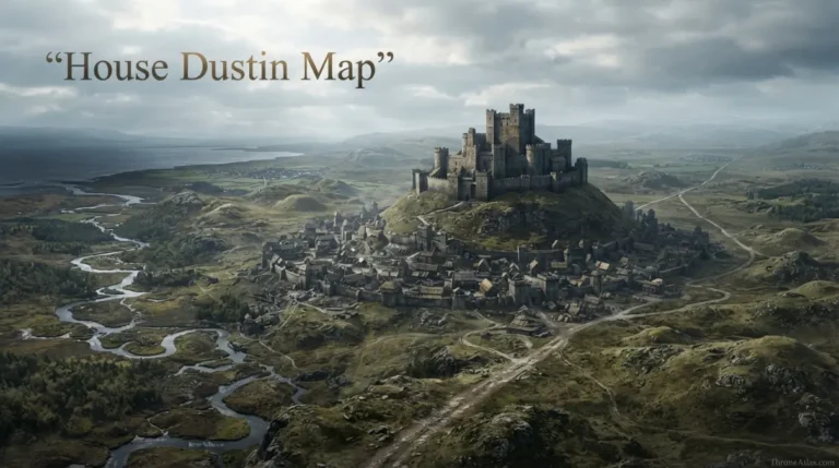
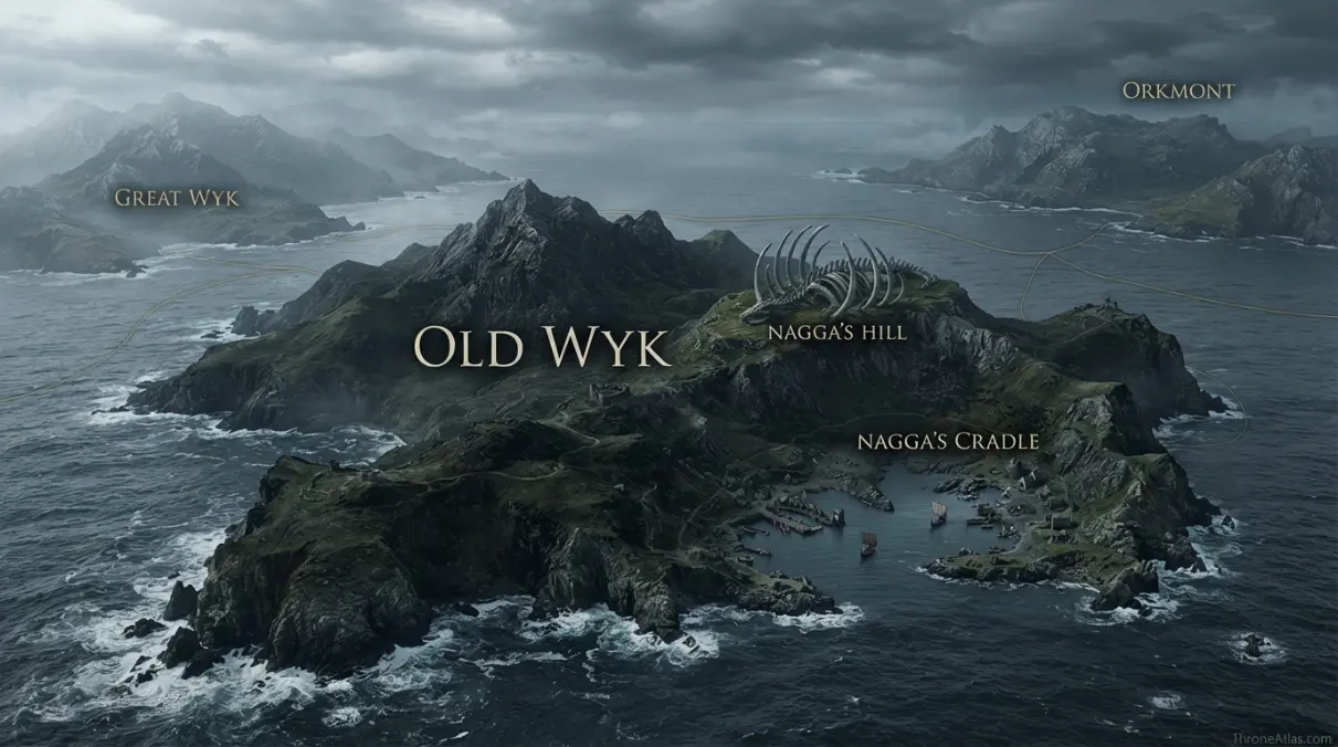
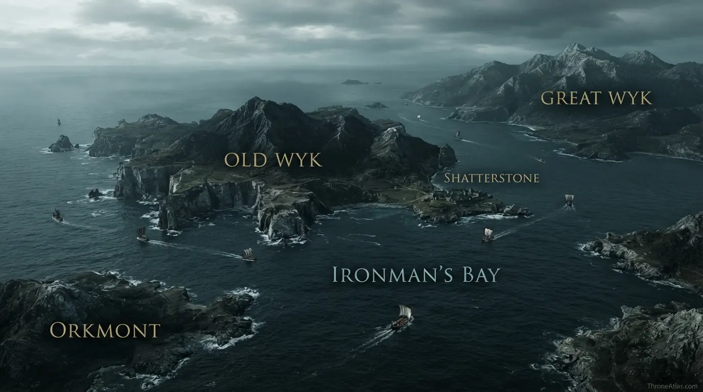
House Drumm is the leading noble house of Old Wyk, the holiest island of the Iron Islands. The family is styled Lords of Old Wyk, but the published material does not provide a clearly named Drumm castle comparable to Pyke or Ten Towers. The correct map therefore centers on Old Wyk itself: its windy hills and black mountains, Nagga’s Hill and Nagga’s Cradle, nearby Shatterstone, and the island’s position between Great Wyk and Orkmont. House Drumm’s geography is island-wide and historical rather than tied to a confidently named fortress pin.
Key Takeaways
House Drumm sphere on Old Wyk
The house is tied securely to an island or region even though a precise named principal castle is not firmly established.
Old Wyk, Nagga’s Hill and Nagga’s Cradle
No invented feudal border polygons.
Known locations and reconstructions are labeled separately.
Maintained for 2026.
Visual Atlas
Each point explains the geographic evidence behind the house map.
Mapped Locations and Confidence
| Location / Zone | Confidence | Why it belongs on the map |
|---|---|---|
| 1. House Drumm sphere on Old Wyk | Medium | House Drumm is the leading house of Old Wyk, but the exact principal castle point is not securely named in the published map material. |
| 2. Old Wyk | High | The island itself is the core of House Drumm geography and is considered the holiest of the Iron Islands. |
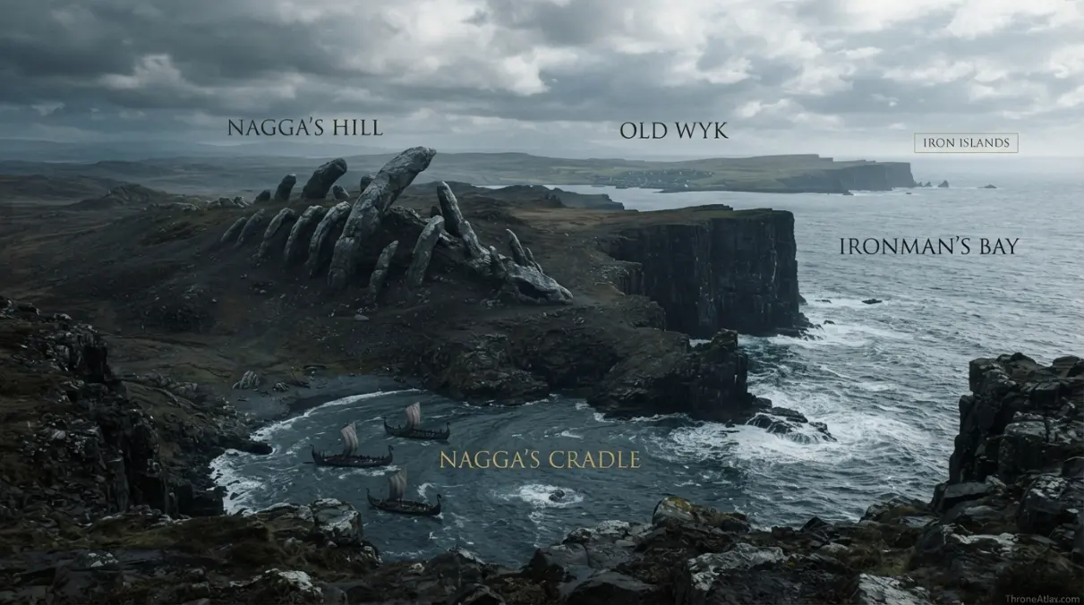
| 3. Nagga’s Hill | High | The sacred hill is one of Old Wyk’s defining landmarks and the gathering place associated with the kingsmoot. |
| 4. Nagga’s Cradle | High | Nagga’s Cradle lies by the sacred hill and ties House Drumm’s island to the oldest religious traditions of the ironborn. |
| 5. Shatterstone | High | Shatterstone, seat of a Goodbrother branch, lies on Old Wyk’s coast and demonstrates that the Drumms share the island with other noble families. |
| 6. Great Wyk | High | Great Wyk lies south and west of Old Wyk and provides the nearest large-island orientation. |
| 7. Orkmont | High | Orkmont lies east of Old Wyk, helping define the island’s position inside the central Iron Islands. |
| 8. Ironman’s Bay | High | The surrounding sea connects Old Wyk to Pyke, Harlaw, Great Wyk and the western coast of Westeros. |
1. House Drumm sphere on Old Wyk
House Drumm is the leading house of Old Wyk, but the exact principal castle point is not securely named in the published map material. This point matters because it fixes the house to a real geographic relationship—seat, road, river, island, neighboring region or political center—rather than relying on a decorative boundary. Read it together with the adjacent markers to understand scale and movement.
2. Old Wyk
The island itself is the core of House Drumm geography and is considered the holiest of the Iron Islands. This point matters because it fixes the house to a real geographic relationship—seat, road, river, island, neighboring region or political center—rather than relying on a decorative boundary. Read it together with the adjacent markers to understand scale and movement.
3. Nagga’s Hill
The sacred hill is one of Old Wyk’s defining landmarks and the gathering place associated with the kingsmoot. This point matters because it fixes the house to a real geographic relationship—seat, road, river, island, neighboring region or political center—rather than relying on a decorative boundary. Read it together with the adjacent markers to understand scale and movement.
4. Nagga’s Cradle
Nagga’s Cradle lies by the sacred hill and ties House Drumm’s island to the oldest religious traditions of the ironborn. This point matters because it fixes the house to a real geographic relationship—seat, road, river, island, neighboring region or political center—rather than relying on a decorative boundary. Read it together with the adjacent markers to understand scale and movement.
5. Shatterstone
Shatterstone, seat of a Goodbrother branch, lies on Old Wyk’s coast and demonstrates that the Drumms share the island with other noble families. This point matters because it fixes the house to a real geographic relationship—seat, road, river, island, neighboring region or political center—rather than relying on a decorative boundary. Read it together with the adjacent markers to understand scale and movement.
6. Great Wyk
Great Wyk lies south and west of Old Wyk and provides the nearest large-island orientation. This point matters because it fixes the house to a real geographic relationship—seat, road, river, island, neighboring region or political center—rather than relying on a decorative boundary. Read it together with the adjacent markers to understand scale and movement.
7. Orkmont
Orkmont lies east of Old Wyk, helping define the island’s position inside the central Iron Islands. This point matters because it fixes the house to a real geographic relationship—seat, road, river, island, neighboring region or political center—rather than relying on a decorative boundary. Read it together with the adjacent markers to understand scale and movement.
8. Ironman’s Bay
The surrounding sea connects Old Wyk to Pyke, Harlaw, Great Wyk and the western coast of Westeros. This point matters because it fixes the house to a real geographic relationship—seat, road, river, island, neighboring region or political center—rather than relying on a decorative boundary. Read it together with the adjacent markers to understand scale and movement.
House Drumm is an island lordship first
The strongest geographic fact is not a castle name but control of Old Wyk. That makes the island the correct center of the map. House Drumm’s identity, history and prestige are tied to the island as a whole, especially its sacred status among the ironborn.
Nagga’s Hill and religious geography
Old Wyk is considered holy because of the traditions centered on Nagga’s Hill and Nagga’s Cradle. The kingsmoot held there gives the island political as well as religious importance. House Drumm therefore occupies a landscape where sacred memory can draw leaders from across the Iron Islands.
Why the castle marker stays uncertain
A map should not create a named Drumm fortress merely because most noble-house pages have one. The published sources clearly identify House Drumm with Old Wyk but do not give the same precise seat naming available for House Harlaw at Ten Towers. ThroneAtlas keeps that gap visible.
Red Rain and house identity
House Drumm possesses the Valyrian steel sword Red Rain, adding prestige to a family already connected with ancient ironborn kingship. The sword does not alter the map, but it helps explain why the Drumms are prominent within an island whose geography is already central to ironborn tradition.
Sea power begins with access, not ownership
An island or coastal house does not control every stretch of surrounding water simply because its castle faces the sea. Real influence depends on harbors, ships, weather, nearby islands and the ability to respond to raids or invasion. The atlas therefore treats sea lanes as corridors of connection and danger, not as hard maritime borders.
Why neighboring islands and coasts belong on a house map
A house may rule one island yet depend on a different coast for trade, allegiance or military support. Nearby landforms help readers understand scale and direction. They are included as orientation points without suggesting political ownership.
Castle, island and overlord are different layers
The seat shows where local authority is centered; the island or coastal region shows the terrain being ruled; the overlord’s seat shows the larger political system. Keeping those layers separate makes the map more accurate than one oversized house-color polygon.
How to read the House Drumm Map
Start with House Drumm sphere on Old Wyk, then locate Nagga’s Cradle and finally zoom outward toward Ironman’s Bay. Those three points create a practical hierarchy: the family’s center, the terrain or route that explains local power, and the wider connection that places the house inside its kingdom. This is more informative than a colored patch labeled with a surname.
The house is tied securely to an island or region even though a precise named principal castle is not firmly established.
House maps also need to separate physical geography from political allegiance. A river does not move when a lord changes sides. A castle remains in the same valley when one king replaces another. Roads may be used by merchants, royal progresses and invading armies in different years. By keeping these stable features visible, the atlas remains useful across multiple periods of the story.
Seat, terrain and political reach
The seat is the strongest fixed anchor on most noble maps, but it should not be mistaken for the full extent of influence. Terrain determines how authority travels. Islands require ships. River crossings concentrate traffic. Great roads connect a house to larger political centers. Mountain passes can make a modest castle strategically important far beyond the size of its household.
Political reach is even more fluid. Bannermen, cadet branches, marriage alliances and wartime occupations can extend influence beyond the immediate home territory. This page shows those relationships through named nodes and corridors rather than implying permanent ownership wherever a family once campaigned.
What this map can and cannot prove
The map can confidently establish the relationships supported by published geography: which region the house belongs to, where its seat is when that location is known, what major roads or waters lie nearby, and which larger political center the family serves. It can also show historical movement where the narrative provides a clear sequence.
It cannot prove the exact shape of every field, village boundary or minor road. Nor can it turn an unnamed seat location into a precise point. That restraint is especially important for House Drumm Map, because a visually confident map can easily make a reconstruction look official.
Why this house matters geographically
House Drumm is the leading noble house of Old Wyk, the holiest island of the Iron Islands. The family is styled Lords of Old Wyk, but the published material does not provide a clearly named Drumm castle comparable to Pyke or Ten Towers. The correct map therefore centers on Old Wyk itself: its windy hills and black mountains, Nagga’s Hill and Nagga’s Cradle, nearby Shatterstone, and the island’s position between Great Wyk and Orkmont. House Drumm’s geography is island-wide and historical rather than tied to a confidently named fortress pin.
The important word is geography. Noble history becomes easier to remember when attached to a map. Island houses make sense through sea lanes; marcher houses through passes; Reach houses through roads and rivers; northern houses through enormous regional distances. The map turns a list of names into a system.
Fast map answers
Primary anchor
House Drumm sphere on Old Wyk is the first place to locate because it defines the house’s geographic center or best-known seat.
Terrain clue
Nagga’s Cradle explains an important part of the local landscape, whether coast, road, river, frontier or regional position.
Wider connection
Ironman’s Bay is the best marker for understanding how the house connects to the surrounding kingdom or sea network.
Travel, supply and military movement
Castles do not exist outside logistics. Food must arrive, messengers must travel, armies need roads or landing places, and political orders have to cross real terrain. A house that controls a crossing or island approach can matter even with fewer soldiers than a wealthier inland lord. Conversely, a rich seat may be difficult to reinforce if roads are poor or weather closes the sea.
For that reason, this atlas emphasizes practical corridors rather than straight lines between castles. The shortest line on a page is not always the usable route. Ships navigate around coasts, riders look for bridges, and armies avoid terrain that cannot support them. Where the source material does not specify a path, the page stays at corridor level.
Historical layers on the same landscape
Many Westerosi houses claim origins in the Age of Heroes, the First Men or the Andal migrations. Whether every genealogy is literal is less important for mapping than the persistence of place. Ancient seats, roads and sacred sites accumulate stories over centuries. The same castle can belong to a legendary founder, a marcher lord, a royal bannerman and a later rebel without changing coordinates.
This layered approach is particularly helpful when comparing the main novels with Fire & Blood or world-history material. A house may appear only briefly in one narrative but become much more meaningful when the older political geography is visible.
Atlas field notes
ThroneAtlas uses confidence labels to prevent three common map errors. First, it avoids drawing exact feudal borders where none are published. Second, it distinguishes a known seat from an assumed seat. Third, it separates neighboring places from owned places. These distinctions sound small, but they prevent a large amount of accidental misinformation.
The visual image and the interactive schematic have complementary roles. The image can show terrain, heraldry and a polished map composition. The numbered schematic underneath preserves the logical structure in an accessible format, letting readers open each anchor and read why it belongs. The table then provides the same evidence in a compact form for quick comparison.
If future canon clarifies an uncertain location, the structure is easy to update: the confidence label can change and the marker can be moved without rewriting the entire page. That makes the atlas durable rather than overcommitted to one fan reconstruction.
Connecting this house to the wider ThroneAtlas
A house map becomes more useful when it can be tested against other scales. Open the regional map to understand distance, the castle or settlement map for local detail, a battle map for temporary military control, and a character journey for movement through the same terrain. The underlying geography should remain consistent across all of them.
This connected approach also reduces duplication. The purpose of House Drumm Map is not to retell every event involving the family. It is to explain the spatial framework beneath those events: where the house belongs, what routes or waters shape it, which neighboring landmarks matter, and where the published evidence becomes uncertain.
Map Accuracy and Canon Confidence
High confidence marks geography directly established in published maps or narrative descriptions. Medium confidence marks a strong regional relationship that should not be mistaken for an exact coordinate or border. Low confidence is used when the existence or regional identity of a place is known but its precise map position remains unrevealed.
ThroneAtlas does not add estate borders, unnamed castles or exact routes merely to make a graphic look complete. Where the source stops, the map says so.
Source Basis
This atlas follows the established geography of Old Wyk and the confirmed status of House Drumm as Lords of Old Wyk. Because a named principal Drumm castle is not clearly established in the main geographic material, the map does not invent one.
The page is an interpretive map guide built from established geography and house history. It organizes the evidence around practical reader questions—where the seat is, what terrain surrounds it, how it connects to major routes and political centers, and how certain each placement is.
Frequently Asked Questions
Where is House Drumm located?
House Drumm is placed through House Drumm sphere on Old Wyk, Old Wyk and the surrounding regional anchors shown on this page. Where the seat is not precisely mapped in canon, that uncertainty is stated directly.
What is the main seat or center on the House Drumm map?
House Drumm sphere on Old Wyk is the primary map anchor. The confidence table explains whether that point is a precisely located castle, a regional seat, or an intentionally unresolved position.
Is this House Drumm map based on book canon?
Yes. The geography follows published maps, the main novels and world-history material. The page does not turn fan estimates into canon.
Are the house borders exact?
No. Most noble-house boundaries are not mapped at survey level. The atlas uses castles, rivers, roads, islands, passes and neighboring regions instead of drawing unsupported border polygons.
Why are some markers Medium or Low confidence?
Medium indicates a strong regional relationship without exact local placement. Low is used where the source confirms a place or seat but does not reveal a reliable coordinate.
Why include nearby castles or regional landmarks?
They help orient the house within its political and physical landscape. Their inclusion does not mean the house owns those places.
Can the visual atlas be used for exact distance?
No. It is designed for relative position, route logic and strategic context, not modern GPS measurement.
How does ThroneAtlas handle conflicting fan maps?
Published geography is treated as the base. Where popular fan maps add detail that the books do not establish, this page keeps the uncertain area unresolved.
What should I read after the House Drumm map?
Use the Continue Exploring section to move into the relevant regional, castle, battle or journey maps and compare the same geography at a different scale.
When was this House Drumm map updated?
This ThroneAtlas page is maintained as a 2026 edition and intentionally avoids a fixed day-and-month freshness stamp.