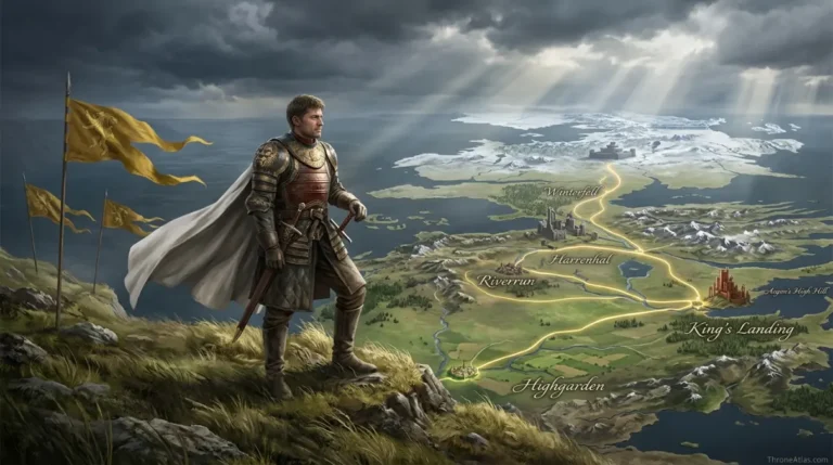
Tywin Lannister Campaign Map: Green Fork, Harrenhal, Red Fork & Blackwater
A campaign atlas showing how Tywin’s objectives changed from destroying Stark forces in the Riverlands to saving King’s Landing from Stannis Baratheon.
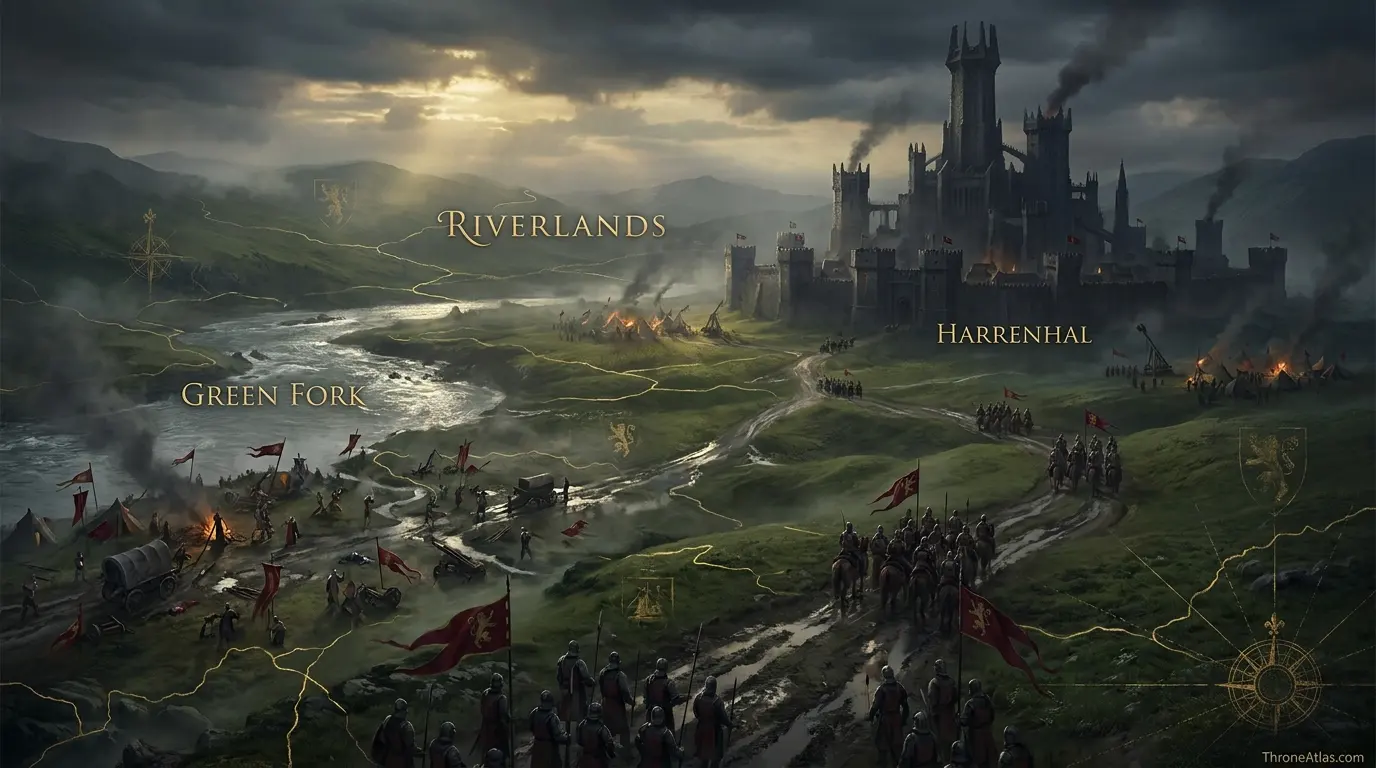
Tywin Lannister’s War of the Five Kings campaign moves through several strategic phases: he defeats Roose Bolton at the Green Fork, uses Harrenhal as a central base, turns west as Robb Stark invades the Westerlands, is checked at the Red Fork by Edmure Tully, then turns southeast after learning Stannis threatens King’s Landing and joins Tyrell strength before the Battle of the Blackwater.
Follow the Campaign as a Chain of Decisions
Click the campaign markers in sequence. The route begins with the Lannister invasion of the Riverlands, centers on Harrenhal, bends toward the western river crossings and then sharply redirects toward King’s Landing. The shape matters because the campaign changes objective more than once.
Canon Confidence & What This Map Claims
ThroneAtlas separates confirmed geography from useful reconstruction so a clean digital map never appears more certain than the underlying source.
Read the Map From Anchors to Story
- Visual Atlas
- Canon Confidence
- Key Takeaways
- Locations & Route Table
- Tywin’s Campaign Is About Objectives, Not Just Distance
- Green Fork: A Victory That Does Not Solve the War
- Why Harrenhal Becomes Tywin’s Central Base
- The Red Fork: Why River Crossings Can Redirect a War
- The Turn to Blackwater: When the Capital Becomes the Priority
- Logistics and Information: The Invisible Geography Behind the Route
- Fast Answers
- Sources & Method
- FAQs
The Campaign Makes Sense Only as a Series of Pivots
The Green Fork is a tactical win
Tywin wins the battle, but Robb’s larger operational plan still succeeds elsewhere.
Harrenhal is chosen for position
The castle’s central Riverlands location makes it a powerful base even if its size is cumbersome.
Robb changes Tywin’s priorities
Stark attacks in the Westerlands pull Tywin’s attention west.
The Red Fork creates friction
Edmure Tully blocks crossings and prevents an easy westward advance.
Stannis changes the strategic map
News of the threat to King’s Landing makes the capital more important than continuing west.
Tyrell alliance multiplies force
The relief of the capital is not a purely Lannister march; Reach strength becomes decisive.
River geography matters constantly
The Trident system and Red Fork crossings constrain armies that look mobile on a flat political map.
Route precision has limits
Campaign sequence is strong; exact camp-to-camp lines are not always fixed by the narrative.
Places, Routes & Strategic Connections
| Map Anchor | Type | Why It Matters |
|---|---|---|
| Westerlands Muster | Origin | The western power base from which Lannister armies draw men, wealth and supply. |
| Green Fork | Battle | Tywin defeats Roose Bolton here while Robb Stark’s main move is aimed elsewhere. |
| Harrenhal | Base | A central Riverlands base from which Tywin can threaten multiple directions. |
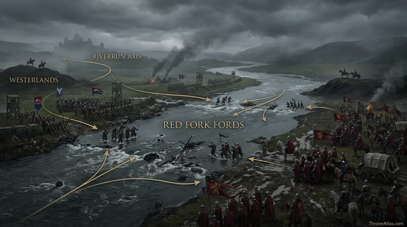
| Riverrun Axis | Front | The western Riverlands front shaped by Robb Stark and Tully resistance. |
| Red Fork Fords | Battle | Edmure Tully contests Tywin’s attempts to cross westward during the campaign. |
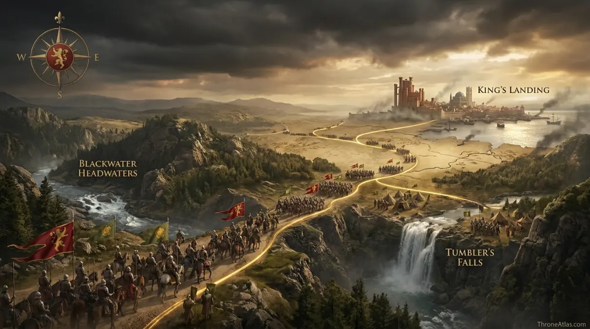
| Blackwater Headwaters | Junction | The southeastern turn that helps bring Tywin toward the relief route. |
| Tumbler’s Falls | Junction | A meeting and movement zone associated with the converging Lannister-Tyrell relief effort. |
| King’s Landing | Objective | The capital becomes the decisive objective once Stannis Baratheon threatens it. |
Tywin’s Campaign Is About Objectives, Not Just Distance
A campaign map can mislead if it treats an army as a colored line moving steadily toward one destination. Tywin Lannister’s operations during the War of the Five Kings are almost the opposite. His route makes sense because the objective changes repeatedly.
At first, Lannister strategy is focused on the Riverlands and the destruction of Stark-Tully resistance. Tywin leads a large host while Jaime Lannister operates on another axis. The Riverlands become a contested corridor where roads, rivers and castles determine which armies can support one another.
The Battle of the Green Fork gives Tywin a battlefield victory over Roose Bolton, yet the larger Stark plan is not broken. Robb Stark has separated forces and moves against Jaime’s army, ultimately capturing him. This is the first lesson of the map: winning the battle directly in front of you does not necessarily mean winning the campaign around it.
Harrenhal then becomes Tywin’s base. From there he can react to threats across the central Riverlands. But when Robb carries the war into the Westerlands, the strategic center of gravity shifts westward. Tywin cannot ignore attacks against his family’s home territory indefinitely.
Then Stannis Baratheon moves on King’s Landing. The capital, Joffrey’s regime and the Lannister political project are suddenly at risk. Tywin’s route turns again.
The map therefore shows decisions rather than just footsteps. Green Fork, Harrenhal, Red Fork and Blackwater are linked by changing priorities. The campaign is best read as an exercise in deciding which threat matters most at each moment.
Green Fork: A Victory That Does Not Solve the War
At the Green Fork, Tywin confronts the northern force commanded by Roose Bolton. The battle is significant because it demonstrates both Lannister battlefield power and Robb Stark’s willingness to divide his army for operational advantage.
Tywin wins the immediate contest. Bolton’s force is beaten back, giving the Lannisters a conventional victory. If the war were judged only by the local battlefield, the result would look reassuring for the western host.
Yet Robb’s primary maneuver is aimed elsewhere. His cavalry and chosen forces move toward Jaime Lannister’s position, leading to victories at the Whispering Wood and the Camps. Jaime is captured, and the balance in the Riverlands changes.
On a map, the separation of these actions is crucial. Green Fork sits on one axis while Riverrun and Jaime’s operations sit on another. Tywin cannot simply translate a win at one point into control of the entire region.
This is why campaign geography is more useful than a chronological battle list. It reveals simultaneous spaces. Two armies belonging to the same side can be too far apart to rescue one another. A feint or holding force can occupy an enemy commander while the decisive blow lands elsewhere.
Tywin’s subsequent movements are shaped by the consequences. The war remains unresolved despite his tactical success. The Riverlands still contain hostile forces, Jaime is lost, and the Stark-Tully alliance gains momentum.
The Green Fork marker therefore carries a deliberately two-sided note: victory in battle, failure to settle the operational problem. That nuance is essential to understanding Tywin as a commander and the war as a geographic system.
Why Harrenhal Becomes Tywin’s Central Base
Harrenhal is enormous, damaged and famously ominous, but its strategic value comes first from location. It sits in the Riverlands near major routes and the Gods Eye, allowing an army based there to watch several directions at once.
For Tywin, that centrality is useful. The Lannister host needs a defensible base from which it can respond to Stark movements, pressure the Riverlands and maintain lines back toward friendly territory. Harrenhal provides space and symbolic dominance, even if occupying such a vast castle creates its own logistical burdens.
A base is different from a destination. Tywin is not at Harrenhal because holding the castle alone will win the war. He is there because the castle supports further movement. Scouts, ravens and reports can reach him; forces can be dispatched; decisions can be made about east, west and south.
That function becomes visible when Robb Stark invades the Westerlands. Harrenhal’s central position allows Tywin to turn west, but the route is still constrained by the river system and hostile Tully forces. The map therefore treats Harrenhal as a hinge.
The castle also demonstrates a broader military principle. A strong central fortress can provide security while an army waits for information, but it can become a trap if the commander grows too attached to it. Tywin does not. He uses Harrenhal and then moves when the war demands it.
This is an important contrast with readers who remember Harrenhal mainly through curse lore, Arya’s captivity or its succession of doomed holders. In the campaign map, the castle is valuable because of where it sits. Its legend is secondary to its roads and regional reach.
The Red Fork: Why River Crossings Can Redirect a War
When Tywin turns west in response to Robb’s campaign in the Westerlands, he encounters one of the Riverlands’ most important geographic constraints: the Red Fork. Crossing a defended river is not the same as marching across open country.
Edmure Tully chooses to contest the fords. His forces oppose Lannister attempts to cross, creating a series of clashes collectively associated with the Battle of the Fords. From Edmure’s local perspective, preventing an enemy army from entering his territory is an obvious success.
The strategic consequences are more complicated. Tywin is delayed and checked. He does not simply force his way west on the schedule he might prefer. That gives new information and new threats time to reach him.
This episode has generated long debate because Robb Stark and Brynden Tully later argue that their broader plan depended on drawing Tywin west. Regardless of how readers judge the command communication, the geographic fact remains: the Red Fork influences what Tywin can do.
Rivers are therefore active elements on the campaign map. A line of water can create days of delay, concentrate combat around fords and force commanders to choose between repeated attacks, alternate crossings or a change of objective.
The Red Fork marker should not be reduced to “Tywin loses a battle.” It is better understood as a point of friction. The army remains powerful, but the route west is no longer easy.
That friction becomes historically decisive because another threat is developing toward King’s Landing. If Tywin had been operating in empty open ground, his choices and timing could have been different. The river helps create the window in which strategy changes.
The Turn to Blackwater: When the Capital Becomes the Priority
Stannis Baratheon’s move against King’s Landing radically alters Tywin’s calculation. The capital is not merely another castle. It contains King Joffrey, the royal court and the political legitimacy on which Lannister power depends. If Stannis captures it, a successful campaign in the west becomes far less meaningful.
Tywin therefore turns away from the effort to reach Robb. The direction of the war changes from westward recovery to southeastern relief. This is one of the clearest strategic pivots in the entire series.
The movement also intersects with diplomacy. House Tyrell, formerly aligned with Renly Baratheon, enters an alliance with the Lannisters. Reach troops and commanders become part of the relief force. The road to Blackwater is therefore a coalition route.
Geography matters in the timing. Tywin’s army must reach the capital while Stannis is committed to the assault. Too early, and Stannis may avoid battle; too late, and King’s Landing may already have fallen.
The Blackwater itself creates another barrier. Stannis’s fleet and army are attacking across and along the river while the city defenders struggle to hold. Tywin’s arrival from outside the immediate siege geometry threatens the attackers from a different direction.
The final victory is often remembered through wildfire, Tyrion’s chain in the books, and the dramatic charge of relief forces. The campaign map adds the missing precondition: Tywin had to be in position to turn toward King’s Landing at the right time.
His path from Harrenhal through the contested westward phase and then southeast is therefore not wasted movement. It is the shape of a commander responding to a war whose most important objective changed faster than armies could march.
Logistics and Information: The Invisible Geography Behind the Route
Every marker on Tywin’s campaign represents more than soldiers walking from one place to another. Large armies depend on food, horses, wagons, road conditions, river crossings, scouts and information. Those invisible systems explain why a route that looks simple on a map can be difficult in practice.
Harrenhal’s central position helps because it can serve as a collection point for supplies and messages. The Riverlands, however, are being devastated by war. Foraging may sustain troops temporarily, but it also destroys local economies and creates hostility. Long supply lines become vulnerable.
Rivers slow movement unless safe bridges or fords are available. The Red Fork episode is the clearest example, but the entire Trident system shapes campaigning. A commander has to know not only where the enemy is but which crossings are held.
Information is equally important. Tywin’s decision to turn toward King’s Landing depends on learning about Stannis’s threat and understanding the emerging Tyrell alliance. Ravens move faster than armies, so strategic reality can change while a host is still marching toward yesterday’s objective.
This is why the atlas uses junctions rather than pretending every decision occurred at a single cinematic crossroads. The Blackwater headwaters and Tumbler’s Falls area represent a broader convergence of routes and forces.
A useful campaign map should make readers ask two questions at every step: “Where can the army physically go?” and “What does the commander know right now?” Tywin’s campaign is one of the best examples in the series of those questions interacting. His most important movement is not the longest march; it is the decision to abandon one objective quickly enough to save another.
Fast Answers About the Map
He fought Roose Bolton’s northern force at the Green Fork in the Riverlands.
Its central Riverlands position made it a strong base for watching and responding to several fronts.
Robb Stark invaded the Westerlands, threatening Lannister home territory and forcing a response.
Edmure Tully’s forces contested the river fords and blocked easy westward crossings.
Stannis Baratheon’s attack made saving the capital and Joffrey’s regime the more urgent objective.
No. Lannister forces operated in alliance with the Tyrells and other Reach strength.
No. Major anchors and strategic sequence are established, while fine day-to-day routing is schematic.
The Riverlands river network is crucial because crossings repeatedly constrain movement and timing.
What This Atlas Is Based On
- George R. R. Martin’s A Clash of Kings and related A Song of Ice and Fire chapters for Tywin’s movements, battles and strategic decisions.
- Published maps of the Riverlands, Westerlands and Crownlands for the relative position of Green Fork, Harrenhal, Red Fork and King’s Landing.
- The World of Ice & Fire for broader War of the Five Kings context.
- The route connects established campaign anchors while avoiding claims about exact camp locations not stated in the narrative.
Continue Exploring ThroneAtlas Maps
Tywin Lannister Campaign Map FAQs
What route did Tywin Lannister take during the War of the Five Kings?
His major campaign anchors run through the Riverlands from the Green Fork to Harrenhal, then toward the Red Fork before turning southeast to relieve King’s Landing.
Did Tywin win the Battle of the Green Fork?
Yes. His army defeated Roose Bolton’s force, although Robb Stark achieved major successes elsewhere at the same time.
Why was Harrenhal important to Tywin?
Its central Riverlands location gave him a secure base from which to react to several fronts.
Did Edmure Tully defeat Tywin?
Edmure successfully contested Tywin’s attempts to cross the Red Fork, but the strategic consequences are more complicated than a simple final defeat.
Was Tywin trying to chase Robb Stark?
He turned west in response to Robb’s invasion of the Westerlands, making the Stark campaign a major concern.
Why did Tywin stop going west?
The threat from Stannis Baratheon to King’s Landing made the capital the more urgent objective.
How did the Tyrells join Tywin?
After Renly’s death, the Tyrells eventually allied with the Lannisters, creating the coalition that relieved King’s Landing.
Did Tywin personally save King’s Landing?
His relief army was decisive, but the victory also depended on the city’s defenders and the Tyrell alliance.
Is every road on this map canonical?
No. Major movements and locations are canonical; the line between them is an explanatory reconstruction.
Why are rivers so important on Tywin’s campaign map?
The Trident and Red Fork crossings determine where large armies can move efficiently and where defenders can delay them.
Why This Geography Matters
Tywin Lannister’s campaign is a map of changing priorities. The Green Fork, Harrenhal and Red Fork define the Riverlands phase, but Stannis’s attack transforms King’s Landing into the decisive objective. The final turn toward Blackwater shows how information and geography can redirect an entire war.