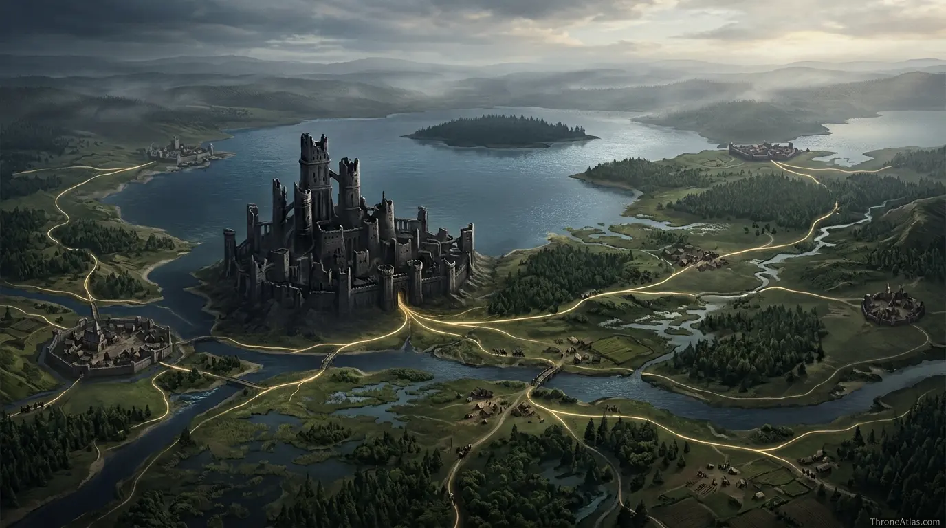
House Strong MapHarrenhal, the Strongs, and the hidden family pressure behind the Dance
The Riverlands · Harrenhal · House Territory Guide
The House Strong map explains where House Strong sits, why Harrenhal matters, and how nearby roads, castles, rivers, seas, overlords, and wars shape the house’s place in Westerosi history.
House Strong is associated with Harrenhal in The Riverlands. A useful House Strong map should show the seat, the surrounding region, nearby routes, connected houses, and the political pressure created by court influence, hidden parentage rumors, cursed castles, Dance politics, and family collapse.
Maester Aldric
Maester Aldric prepares ThroneAtlas map guides by reading the geography first: where a house sits, what it can reach, what threatens it, and which castles, roads, coasts, rivers, and oaths turn a name on a banner into a working political force. This page is written as an independent fan atlas entry for readers who want clear location logic, house context, and reliable connections to the wider Westeros map.
House Strong at a Glance
The key details below give readers a clean map-first summary before moving into history, routes, and connected story events.
Visual Map Guide

House Strong is one of the most important House of the Dragon map subjects because it connects Harrenhal, King’s Landing, the royal court, and the private scandal that shadows Rhaenyra’s heirs. The house is geographically Riverlands-based, but politically it reaches straight into the Red Keep.
A House Strong map should draw two centers: Harrenhal and King’s Landing. Harrenhal explains land, title, and cursed inheritance. King’s Landing explains power, rumor, and the court careers of Lyonel, Harwin, and Larys Strong. Between those points lies much of the Dance’s emotional geography.
A strong map page should not only answer “where is it?” It should also answer “what can this house reach?” and “what can reach this house?” For House Strong, those questions point toward Gods Eye, King’s Landing, Dragonstone routes, Riverrun, and the central Riverlands. Every one of those connections changes the page from a flat location note into a useful atlas entry.
Location Logic: Why Harrenhal Matters
The seat of House Strong, Harrenhal, is best understood as Harrenhal, the enormous castle by the Gods Eye. Its importance comes from the practical shape of the surrounding land and the alliances that must pass through it. When a house controls a point like this, it does more than hold walls. It controls messages, food, retreat paths, family marriages, oath networks, and the local memory of who once ruled.
In map terms, Harrenhal functions as the reader’s first pin. From that pin, the eye should move outward to the region, then to neighboring seats, then to roads, rivers, bays, islands, forests, or passes. This outward reading keeps the page useful for both casual viewers and serious lore readers because it turns geography into cause and effect.

Reading the House Through Distance
Distance is one of the most underrated parts of a house map. A castle that looks close on a simplified fan map may still be separated by mountains, forests, rivers, dangerous coasts, or hostile lordships. That is why the House Strong map should be read with terrain in mind rather than only with straight lines.
For House Strong, distance matters because the house sits within a chain of obligations. It must answer upward to regional powers, sideways to neighbors, and outward to larger conflicts. When a war begins, the house’s options are shaped by which roads remain open, which ports can be used, which allies are near enough to help, and which enemies can move quickly toward the seat.
History and Timeline
The history of House Strong is easiest to follow when each moment is tied to a map position. Instead of treating the house as a list of names, ThroneAtlas reads it as a place that repeatedly meets pressure from rulers, neighbors, wars, and old memory.
This timeline shows why the house cannot be reduced to a single castle marker. The map changes meaning when the same seat appears in different periods: peace, rebellion, civil war, occupation, court intrigue, or restoration. A house map becomes stronger when it shows those layers together.
Political Network and House Stakes
Regional Pressure
The Riverlands shapes House Strong more than any single ruler. Geography decides whether the house looks toward rivers, forests, ports, mountain roads, or royal courts.
House Identity
The sigil — a tripartite field of blue, red, and green around a clenched fist — gives the page a visual anchor, but the deeper identity comes from court influence, hidden parentage rumors, cursed castles, Dance politics, and family collapse and the way those themes appear on the map.
Route Value
The strongest routes to show are the practical ones: roads to overlords, paths toward battle sites, sea lanes or river movement, and the corridors that connect Harrenhal to larger wars.
The Strongs show how a house can become dangerous without ruling a kingdom. Their influence comes from office, proximity, personal trust, secrecy, and the unsettling reputation of Harrenhal. That combination makes their map feel like a web rather than a border.
The political stakes around House Strong become clearer when the page is linked to nearby atlas entries. A reader may arrive looking only for Harrenhal, but the full story often requires moving to connected hubs: the regional map, the ruling house, nearby castles, major battles, and character journeys that pass through the same ground.
| Map Element | What to Show | Why It Matters |
|---|---|---|
| Primary seat | Harrenhal | Anchor point for the page and the safest first map marker. |
| Regional lens | The Riverlands | Shows which overlord, border, or road system controls the house story. |
| Nearby network | Gods Eye, King’s Landing, Dragonstone routes, Riverrun, and the central Riverlands | Prevents the page from feeling like an isolated castle entry. |
| Story function | court influence, hidden parentage rumors, cursed castles, Dance politics, and family collapse | Explains why readers should care about the map beyond the name of the house. |
| Best internal path | House hub → region map → battle or character route | Creates a useful reading journey across ThroneAtlas. |
Territory Reading: What the House Actually Controls
A house map becomes much more useful when control is read as layers instead of a single colored border. House Strong controls a seat, but it also influences approaches, harvest zones, oath networks, marriage paths, and the smaller households that depend on its protection. The first layer is the visible stronghold: Harrenhal. The second layer is the local land around it. The third layer is the route system that connects the seat to Gods Eye, King’s Landing, Dragonstone routes, Riverrun, and the central Riverlands. The fourth layer is memory: old oaths, old rivalries, and the stories that make people accept or resist the house’s authority.
This layered reading is especially important for House Strong map because a flat map can make every noble house look equal. They are not equal. Some houses sit beside ports. Some guard passes. Some hold fertile fields. Some survive in forests or on islands. Some are dangerous because they sit near the capital. Others matter because their seat is close to a famous battlefield or because a marriage tie makes a local castle suddenly relevant to royal politics. House Strong should be read through the pressure created by court influence, hidden parentage rumors, cursed castles, Dance politics, and family collapse.
The practical question is not only where Harrenhal stands, but what happens when messengers, armies, ships, or claimants begin moving across the map. If a rider leaves the seat, which major road does he try to reach first? If an enemy marches toward the region, which nearby castle becomes the warning point? If a lord needs allies, which neighboring house receives the first raven? These questions turn the page into a working atlas guide rather than a simple name-and-sigil entry.
Military Value
Military value does not always mean a castle can defeat a royal host by itself. In many cases, value comes from delaying movement, warning an overlord, holding food, guarding a crossing, anchoring a coastline, or forcing an enemy to choose a slower route. A proper House Strong map should therefore mark Harrenhal as a strategic node. The seat is the point where local strength becomes useful to a wider campaign.
For House Strong, the surrounding map shows why small houses can matter in large wars. Great houses need bannermen, supplies, scouts, ships, fortresses, and safe roads. A powerful claimant may own a crown, but he still needs regional houses to turn that claim into movement. That is why a house like House Strong deserves its own page: it helps explain the mechanics behind the larger wars already shown on ThroneAtlas.
Political Value
Political value is different from military value. It depends on reputation, marriage, inheritance, debts, hostages, old wounds, and the confidence other lords place in a house. A seat may be small but politically sensitive if it lies between rivals or if its lord has a claim, a grievance, or a useful blood connection. The House Strong map should make those invisible forces easier to see.
The best way to understand House Strong is to read its position in relation to stronger neighbors and older loyalties. The house’s choices rarely happen in empty space. They are shaped by overlords, nearby seats, religious memory, regional pride, court politics, and whatever conflict is currently pulling the realm apart. When the map is read this way, even a short mention of the house in the story gains weight.
Reader Route Through ThroneAtlas
A good reading route begins on this page, then moves outward. First, study Harrenhal and its region. Second, open the wider Westeros map to see where the region sits compared with the capital, the Wall, Dorne, the Reach, the Riverlands, the Iron Islands, and the Narrow Sea. Third, follow the related house or battle pages that touch the same ground. Fourth, return to this page and the house will feel less isolated because its role in the wider atlas will be clearer.
That reading route is useful for both new viewers and deep lore readers. New viewers get a clean answer to the location question. Lore readers get a stronger explanation of why the house belongs in the atlas. For House Strong, the most useful path is to move from the seat to The Riverlands, then toward Gods Eye, King’s Landing, Dragonstone routes, Riverrun, and the central Riverlands, then into the wars and character routes linked in the related atlas network.
Visual Clarity Notes
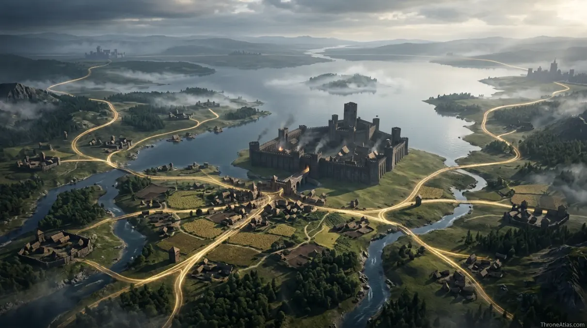
The clearest visual reading of this house uses five layers: the wide regional map, the closer seat map, the route overlay, the house banner, and the terrain view. A wide map explains where The Riverlands sits in Westeros. A seat map explains why Harrenhal is the anchor. A route overlay explains movement. A banner view gives the house identity. A terrain view explains why the surrounding land, water, forest, fields, mountains, or roads create the political story.
Good map visuals should never force the reader to guess what is being shown. Labels should be readable, route lines should be simple, and every image should support the page question: where is House Strong, what does it control, and why does it matter? This is especially important for lesser-known houses because the visual guide often teaches the reader faster than a long family list.
Comparison with Greater Houses
House Strong should also be compared with the great houses around it. Great houses usually control a whole region, but supporting houses control the practical details that make regional power work. They guard harbors, ride through forests, hold road junctions, manage food routes, reinforce armies, or carry old claims that a great lord cannot ignore. On a map, that makes a secondary house valuable even when it does not sit on the Iron Throne or rule an entire kingdom.
This comparison helps explain why the House Strong map belongs beside major maps for Winterfell, King’s Landing, Highgarden, Harrenhal, Dragonstone, Riverrun, and the Iron Islands. The great seats show who claims authority. The supporting houses show how authority actually travels across the land. Without them, the map becomes too simple and the politics lose their working machinery.
Cartographer’s Reliability Check
The safest atlas reading separates firm map logic from decorative certainty. Firm map logic includes the house seat, region, neighboring powers, named routes, nearby castles, and repeated story connections. Decorative certainty includes exact road shapes, exact building layouts, and travel measurements that the story does not define clearly. This page keeps those two categories separate so readers can understand House Strong without being misled by overdrawn borders.
For that reason, the House Strong map is presented as a house-territory guide rather than a modern survey map. It gives the location, political network, and route logic that a reader needs, while leaving room for the uncertainty that naturally exists in fictional medieval geography.
Book and Show Notes
Some houses are richly described in the books but only briefly shown or mentioned on screen. Others are visually present through banners, dialogue, marriage connections, or battlefield consequences. A careful House Strong map should respect both experiences. The book-focused reader wants family context, overlord chains, and geographic precision. The show-focused reader wants a direct explanation of why the name matters and which better-known locations it connects to.
For House Strong, the safest reading is to separate confirmed location logic from visual adaptation. The seat, region, neighboring powers, and major story connections should remain stable, while details about exact castle appearance, road width, or travel time should be treated with care unless the adaptation clearly shows them. This protects the page from overclaiming while still giving readers a complete map experience.
Travel and Route Reading
Travel time in Westeros is rarely simple. Weather, terrain, river crossings, naval access, horse supply, and army size all change movement. A lone rider may move differently from a host, and a raven may carry news faster than any road party. The House Strong map should therefore explain direction and connection without pretending that every route has one fixed modern measurement.
In practical terms, Harrenhal should be shown with routes toward Gods Eye, King’s Landing, Dragonstone routes, Riverrun, and the central Riverlands. These links help readers understand where armies might march, where messengers might travel, where ships might sail, and where political pressure would come from first.

Common Map Mistakes
House maps often become confusing when they copy a castle name without explaining the surrounding system. The mistakes below are the most common issues readers run into when trying to place House Strong correctly.
- Mapping House Strong only at Harrenhal and ignoring King’s Landing court influence.
- Treating the house as a minor Riverlands note despite its Dance importance.
- Forgetting that the Strong story depends on rumor, succession, and proximity to Rhaenyra.
The fix is to map the house as a network. Begin with Harrenhal, add the regional frame of The Riverlands, show nearby powers, then connect the page to the events that make the house matter. That is how a house map becomes useful rather than decorative.
Related Atlas Network
Use these related maps to follow nearby places, connected houses, character routes, battles, and lore events across ThroneAtlas.
Core Map Hubs
House and Region Links
Lore Context
House Strong Map FAQ
Clear answers to common questions about the house, its seat, and its place on the Westeros map.
Where is House Strong located?
House Strong is located in The Riverlands, with its main seat at Harrenhal. The page map should show the seat, nearby routes, connected houses, and the regional pressure that explains why the house matters.
What castle did House Strong hold?
Harrenhal is Harrenhal, the enormous castle by the Gods Eye. It works as the main anchor for reading House Strong on a political and geographic map.
How is House Strong connected to Harrenhal?
House Strong matters because it connects court influence, hidden parentage rumors, cursed castles, Dance politics, and family collapse. Its map position explains why the house appears in larger conflicts rather than remaining only a local name.
Why does House Strong matter in House of the Dragon?
The best way to read the House Strong map is to place Harrenhal beside Gods Eye, King’s Landing, Dragonstone routes, Riverrun, and the central Riverlands. Those connections show the practical movement of armies, messengers, marriages, fleets, and claims.
How is Harwin Strong connected to Rhaenyra?
A strong House Strong map should include the seat, the region, major roads or sea lanes, neighboring powers, related battles, ruling alliances, and a clear note on book/show differences.
What should a House Strong map include?
Readers often confuse House Strong by treating it as isolated. The map becomes clearer when the house is shown as part of The Riverlands and linked to nearby castles, rivers, coastlines, and political centers.
Explore More of the Westeros Atlas
Move from this house map into the wider network of regions, castles, battles, routes, and noble family pages.