Blackfyre Rebellions Map: Redgrass Field to the Stepstones
One map for the long Blackfyre struggle: a failed royal challenge that moves from Westerosi battlefields into exile, conspiracies, repeated landings and finally the Stepstones.
Read the Map by Place, Route and Confidence
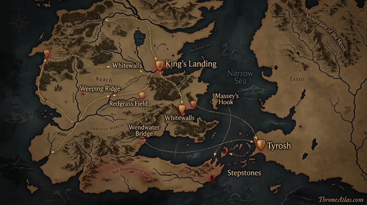
Interactive Blackfyre Rebellions Map: Redgrass Field to the Stepstones
This schematic is a reading aid, not an official cartographic plate. Tap a marker to see why that location matters. The connecting route is intentionally simplified so confirmed geography is not confused with an invented exact path.
Map Navigator
Six Things the Map Makes Clear
1. Map Takeaway
The map is built around multi-rebellion timeline map, not a generic Westeros overview.
2. Map Takeaway
Confirmed places are separated from reconstructed corridors so the page does not overstate precision.
3. Map Takeaway
The strongest geographic anchors are King’s Landing, Redgrass Field and Stepstones.
4. Map Takeaway
Political, military and environmental geography are explained together instead of being reduced to a pin list.
5. Map Takeaway
Book chronology and adaptation material are kept separate whenever they do not align exactly.
6. Map Takeaway
The map is designed to connect naturally with the surrounding ThroneAtlas location, house, battle and journey pages.
Key Places on the Blackfyre Rebellions Map
| Location | Map confidence | Why it matters |
|---|---|---|
| King’s Landing | Royal center | Seat of the Targaryen monarchy challenged by the Blackfyre claim. |
| Redgrass Field | First Rebellion | Decisive 196 AC battlefield where Daemon I and his twin sons died. |
| Weeping Ridge | Battle feature | High ground used by Bloodraven and the Raven’s Teeth during Redgrass Field. |
| Tyrosh | Exile base | Bittersteel and surviving Blackfyres withdrew across the narrow sea; Tyroshi connections remained important. |
| Whitewalls | Second Rebellion | Site of the failed 212 AC conspiracy around Daemon II Blackfyre. |
| Massey’s Hook | Fourth Rebellion | Landing region for Daemon III Blackfyre’s 236 AC attempt. |
| Wendwater Bridge | Fourth Rebellion | Battle where Daemon III was slain and the invasion collapsed. |
| Stepstones | Final campaign | Maelys Blackfyre’s threat ended here during the War of the Ninepenny Kings. |
A location marked “reconstructed” is not a guess presented as fact. It means the surrounding event is attested but the surviving narrative does not give enough spatial detail to place a modern-style coordinate. That distinction is especially important for ancient battles, aerial pursuits, siege camps and long sea voyages.
How the Story Moves Across the Map
The First Rebellion is the geographic core
The Blackfyre story begins as a domestic civil war. Daemon Blackfyre has supporters inside the Seven Kingdoms, and the decisive struggle comes at Redgrass Field. That battle matters because it fixes several recurring themes: the symbolic sword Blackfyre, the rivalry between Bittersteel and Bloodraven, the death of Daemon and the survival of his cause through exile. Every later point on the map radiates from the failure of this first attempt.
From an atlas perspective, this section is best read through the relationship between King’s Landing and Weeping Ridge. The first anchors the narrative in a named place, while the second shows how the consequences spread into a wider political or military space. That relationship is more useful than forcing the episode into an artificial straight line, because Westerosi history is shaped by roads, seas, fortifications, weather, alliances and the time required to move information as much as by raw distance.
Redgrass Field is more than one pin
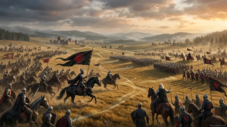
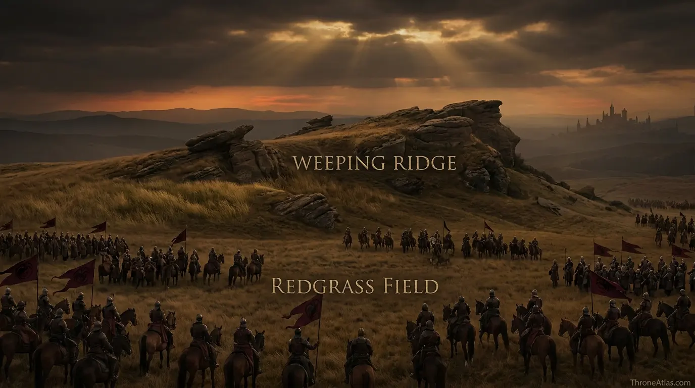
At Redgrass Field, terrain matters. Bloodraven and the Raven’s Teeth gain the Weeping Ridge and use high ground to rain arrows onto Daemon’s position. Daemon’s sons die; Bittersteel rallies the rebels; Baelor Breakspear’s arrival helps shatter the remaining force. A map that includes the ridge communicates the tactical structure without pretending the exact formation line is perfectly known.
From an atlas perspective, this section is best read through the relationship between Redgrass Field and Tyrosh. The first anchors the narrative in a named place, while the second shows how the consequences spread into a wider political or military space. That relationship is more useful than forcing the episode into an artificial straight line, because Westerosi history is shaped by roads, seas, fortifications, weather, alliances and the time required to move information as much as by raw distance.
Exile moves the struggle across the narrow sea
After defeat, Bittersteel carries survivors, the sword Blackfyre and the dynastic cause into exile. Tyrosh becomes one of the important eastern anchors, and Bittersteel later creates the Golden Company. This changes the conflict permanently. The Blackfyres no longer rely only on lords already inside Westeros; they acquire a professional exile network capable of waiting between attempts.
From an atlas perspective, this section is best read through the relationship between Weeping Ridge and Whitewalls. The first anchors the narrative in a named place, while the second shows how the consequences spread into a wider political or military space. That relationship is more useful than forcing the episode into an artificial straight line, because Westerosi history is shaped by roads, seas, fortifications, weather, alliances and the time required to move information as much as by raw distance.
Whitewalls shows rebellion without a full invasion
The Second Blackfyre Rebellion is a conspiracy more than a conventional campaign. The gathering at Whitewalls tries to place Daemon II in position to challenge the crown, but Bloodraven’s intervention collapses the plot. Its map marker is important precisely because the rebellion does not spread far. Whitewalls demonstrates that dynastic threats can be organized through feasts, alliances and secrecy before armies ever form.
From an atlas perspective, this section is best read through the relationship between Tyrosh and Massey’s Hook. The first anchors the narrative in a named place, while the second shows how the consequences spread into a wider political or military space. That relationship is more useful than forcing the episode into an artificial straight line, because Westerosi history is shaped by roads, seas, fortifications, weather, alliances and the time required to move information as much as by raw distance.
Later landings shrink as the crown adapts
The Fourth Rebellion lands near Massey’s Hook in 236 AC and ends quickly at Wendwater Bridge, where Duncan the Tall kills Daemon III. Compared with the first rebellion, support is thinner and the campaign footprint is smaller. The sequence on the map shows a rival dynasty losing domestic depth even as Bittersteel and the Golden Company keep the cause alive abroad.
From an atlas perspective, this section is best read through the relationship between Whitewalls and Wendwater Bridge. The first anchors the narrative in a named place, while the second shows how the consequences spread into a wider political or military space. That relationship is more useful than forcing the episode into an artificial straight line, because Westerosi history is shaped by roads, seas, fortifications, weather, alliances and the time required to move information as much as by raw distance.
The Stepstones close the male-line story
Maelys the Monstrous represents the last male Blackfyre claimant. By the time of the Ninepenny Kings, the movement is embedded in a broader coalition operating from Essos and the Stepstones. Barristan Selmy kills Maelys in 260 AC, ending the male line. Geographically, the arc is striking: the Blackfyres begin with a huge battle inside Westeros and end on contested islands outside it. The cause is pushed farther from the throne with each generation.
From an atlas perspective, this section is best read through the relationship between Massey’s Hook and Stepstones. The first anchors the narrative in a named place, while the second shows how the consequences spread into a wider political or military space. That relationship is more useful than forcing the episode into an artificial straight line, because Westerosi history is shaped by roads, seas, fortifications, weather, alliances and the time required to move information as much as by raw distance.
What Changes When You Read the Story Spatially
Read from the first marker to the last and the map becomes a sequence of changing pressures rather than a simple itinerary. King’s Landing establishes the opening context, while Stepstones shows where the central arc resolves. Between those points, the map distinguishes sites named directly in the histories from zones added only to make the geography legible. That distinction prevents a smooth-looking route from being mistaken for a surveyed road or flight path.
King’s Landing and Redgrass Field serve different functions on this page. Seat of the Targaryen monarchy challenged by the Blackfyre claim. Decisive 196 AC battlefield where Daemon I and his twin sons died. Seeing them together helps explain why blackfyre rebellions map is best treated as a spatial argument: the story depends on what each place enables, restricts or exposes, not merely on the order in which names appear in a chronology.
Weeping Ridge and Tyrosh serve different functions on this page. High ground used by Bloodraven and the Raven’s Teeth during Redgrass Field. Bittersteel and surviving Blackfyres withdrew across the narrow sea; Tyroshi connections remained important. Seeing them together helps explain why blackfyre rebellions map is best treated as a spatial argument: the story depends on what each place enables, restricts or exposes, not merely on the order in which names appear in a chronology.
Whitewalls and Massey’s Hook serve different functions on this page. Site of the failed 212 AC conspiracy around Daemon II Blackfyre. Landing region for Daemon III Blackfyre’s 236 AC attempt. Seeing them together helps explain why blackfyre rebellions map is best treated as a spatial argument: the story depends on what each place enables, restricts or exposes, not merely on the order in which names appear in a chronology.
The broader value of this atlas is context. A named castle or bay can look isolated in prose, but once it is placed beside nearby regions, rival seats and movement corridors, the choices of rulers and commanders become easier to understand. Distance creates delay. Water creates risk. Fortresses concentrate power. Roads channel armies. Dragons ignore some of those limits while introducing others. The map is useful because it lets those constraints appear together.
That is also why ThroneAtlas avoids false precision. Westerosi sources often preserve destination names while omitting exact road segments, camp positions or mile-by-mile paths. A responsible reconstruction should tell readers where certainty ends. The result may look less absolute than a fictional GPS trace, but it is more faithful to how the geography is actually described.
Canon Confidence & Reconstruction Limits
This page separates firm geographic anchors from interpretive connectors. The goal is to make the map useful without upgrading inference into canon.
Four Details Worth Watching
King’s Landing
Seat of the Targaryen monarchy challenged by the Blackfyre claim. Its placement on this atlas is intended to clarify the wider story without claiming precision beyond the source record.
Weeping Ridge
High ground used by Bloodraven and the Raven’s Teeth during Redgrass Field. Its placement on this atlas is intended to clarify the wider story without claiming precision beyond the source record.
Whitewalls
Site of the failed 212 AC conspiracy around Daemon II Blackfyre. Its placement on this atlas is intended to clarify the wider story without claiming precision beyond the source record.
Wendwater Bridge
Battle where Daemon III was slain and the invasion collapsed. Its placement on this atlas is intended to clarify the wider story without claiming precision beyond the source record.
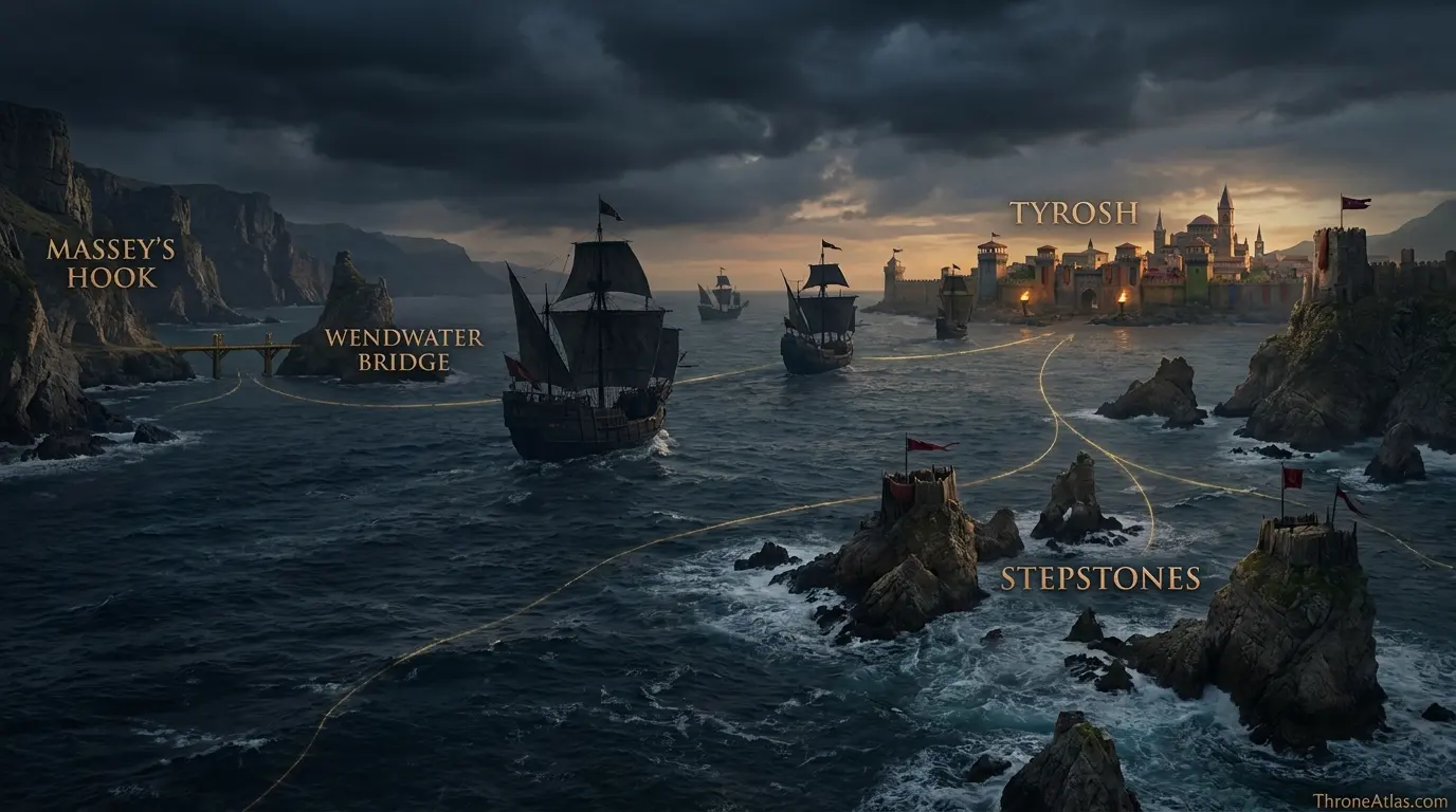
The visual layer should reinforce the text rather than merely decorate it. When you replace these image URLs with final artwork using the same filenames, keep the labels readable on mobile and avoid placing invented borders, distances or roads where the source record is uncertain.
Fast Answers About This Map
The Blackfyre conflicts do not belong to one battlefield. The First Rebellion culminates at Redgrass Field in 196 AC; later plots and invasions involve Whitewalls, exile in Tyrosh, the Golden Company, a landing near Massey’s Hook and fighting at Wendwater Bridge, before Maelys Blackfyre’s final threat is broken in the Stepstones in 260 AC. Mapping the rebellions as a sequence shows how the movement evolves from domestic civil war into an exile-based dynastic challenge.
King’s Landing is the opening anchor, but Stepstones is equally important because it shows where the main geographic arc reaches its consequence.
No. Named destinations and major event locations come from the source record, while connecting lines are schematic unless a specific road, river or route is directly established.
Use the confidence labels. They distinguish fixed places from probable regions and explanatory reconstructions, which is especially important for battles, dragonflights and ancient migrations.
What This Atlas Is Based On
- The World of Ice & Fire for the Blackfyre dynasty and rebellion chronology.
- The Sworn Sword and The Mystery Knight for Blackfyre-era memory, Whitewalls and the Second Rebellion.
- Published Westeros and Stepstones maps for Redgrass Field region, crownlands approaches and exile geography.
- Where sources disagree or omit exact coordinates, the page labels the uncertainty rather than silently choosing one version.
Continue Exploring ThroneAtlas
These connected pages expand the same geography from different angles—regional maps for physical context, character routes for movement, house maps for political control and battle maps for moments when the landscape directly shapes the outcome.
Blackfyre Rebellions Map: Redgrass Field to the Stepstones FAQs
What were the Blackfyre Rebellions?
They were repeated challenges to the Targaryen monarchy by descendants and supporters of Daemon Blackfyre.
Where was the First Blackfyre Rebellion decided?
At the Battle of the Redgrass Field in 196 AC.
Who founded House Blackfyre?
Daemon Waters took the name Blackfyre after receiving the Targaryen sword Blackfyre.
Who was Bittersteel?
Aegor Rivers, a major Blackfyre supporter who survived Redgrass Field and later founded the Golden Company.
What happened at Whitewalls?
A conspiracy supporting Daemon II Blackfyre was exposed and collapsed before becoming a large open war.
Where did Daemon III land?
The Fourth Blackfyre Rebellion involved a landing near Massey’s Hook.
Who killed Daemon III?
Ser Duncan the Tall killed him at Wendwater Bridge.
Who was the last male Blackfyre?
Maelys the Monstrous was the last male-line Blackfyre claimant.
Where did Maelys die?
He was killed in the Stepstones during the War of the Ninepenny Kings.
Why does Tyrosh appear on the map?
Exile in the Free Cities, especially Tyroshi connections, was central to the survival of the Blackfyre cause after defeat in Westeros.
These questions focus on the distinctions most likely to matter when reading the blackfyre rebellions map: what is directly named, what is inferred from regional geography, and what should remain uncertain. Where the chronicles preserve competing versions, ThroneAtlas keeps the disagreement visible rather than selecting the most dramatic account simply because it produces a cleaner map.
Why This Geography Matters
The Blackfyre conflicts do not belong to one battlefield. The First Rebellion culminates at Redgrass Field in 196 AC; later plots and invasions involve Whitewalls, exile in Tyrosh, the Golden Company, a landing near Massey’s Hook and fighting at Wendwater Bridge, before Maelys Blackfyre’s final threat is broken in the Stepstones in 260 AC. Mapping the rebellions as a sequence shows how the movement evolves from domestic civil war into an exile-based dynastic challenge.
Seen as a map rather than a list of names, the story becomes easier to follow because movement, control and consequence share the same frame. That is the purpose of this atlas: not to replace the books or screen adaptation, but to make their geography legible.