
Westeros Distance Calculator Miles and Travel Time by Horse, Ship, Army and Dragon
30 locations · Road · Sea · Army · Dragon
How far is Winterfell from King’s Landing? How long would a ship take from Braavos? Pick any two of 30 castles and cities in Westeros and Essos and get distance and travel time instantly.
The Westeros Distance Calculator estimates the distance and travel time between 30 places in Westeros and Essos. For example, Winterfell is about 1,560 miles from King’s Landing by the Kingsroad: roughly 39 days for a lone rider, 104 days for an army or 23 hours by dragon.
Estimates use ThroneAtlas assumptions: road = straight line × 1.15, sea = × 1.3, lone rider 40 mi/day, army 15 mi/day, ship 100 mi/day, dragon 60 mph. These are fan estimates, not official figures.
Calculator Assumptions
These are the speeds and factors behind every result.
How to use the calculator
Choose a starting point and a destination from the two lists above. The calculator shows the straight-line distance, the road distance where both places are on the same landmass, travel time for a lone rider and for a marching army, sailing time where both places are on the coast, and flying time by dragon.
Islands such as Dragonstone, Pyke and Bear Island have no road option, and inland castles such as Winterfell have no direct ship option. That mirrors how characters actually travel in the books and the show.
Popular routes
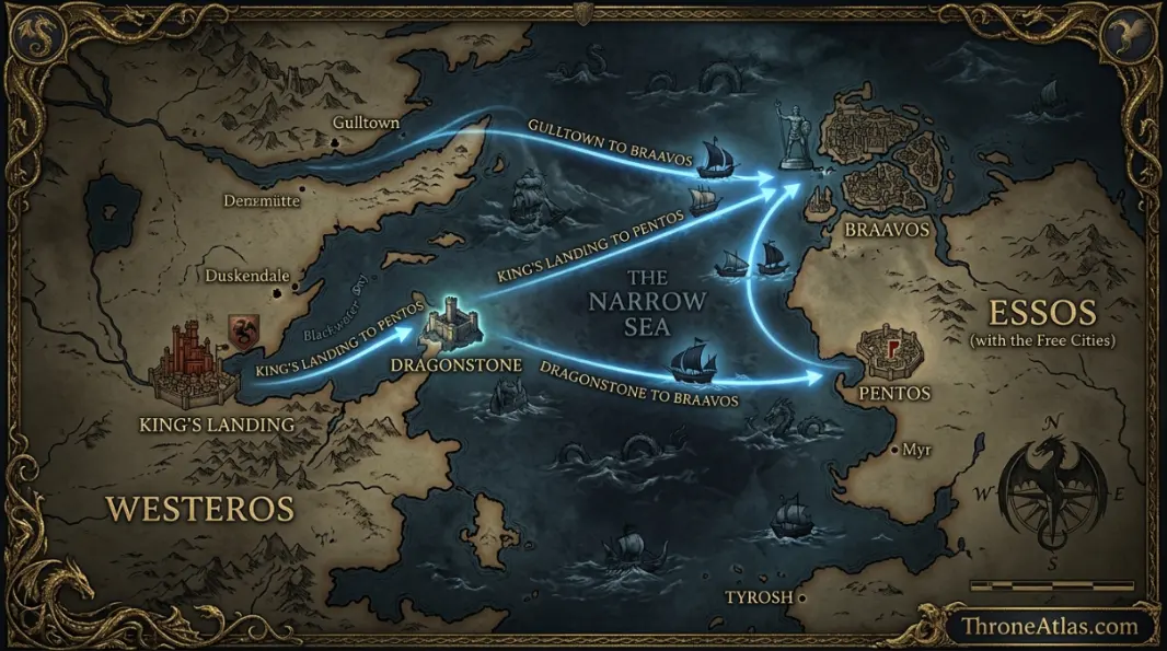
These are the journeys readers ask about most, each with its own full route guide.
| Route | Straight line | Travel time |
|---|---|---|
| Winterfell → King's Landing | ≈ 1,356 mi | 39 days riding · 23 h dragon |
| Castle Black → Winterfell | ≈ 563 mi | 16 days riding · 9 h dragon |
| King's Landing → Dragonstone | ≈ 206 mi | 2.7 days by ship · 3.4 h dragon |
| King's Landing → Meereen | ≈ 2,704 mi | 35 days by ship · 45 h dragon |
Why distance matters in Game of Thrones
Distance explains the story. Robb Stark's war is a race against the time it takes armies to cross the Riverlands. Ravens matter because riders need weeks. And dragons are decisive because they shrink a month's ride into a day.
Our guides to how big Westeros is and how long the Wall is explain the scale in more depth.
How ThroneAtlas calculates distances
Every location on ThroneAtlas sits on one grid scaled to the 300-mile Wall, the only firm measurement in the books. Road distance adds 15% to the straight line for bends, fords and hills; sea routes add 30% for coastlines and capes.
Speeds are realistic medieval averages: about 40 miles a day for a lone rider, 15 for an army with baggage, 100 for a sailing ship and an estimated 60 miles an hour for a grown dragon. Treat the results as fan estimates for comparing routes, not official figures.
Distance Calculator: Questions
About 1,356 miles in a straight line and about 1,560 miles by the Kingsroad.
A lone rider covering 40 miles a day needs roughly three months to go from the Wall to Dorne.
ThroneAtlas uses a sustained cruising speed of about 60 miles an hour for a grown dragon.
No. They are ThroneAtlas estimates scaled from the Wall's canon length of 300 miles.
Yes. The page address updates as you choose places, so you can share a link to any route.
ThroneAtlas is an independent fan-made atlas and lore reference. It is not affiliated with HBO, Warner Bros. Discovery or George R. R. Martin. Map artwork is original ThroneAtlas illustration.